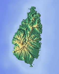
Dennery District is one of 10 districts of the Caribbean island nation of Saint Lucia. The seat of Dennery District is the Dennery Village. The main economic activities are fishing, and the cultivation of lima beans, bananas, and other tropical fruit. The population of the quarter was estimated at 12,876 in 2002 and fell to 12,767 in 2010.
The Troumassée River is a river in Saint Lucia. It rises in the centre of the island, flowing southeast to its mouth close to the town of Micoud on the southeast coast.

The Cul De Sac River is a river in Castries Quarter of the island country of Saint Lucia. It flows north and then west from the central highlands in the south of the island, reaching the Caribbean Sea in Grand Cul de Sac Bay, south of the capital, Castries. It is one of the longest rivers in Saint Lucia.
The Canelles River is a river in Saint Lucia. It flows southeast from the central highlands in the south of the island, reaching the Atlantic Ocean to the south of the town of Micoud.
The Roseau River is a river in the Anse-la-Raye Quarter of the island country of Saint Lucia. It flows north and then west from the central highlands in the south of the island, reaching the Caribbean Sea to the north of the town of Anse la Raye. The Roseau river is also the longest in the country and is dammed by the John Compton Dam near Millet.

The Balembouche River is a coastal river in Laborie Quarter, Saint Lucia that flows into the Caribbean Sea.

The Castries River is a river in Castries Quarter on the island country of Saint Lucia.
The Dorée River is a river on the island of Saint Lucia.
The Migny River is a river on the island of Saint Lucia.
The Soufrière River is a river in the Soufrière Quarter on the island country of Saint Lucia. The French term "Soufrière" is a generic one referring to "Sulphury" volcanic peaks called La Soufrière or Soufrière Hills on each of St. Vincent, St. Lucia, Dominica, Guadeloupe.
The Choc River is a river in the Soufrière Quarter of the island country of Saint Lucia. It flows to the Caribbean Sea.
The Dauphin River is a river in Gros Islet Quarter, Saint Lucia.
The Esperance River is a river in Gros Islet Quarter in the island country of Saint Lucia.
The Jeremy River (Saint Lucia) is a river of Saint Lucia. It drains from the forest area to the east coast.
The Little Vieux Fort River is a river in Vieux Fort Quarter of the island country of Saint Lucia. It is a tributary of the Vieux Fort River.
The Mamiku River is a river of Saint Lucia.
The Millet River is a river of Saint Lucia.
The Praslin River is a river of Saint Lucia.
The Trou Sallé River is a river of Saint Lucia.


