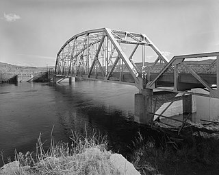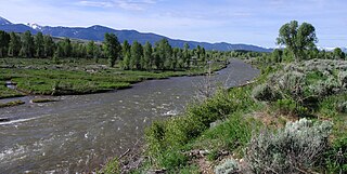
The Snake River is a major river of the greater Pacific Northwest region in the United States. At 1,078 miles (1,735 km) long, it is the largest tributary of the Columbia River, in turn, the largest North American river that empties into the Pacific Ocean. The Snake River rises in western Wyoming, then flows through the Snake River Plain of southern Idaho, the rugged Hells Canyon on the Oregon–Idaho border and the rolling Palouse Hills of Washington, emptying into the Columbia River at the Tri-Cities in the Columbia Basin of Eastern Washington.

Grand Teton National Park is an American national park in northwestern Wyoming. At approximately 310,000 acres (1,300 km2), the park includes the major peaks of the 40-mile-long (64 km) Teton Range as well as most of the northern sections of the valley known as Jackson Hole. Grand Teton National Park is only 10 miles (16 km) south of Yellowstone National Park, to which it is connected by the National Park Service–managed John D. Rockefeller Jr. Memorial Parkway. Along with surrounding national forests, these three protected areas constitute the almost 18-million-acre (73,000-square-kilometer) Greater Yellowstone Ecosystem, one of the world's largest intact mid-latitude temperate ecosystems.

The Bighorn River is a tributary of the Yellowstone, approximately 461 miles (742 km) long, in the states of Wyoming and Montana in the western United States. The river was named in 1805 by fur trader François Larocque for the bighorn sheep he saw along its banks as he explored the Yellowstone.

The Teton River is a 64-mile-long (103 km) tributary of the Henrys Fork of the Snake River in southeastern Idaho in the United States. It drains through the Teton Valley along the west side of the Teton Range along the Idaho-Wyoming border at the eastern end of the Snake River Plain. Its location along the western flank of the Tetons provides the river with more rainfall than many other rivers of the region.

The geology of the Grand Teton area consists of some of the oldest rocks and one of the youngest mountain ranges in North America. The Teton Range, partly located in Grand Teton National Park, started to grow some 9 million years ago. An older feature, Jackson Hole, is a basin that sits aside the range.

The Gros Ventre landslide is in the Gros Ventre Wilderness of Bridger-Teton National Forest, Wyoming, United States. The Gros Ventre landslide is seven miles (11 km) east of Jackson Hole valley and Grand Teton National Park.

John D. Rockefeller Jr. Memorial Parkway is a scenic road and protected area that connects Grand Teton National Park and Yellowstone National Park in the U.S. state of Wyoming. It is federally owned and managed by the National Park Service by Grand Teton National Park. It is named in remembrance of John D. Rockefeller Jr., a conservationist and philanthropist who was instrumental in the creation and enlargement of numerous national parks including Grand Teton, Virgin Islands, Acadia and the Great Smoky Mountains. This parkway carries U.S. Route 89, U.S. Route 191, and U.S. Route 287

Bridger–Teton National Forest is located in western Wyoming, United States. The forest consists of 3.4 million acres, making it the third largest National Forest outside Alaska. The forest stretches from Yellowstone National Park, along the eastern boundary of Grand Teton National Park and from there rides along the western slope of the Continental Divide to the southern end of the Wind River Range. The forest also extends southward encompassing the Salt River Range and Wyoming Range mountains near the Idaho border.

The Bridger Wilderness is located in Bridger-Teton National Forest in Wyoming, United States. Originally established in 1931 as a primitive area, 428,169-acre (1,732.74 km2) region was redesignated as a wilderness in 1964 and expanded to the current size in 1984. The wilderness lies on the west side of the Continental Divide in the Wind River Range and contains Gannett Peak; at 13,809 feet (4,209 m) it is the tallest mountain in Wyoming. The wilderness is a part of the Greater Yellowstone Ecosystem.

The Gros Ventre Wilderness is located in Bridger-Teton National Forest in the U.S. state of Wyoming. Most of the Gros Ventre Range is located within the wilderness.

The Gros Ventre River is a 74.6-mile-long (120.1 km) tributary of the Snake River in the state of Wyoming, USA. During its short course, the river flows to the east, north, west, then southwest. It rises in the Gros Ventre Wilderness in western Wyoming, and joins the Snake River in the Jackson Hole valley. In 1925, the massive Gros Ventre landslide dammed the river and formed Lower Slide Lake. The natural dam collapsed in 1927, flooding the downstream town of Kelly, Wyoming. The river is noted for the excellent trout fishing along its length, where native Snake River Fine-spotted Cutthroat Trout average 12 to 16 inches, with some to 20 inches (510 mm).

Blacktail Butte is a butte mountain landform rising from Jackson Hole valley in Grand Teton National Park in the U.S. state of Wyoming. Blacktail Butte was originally named Upper Gros Ventre Butte in an early historical survey conducted by the U.S. Geological Survey. Most of Blacktail Butte is densely forested with a mixed fir forest of lodgepole pine, Douglas fir and Engelmann spruce, with scattered pockets of aspen. There are several large sedimentary rock outcroppings, which are used by rock climbers. This butte is a principal landmark in Jackson Hole, with much of the Jackson Hole valley floor and many portions of the Teton Range visible from its hillsides.
Kelly is a census-designated place (CDP) in Teton County in the U.S. state of Wyoming. The population was 138 at the 2010 census.

Union Pass is a high mountain pass in the Wind River Range in Fremont County of western Wyoming in the United States. The pass is located on the Continental Divide between the Gros Ventre mountains on the west and the Wind River Range on the east. A triple divide exists nearby, where water may flow to the Mississippi River, Columbia River, or Colorado River. The pass was historically used by Native Americans and early mountain men including the Astor Expedition in 1811 on its way west. On the return trip, fearing hostile Indian activity near Union Pass, the Astorians chose a southern route and discovered South Pass.

The Hoback River, once called the Fall River, is an approximately 55-mile (89 km)-long tributary of the Snake River in the U.S. state of Wyoming. It heads in the northern Wyoming Range of Wyoming and flows northeast, northwest, and then west through the Bridger-Teton National Forest. Its largest tributary is its South Fork, which joins the Hoback about nine miles downstream of its head as it turns northeast and continues to U.S. Route 191. It then turns northwest, where it spreads onto a large marshy flat in a braided floodplain once known as Jackson's Little Hole, but now referred to as the "Hoback Basin" in which lies the town of Bondurant. It then heads west, entering the steep, narrow Hoback Canyon from which it emerges to join the Snake about 11 miles (18 km) south of Jackson Hole, just upstream of head of the Snake River Canyon near the town of Hoback. The entire length of the Hoback is free flowing and unobstructed by dams. About 30 miles (48 km) downstream from the confluence with the Hoback River, the Snake River crosses into the state of Idaho and is impounded by Palisades Dam.

The Gros Ventre Range is part of the Central Rocky Mountains and is located west of the Continental Divide in U.S. state of Wyoming. The highest summit in the range is Doubletop Peak at 11,720 feet (3,570 m). The Gros Ventre Range is mostly within the Gros Ventre Wilderness of Bridger–Teton National Forest. To the northwest of the range lies the valley known as Jackson Hole. Snow King ski resort is in the range adjacent to the town of Jackson, Wyoming. Also in the Gros Ventre Range is the Gros Ventre landslide, which in 1925 slid down the north slope of Sheep Mountain.

Sheep Mountain is located in the U.S. state of Wyoming. Sheep Mountain forms a 5-mile (8 km) long ridge in the Gros Ventre Range and is easily seen from Jackson Hole. The town of Jackson is 13 miles (21 km) southwest of the peak. The southern end of Sheep Mountain is above the tree line and consists of rocky cliffs that are referred to as the "Sleeping Indian" due to their appearance as viewed from Jackson Hole. Sheep Mountain is in the Gros Ventre Wilderness of Bridger–Teton National Forest. At the northern end of Sheep Mountain is the location of the Gros Ventre landslide.
Doubletop Peak is a mountain in the state of Wyoming. The peak is the tallest in the Gros Ventre Range. Doubletop Peak is within the Gros Ventre Wilderness region of Bridger-Teton National Forest.
The Darwin Ranch in Teton County, Wyoming near Cora, Wyoming is a guest ranch which was listed on the National Register of Historic Places in 2021.


