The Rio Negro is the largest left tributary of the Amazon River, the largest blackwater river in the world, and one of the world's ten largest rivers by average discharge.
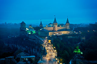
Podolia or Podilia is a historic region in Eastern Europe, located in the west-central and south-western parts of Ukraine and in northeastern Moldova. The name derives from Old Slavic po, meaning "by/next to/along" and dol, "valley".

Polesia, Polesie or Polesye is a natural and historical region starting from the farthest edges of Central Europe and into Eastern Europe, stretching from parts of Eastern Poland, touching similarly named Podlasie, straddling the Belarus–Ukraine border and into western Russia.
The Dniester River is a river in Eastern Europe. It runs first through Ukraine and then through Moldova, finally discharging into the Black Sea on Ukrainian territory again.

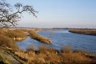
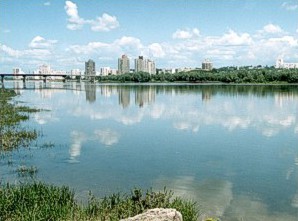
The Dnieper is one of the major rivers of Europe, rising in the Valdai Hills near Smolensk, Russia, and flowing through Russia, Belarus and Ukraine to the Black Sea. It is the longest river of Ukraine and Belarus and the fourth-longest river in Europe. The total length is approximately 2,200 km (1,400 mi) with a drainage basin of 504,000 square kilometres (195,000 sq mi). The river is noted for its dams and hydroelectric stations. The Dnieper is an important navigable waterway for the economy of Ukraine and is connected via the Dnieper–Bug Canal to other waterways in Europe.

The Lahn is a 245.6-kilometer (152.6 mi)-long, right tributary of the Rhine in Germany. Its course passes through the federal states of North Rhine-Westphalia (23.0 km), Hesse (165.6 km), and Rhineland-Palatinate (57.0 km).

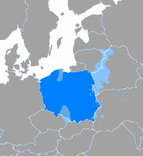
Volhynia, is a historic region in Central and Eastern Europe, situated between south-eastern Poland, south-western Belarus, and western Ukraine. While the borders of the region are not clearly defined, the territory that still carries the name is Volyn Oblast, located in western Ukraine. Volhynia has changed hands numerous times throughout history and been divided among competing powers. At one time all of Volhynia was part of the Pale of Settlement designated by Imperial Russia on its southwestern-most border.

The Virgin River is a tributary of the Colorado River in the U.S. states of Utah, Nevada, and Arizona. The river is about 162 miles (261 km) long. It was designated Utah's first wild and scenic river in 2009, during the centennial celebration of Zion National Park.
The Kasai River is a tributary of the Congo River, located in Central Africa. The river begins in central Angola and flows to the east until it reaches the border between Angola and the Democratic Republic of the Congo (DRC), where it turns north and serves as the border until it flows into the DRC. From Ilebo, between the confluences with Lulua river and Sankuru river, the Kasai river turns to a westerly direction. The lower stretch of the river from the confluence with Fimi river, is known as the Kwa(h) River, before it joins the Congo at Kwamouth northeast of Kinshasa. The Kasai basin consists mainly of equatorial rainforest areas, which provide an agricultural land in a region noted for its infertile, sandy soil. It is a tributary of Congo river and diamonds are found in this river. Around 60% of diamonds in Belgium go from Kasai river for cutting and shaping.

The Our is a river in Belgium, Luxembourg and Germany. It is a left-hand tributary of the river Sauer/Sûre. Its total length is 78 kilometres (48 mi).
The Treaty of Bakhchisarai was signed in Bakhchisaray, which ended the Russo-Turkish War (1676–1681), on 3 January 1681 by Russia, the Ottoman Empire, and the Crimean Khanate. They agreed to a 20-year truce and had accepted the Dnieper River as the demarcation line between the Ottoman Empire and Moscow's domain. All sides agreed not to settle the territory between the Southern Bug and Dnieper rivers. After the signing of the treaty, the Nogai hordes still retained the right to live as nomads in the southern steppes of Ukraine, while the Cossacks retained the right to fish in the Dnieper and its tributaries; to obtain salt in the south; and to sail on the Dnieper and the Black Sea. The sultan then recognized Muscovy's sovereignty in the Left-bank Ukraine region and the Zaporozhian Cossack domain, while the southern part of the Kiev region, the Bratslav region, and Podolia were left under Ottoman control. The Bakhchisaray peace treaty once again redistributed land between neighboring states. The treaty was also of great international significance and stipulated the signing of “ Eternal Peace” in 1686 between Russia and Poland.
The Schwarzbach is a river in southwestern Germany, left tributary of the Blies. Its source is in the Palatinate Forest, near Trippstadt. It flows through the states Rhineland-Palatinate and Saarland. Towns along its course are Waldfischbach-Burgalben, Contwig and Zweibrücken. After 50 km (31 mi), it flows into the Blies in Homburg-Einöd.

The Rothaarsteig is a 154.80 km long hiking trail along the crest of the Rothaargebirge mountain range in Germany in the border region between the states of North Rhine-Westphalia (NW) and Hesse (HE). It was opened in 2001.
The Weper is a long, high ridge of hills up to 379 m above sea level (NN) located in the district of Northeim in the German state of Lower Saxony.
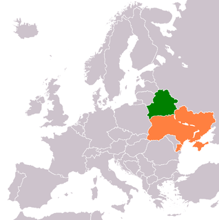
The Belarusian-Ukrainian border is the state border between Belarus and Ukraine with a length of about 1,084 km (674 mi). It starts from the triple junction with Poland to the west and stretches to the triple junction with Russia to the east. The tripoint border at the triple border junction of Belarus, Russia and Ukraine is marked in the form of a monument, while at the other border junction there is a river Western Bug that coincides with the border of Poland.
The Solokiya is a river in Poland and the Ukraine and a tributary of the Bug River. Its source is located north of Tomaszów Lubelski and in its upper reaches the Solokiya runs mainly in a southeastern direction. Near the crossing of the Polish-Ukrainian border it turns to the east and after passing through Uhniv and Belz it flows in Chervonohrad as a left affluent into the Western Bug.
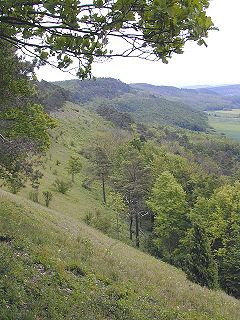
Derman-Ostroh National Nature Park sits in a river valley that separates the southern edge of the Polesian Lowland, and the northern edge of the Podolian Upland in northwestern Ukraine. The terrain is a mixture of pine-oak forest and marshy river lowlands. The park is in the administrative districts of Zdolbuniv Raion and Ostroh Raion, in the southernmost region of Rivne Oblast.