Last updated Chinae... nova descriptio by Ludovicus Georgius (1584)
Luiz Jorge de Barbuda (1564 (?)-1613 (?)[1]) was a Portuguese cartographer. It is believed that he was the person known under the Latinized name Ludovicus Georgius, the creator of the influential map of China, published by Abraham Ortelius in 1584 in his Theatrum Orbis Terrarum.[2]
During his life the cartographer was known under the Portuguese name Luiz Jorge, or its Hispanicized version Luis Jorge. Later Spanish writers would "disambiguate" his name using the place of his origin, calling him Luis Jorge de la Barbuda.[3]
Even if Szcześniak's identification of Ludovicus Georgius as Luiz Jorge de Barbuda is correct, the birth date given by Szcześniak may not be in agreement with the biographical points given in Maroto & Piñeiro 2006. According to Maroto and Piñeiro, Luis Jorge was hired by Philip II of Spain in 1582 as the "master of making navigation charts and world maps" (maestro de hacer cartas de marear y cosmographias).[3]
The China map
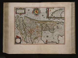
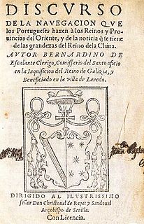
Ludovicus Georgius' famous work, the 1584 map of China, appeared in Abraham Ortelius' Theatrum Orbis Terrarum. It was accompanied by a brief description of China and its language, which Ludovicus Georgius derived from Spain's first book on China: Bernardino de Escalante's Discurso de la navegacion que los Portugueses hacen a los Reinos y Provincias de Oriente, y de la noticia que se tiene de las grandezas del Reino de la China (1577). Both Ludovicus Georgius' map and Escalante-based "country summary" became highly influential, becoming the base for most European cartographic and literary work on the topic for several decades,[4] until much more precise information from China-based Jesuit became available (Martino Martini, Novus Atlas Sinensis, 1655).
Lach, Donald F. (1965), Asia in the making of Europe, vol.I, Book Two, The University of Chicago Press
Related Research Articles
An atlas is a collection of maps; it is typically a bundle of maps of Earth or of a region of Earth.
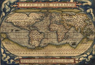
Abraham Ortelius was a Brabantian cartographer, geographer, and cosmographer, conventionally recognized as the creator of the first modern atlas, the Theatrum Orbis Terrarum. Along with Gemma Frisius and Gerardus Mercator, Ortelius is generally considered one of the founders of the Netherlandish school of cartography and geography. He was a notable figure of this school in its golden age and an important geographer of Spain during the age of discovery. The publication of his atlas in 1570 is often considered as the official beginning of the Golden Age of Netherlandish cartography. He was the first person proposing that the continents were joined before drifting to their present positions.
Theatrum Orbis Terrarum is considered to be the first true modern atlas. Written by Abraham Ortelius, strongly encouraged by Gillis Hooftman and originally printed on 20 May 1570 in Antwerp, it consisted of a collection of uniform map sheets and supporting text bound to form a book for which copper printing plates were specifically engraved. The Ortelius atlas is sometimes referred to as the summary of sixteenth-century cartography. The publication of the Theatrum Orbis Terrarum (1570) is often considered as the official beginning of the Golden Age of Netherlandish cartography.
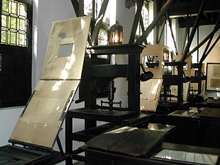
The Plantin Press at Antwerp was one of the focal centers of the fine printed book in the 16th century.
Jodocus Hondius was a Flemish and Dutch engraver and cartographer. He is sometimes called Jodocus Hondius the Elder to distinguish him from his son Jodocus Hondius II. Hondius is best known for his early maps of the New World and Europe, for re-establishing the reputation of the work of Gerard Mercator, and for his portraits of Francis Drake. One of the notable figures in the Golden Age of Dutch/Netherlandish cartography, he helped establish Amsterdam as the center of cartography in Europe in the 17th century.
Gerard de Jode was a Netherlandish cartographer, engraver, and publisher who lived and worked in Antwerp.
Luís Teixeira or Ludovico Teixeira was a 16th-century Portuguese, cartographer, and mathematician. He had two sons, also cartographers.
The Atlas Maior is the final version of Joan Blaeu's atlas, published in Amsterdam between 1662 and 1672, in Latin, French, Dutch, German and Spanish, containing 594 maps and around 3,000 pages of text. It was the largest and most expensive book published in the seventeenth century. Earlier, much smaller versions, titled Theatrum Orbis Terrarum, sive, Atlas Novus, were published from 1634 onwards. Like Abraham Ortelius's Theatrum Orbis Terrarum (1570), the Atlas Maior is widely considered a masterpiece of the Golden Age of Dutch/Netherlandish cartography.
Joan Blaeu was a Dutch cartographer born in Alkmaar, the son of cartographer Willem Blaeu.
Humphrey Llwyd (1527–1568) was a Welsh cartographer, author, antiquary and Member of Parliament. He was a leading member of the Renaissance period in Wales along with other such men as Thomas Salisbury and William Morgan. His library, together with those of his patron, the Earl of Arundel and his brother-in-law, Lord Lumley, formed the basis of the Royal Collection of books; currently housed at the British Library. His motto was Hwy pery klod na golyd.
Cornelis de Jode was a cartographer, engraver and publisher from Antwerp. He was the son of Gerard de Jode, also a cartographer. Cornelis studied science at Academy of Douai
The year 1570 in science and technology included a number of events, some of which are listed here.
Bernardino de Escalante was a Spanish soldier, priest, geographer and a prolific writer. He is best known as the author of the second book on China that was published in Europe, and the first author of such a book to obtain wide circulation outside of Portugal.
William Soone or Zoone was an English jurist and cartographer.
Franciscus Haraeus, , was a theologian, historian, and cartographer from the Low Countries. He is best known for his history of the origins of the Dutch Revolt, written from a Catholic perspective but without polemical bias. He was one of the first cartographers to make thematic maps and globes.
Marcel Peter René van den Broecke was a Dutch specialist in phonetics and also in cartography, more in particular the historical maps by Abraham Ortelius.
Africae Tabula Nova is a map of Africa published by Abraham Ortelius in 1570. It was engraved by Frans Hogenberg and included in Ortelius's 1570 atlas Theatrum Orbis Terrarum, commonly regarded as the first modern atlas. The atlas was printed widely in seven languages and 31 total editions between 1570 and 1612.
Jean Surhon, also known as Jean de Surhon, Jean Surhonio, Jean Surchon, Johann Surhonio or Ioannes Suthon, was a Franco-Flemish engraver and cartographer.
This page is based on this Wikipedia article Text is available under the CC BY-SA 4.0 license; additional terms may apply. Images, videos and audio are available under their respective licenses.