Luteba is an administrative ward in the Busokelo District of the Mbeya Region of Tanzania. According to the 2002 census, the ward has a total population of 7,501. [1]
Luteba is an administrative ward in the Busokelo District of the Mbeya Region of Tanzania. According to the 2002 census, the ward has a total population of 7,501. [1]
Nzega District is one of the seven districts of the Tabora Region of Tanzania. It is bordered to the north by Shinyanga Region, to the south and southwest by Uyui District and to the east by Igunga District. Its administrative seat is the town of Nzega.
Ipinda is an administrative ward in the Kyela district of the Mbeya Region of Tanzania. According to the 2002 census, the ward has a total population of 16,756.
Lusungo is an administrative ward in the Kyela district of the Mbeya Region of Tanzania. According to the 2002 census, the ward has a total population of 5,819.
Makwale is an administrative ward in the Kyela district of the Mbeya Region of Tanzania. According to the 2002 census, the ward has a total population of 16,390.
Isange is an administrative ward in the Busokelo District of the Mbeya Region of Tanzania. According to the 2002 census, the ward has a total population of 7,932. According to the 2012 census, the ward has a total population of 5,790 with a population density of 413.0/km²
Kabula is an administrative ward in the Busokelo District of the Mbeya Region of Tanzania. According to the 2002 census, the ward has a total population of 10,251.
Kiwira is an administrative ward in the Rungwe district of the Mbeya Region of Tanzania. According to the 2002 census, the ward has a total population of 20,119.
Kyimo is an administrative ward in the Rungwe district of the Mbeya Region of Tanzania. According to the 2002 census, the ward has a total population of 12,140.
Lupata is an administrative ward in the Busokelo District of the Mbeya Region of Tanzania. According to the 2002 census, the ward has a total population of 8,126.
Nkunga is an administrative ward in the Rungwe district of the Mbeya Region of Tanzania. According to the 2002 census, the ward has a total population of 14,685.
Ikinga is an administrative ward in Ileje District, Songwe Region, Tanzania. According to the 2002 census, the ward had a total population of 7,114.
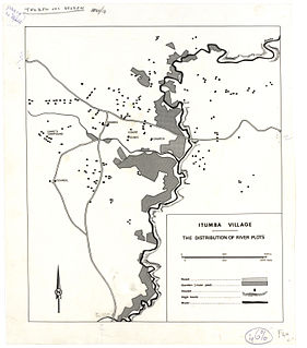
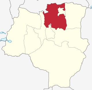
Itumba is an administrative ward in Ileje District, Songwe Region, Tanzania. According to the 2002 census, the ward has a total population of 12,668. It is home to the Ndali people, who occupy that region of Tanzania and parts of Malawi.
Lubanda is an administrative ward in Ileje District, Songwe Region, Tanzania. According to the 2002 census, the ward has a total population of 7,952.
Ngulilo is an administrative ward in Ileje District, Mbeya Region, Tanzania. According to the 2002 census, the ward has a total population of 3,820. The official language is Swahili, and much of the population does not know how to speak English.
Ngulugulu is an administrative ward in Ileje District, Songwe Region, Tanzania. According to the 2002 census, the ward has a total population of 5,346.
Sange is an administrative ward in Ileje District, Songwe Region, Tanzania. According to the 2002 census, the ward has a total population of 4,396.
Santilya is an administrative ward in the Mbeya Rural district of the Mbeya Region of Tanzania. According to the 2002 census, the ward has a total population of 15,271.
Poli is an administrative ward in the Meru District district of the Arusha Region of Tanzania. Despite being one of the least populous wards in the district, Poli is home to Tumaini University Makumira and Makumira University College. Both institutions are located in the largest town in the ward, Makumira. According to the 2002 census, the ward has a total population of 8,659.
Dungunyi is an administrative ward in the Singida Rural district of the Singida Region of Tanzania. According to the 2002 census, the ward has a total population of 10,747.
Itale is an administrative ward in Ileje District, Songwe Region, Tanzania. According to the 2012 census, the ward has a total population of 7,609, up from 6,720 in 2002.
Coordinates: 9°05′S33°48′E / 9.083°S 33.800°E
| | This Mbeya Region location article is a stub. You can help Wikipedia by expanding it. |