
Nicollet Avenue is a major street in Minneapolis, Richfield, Bloomington, and Burnsville in the U.S. state of Minnesota. It passes through a number of locally well-known neighborhoods and districts, notably Eat Street in south Minneapolis and the traffic-restricted Nicollet Mall in downtown Minneapolis.

U.S. Route 65 is a north–south United States highway in the southern and midwestern United States. The southern terminus of the route is at U.S. Route 425 in Clayton, Louisiana. The northern terminus is at Interstate 35 just south of Interstate 90 in Albert Lea, Minnesota. Parts of its modern route in Iowa and historic route in Minnesota follow the old Jefferson Highway.
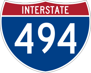
Interstate 494 (I-494) is an auxiliary Interstate Highway making up part of a beltway of I-94, circling through the southern and western portions of the Minneapolis–Saint Paul metropolitan area in Minnesota. The 42.94-mile (69.11 km) road is coupled with I-694 at each end and composes more than half of the major beltway of the region. I-694/I-494 also act as loop routes for I-35E and I-35W.

U.S. Highway 55 was a north–south United States highway. Though it was part of the original 1926 numbering plan, it was deleted within 10 years.

Minnesota State Highway 36 (MN 36) is a 21.718-mile-long (34.952 km) highway in the U.S. state of Minnesota, which runs from its interchange with Interstate 35W (I-35W) in Roseville and continues east to its eastern terminus at the Wisconsin state line, where it becomes Wisconsin Highway 64 (WIS 64) upon crossing the St. Croix River at the St. Croix Crossing bridge. MN 36 is a major freeway in suburban Minneapolis–Saint Paul from its western terminus to its intersection with MN 120, at which point it becomes an at-grade expressway.
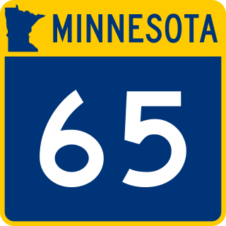
Minnesota State Highway 65 is a highway in the east–central and northeast parts of the U.S. state of Minnesota, which starts at its split from I-35W, skipping past the downtown Minneapolis core, only to resume at the intersection with Washington Avenue at the north end of downtown Minneapolis to continue north to its northern terminus at its intersection with U.S. Highway 71 (US 71) in Littlefork near International Falls.

Minnesota State Highway 77 (MN 77) is a 11.403-mile-long (18.351 km) highway in Minnesota, which runs from its intersection with 138th Street in Apple Valley and continues north to its northern terminus at its interchange with State Highway 62 in Minneapolis. MN 77 is also known as Cedar Avenue.

Minnesota State Highway 121 (MN 121) is a short freeway stub in Minnesota. It is less than one mile (1.6 km) in length.

Lake Street is a major east-west thoroughfare between 29th and 31st streets in Minneapolis, Minnesota United States. From its western most end at the city's limits, Lake Street reaches the Chain of Lakes, passing over a small channel linking Bde Maka Ska and Lake of the Isles, and at its eastern most end it reaches the Mississippi River. In May 2020, the Lake Street corridor suffered extensive damage during local unrest following the murder of George Floyd. In August of the same year, city officials designated East Lake Street as one of seven cultural districts to promote racial equity, preserve cultural identity, and promote economic growth.

Interstate 35E (I-35E) is an Interstate Highway in the US state of Minnesota, passing through downtown Saint Paul. It is one of two through routes for I-35 through the Twin Cities of Minneapolis and Saint Paul, the other being I-35W through Minneapolis. Thus, both ends of I-35E are shared with I-35W and I-35.

Interstate 35W (I-35W) is an Interstate Highway in the US state of Minnesota, passing through downtown Minneapolis. It is one of two through routes for I-35 through the Twin Cities of Minneapolis and Saint Paul, the other being I-35E through downtown Saint Paul.

Interstate 335 (I-335) is a canceled auxiliary Interstate route in Minneapolis, Minnesota. It was planned to cross Northeast Minneapolis from I-35W south of Broadway to I-94 in North Minneapolis. Land was acquired and some demolition had proceeded when the road was defeated by local opposition.

Lyn-Lake is a commercial district in Minneapolis centered at the intersection of West Lake Street and Lyndale Avenue from which it takes its name. The street intersection is the boundary for four official neighborhoods: Whittier on the northeast, Lyndale on the southeast, South Uptown on the southwest, and Lowry Hill East on the northwest. The Lyn-Lake Business Association branded the unofficial commercial district as "Lyn-Lake" in 1999.

The Metro Orange Line is a bus rapid transit line in the Twin Cities, Minnesota operated by Metro Transit. The line operates primarily along Interstate 35W from downtown Minneapolis through Richfield and Bloomington before terminating in Burnsville, Minnesota. The Orange Line provides access to 198,000 jobs with roughly a quarter of them outside downtown Minneapolis. The route serves a mix of stations located in the center of the highway, stations near highway exits, and on-street stations. The line has features typical of bus rapid transit systems with off-board fare payment, articulated buses with extra doors, stations with improved passenger amenities, and transit-only bus lanes on portions of the route.

Minnesota State Highway 62 (MN 62) is a highway in the Twin Cities region of Minnesota. The route was part of County Road 62 (CR 62) until 1988, when a portion of the route was inherited by the state. The western terminus of the highway is at Interstate 494 (I-494) in Eden Prairie, where the roadway continues west as CR 62 to CR 101. The eastern terminus of the route is at the junction with I-494 in Inver Grove Heights. Locally, the original portion of the route in Hennepin County is known as "the Crosstown Highway" or simply "the Crosstown," though signage with this name does not appear on the highway itself, but only on local streets adjacent to the road. It is also used as an alternate name, even by the Minnesota Department of Transportation (MnDOT). The route is 18.6 miles (29.9 km) in length.

Hennepin County Road 122 (CR 122) or County State-Aid Highway 122 (CSAH 122) is an unsigned county state-aid highway within the city of Minneapolis, Hennepin County, Minnesota, United States, crossing the Mississippi River on the Washington Avenue Bridge.

U.S. Highway 169 (U.S. 169) is a major north–south highway in the U.S. state of Minnesota, connecting the Minnesota River valley with the Twin Cities and the Iron Range. Much of the route is built to expressway or freeway standards.

I-35W & Lake Street station is a bus rapid transit station along the Metro Orange Line and planned B Line bus rapid transit (BRT) routes in Minneapolis, Minnesota. In addition to the BRT services, the station is also served by Metro route 578, Minnesota Valley Transit Authority routes 460, 465, 467, 470, 472, 475 and 477, along with SouthWest Transit routes 600 and 695.
Cedar Avenue is a roadway that runs from Minneapolis to Northfield in the U.S. state of Minnesota. The roadway is known as Minnesota State Highway 77 in the busiest portion of the route, from Minneapolis to Apple Valley. The portions north and south of this are county roads, Hennepin County 152 and Dakota County 23, respectively. Its northern terminus in Minneapolis is at Washington Avenue in Cedar-Riverside, though its alignment is briefly interrupted by an interchange at Hiawatha Avenue to the south.


