The Petaling Komuter station is a commuter train station located in Kampung Pasir, Lembah Pantai, in southwestern Kuala Lumpur, Malaysia, served by the Port Klang Line. The station was built near the western end of Old Klang Road, where it then merges into the New Pantai Expressway .

Ligota Strupińska is a village in the administrative district of Gmina Prusice, within Trzebnica County, Lower Silesian Voivodeship, in south-western Poland. Prior to 1945 it was in Germany. It lies approximately 12 kilometres (7 mi) west of Prusice, 21 km (13 mi) north-west of Trzebnica, and 35 km (22 mi) north-west of the regional capital Wrocław.
Kruśliwiec is a village in the administrative district of Gmina Inowrocław, within Inowrocław County, Kuyavian-Pomeranian Voivodeship, in north-central Poland.
Olszewice is a village in the administrative district of Gmina Inowrocław, within Inowrocław County, Kuyavian-Pomeranian Voivodeship, in north-central Poland.

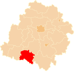
Łążek is a village in the administrative district of Gmina Nowa Brzeźnica, within Pajęczno County, Łódź Voivodeship, in central Poland. It lies approximately 7 kilometres (4 mi) west of Nowa Brzeźnica, 12 km (7 mi) south-east of Pajęczno, and 85 km (53 mi) south of the regional capital Łódź.

Przywidz is a village in the administrative district of Gmina Pęczniew, within Poddębice County, Łódź Voivodeship, in central Poland. It lies approximately 6 kilometres (4 mi) south-east of Pęczniew, 18 km (11 mi) south-west of Poddębice, and 46 km (29 mi) west of the regional capital Łódź.

Alfonsów is a village in the administrative district of Gmina Zadzim, within Poddębice County, Łódź Voivodeship, in central Poland. It lies approximately 4 kilometres (2 mi) north-west of Zadzim, 15 km (9 mi) south-west of Poddębice, and 46 km (29 mi) west of the regional capital Łódź.

Kolonia Rzejowice is a settlement in the administrative district of Gmina Kodrąb, within Radomsko County, Łódź Voivodeship, in central Poland. It lies approximately 4 kilometres (2 mi) east of Kodrąb, 17 km (11 mi) east of Radomsko, and 79 km (49 mi) south of the regional capital Łódź.

Zapolice is a village in the administrative district of Gmina Kodrąb, within Radomsko County, Łódź Voivodeship, in central Poland. It lies approximately 2 kilometres (1 mi) south of Kodrąb, 14 km (9 mi) east of Radomsko, and 79 km (49 mi) south of the regional capital Łódź.

Krukówka is a village in the administrative district of Gmina Biała Rawska, within Rawa County, Łódź Voivodeship, in central Poland. It lies approximately 6 kilometres (4 mi) east of Biała Rawska, 22 km (14 mi) east of Rawa Mazowiecka, and 76 km (47 mi) east of the regional capital Łódź.

Ostrów is a village in the administrative district of Gmina Tarłów, within Opatów County, Świętokrzyskie Voivodeship, in south-central Poland. It lies approximately 9 kilometres (6 mi) north-east of Tarłów, 39 km (24 mi) north-east of Opatów, and 86 km (53 mi) east of the regional capital Kielce.

Wola Żelechowska is a village in the administrative district of Gmina Żelechów, within Garwolin County, Masovian Voivodeship, in east-central Poland. It lies approximately 4 kilometres (2 mi) west of Żelechów, 19 km (12 mi) south-east of Garwolin, and 75 km (47 mi) south-east of Warsaw.
Czarzaste Małe is a village in the administrative district of Gmina Chorzele, within Przasnysz County, Masovian Voivodeship, in east-central Poland.
Dąbrówka Nagórna-Wieś is a village in the administrative district of Gmina Zakrzew, within Radom County, Masovian Voivodeship, in east-central Poland.

Dłużewo is a village in the administrative district of Gmina Trzcianka, within Czarnków-Trzcianka County, Greater Poland Voivodeship, in west-central Poland. It lies approximately 5 kilometres (3 mi) north of Trzcianka, 22 km (14 mi) north of Czarnków, and 82 km (51 mi) north of the regional capital Poznań.
Kolonia Skarszewek is a village in the administrative district of Gmina Żelazków, within Kalisz County, Greater Poland Voivodeship, in west-central Poland.

Antonie is a village in the administrative district of Gmina Popów, within Kłobuck County, Silesian Voivodeship, in southern Poland. It lies approximately 6 kilometres (4 mi) north of Popów, 19 km (12 mi) north of Kłobuck, and 93 km (58 mi) north of the regional capital Katowice.

Potuły is a village in the administrative district of Gmina Stężyca, within Kartuzy County, Pomeranian Voivodeship, in northern Poland. It lies approximately 10 kilometres (6 mi) east of Stężyca, 15 km (9 mi) south-west of Kartuzy, and 40 km (25 mi) south-west of the regional capital Gdańsk.

Bludov is a village and municipality in Kutná Hora District in the Central Bohemian Region of the Czech Republic.
Ajudanieh is a neighbourhood in the north of Tehran, Iran. Ajudanieh is located in Niavaran district. The south end of the street leads to the Aghdasieh area, while the north end leads to Darabad.


