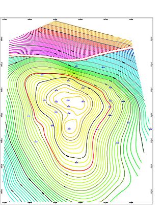
Geologic modelling,geological modelling or geomodelling is the applied science of creating computerized representations of portions of the Earth's crust based on geophysical and geological observations made on and below the Earth surface. A geomodel is the numerical equivalent of a three-dimensional geological map complemented by a description of physical quantities in the domain of interest. Geomodelling is related to the concept of Shared Earth Model; which is a multidisciplinary, interoperable and updatable knowledge base about the subsurface.

A multi-agent system is a computerized system composed of multiple interacting intelligent agents. Multi-agent systems can solve problems that are difficult or impossible for an individual agent or a monolithic system to solve. Intelligence may include methodic, functional, procedural approaches, algorithmic search or reinforcement learning. With advancements in Large language model (LLMs), LLM-based multi-agent systems have emerged as a new area of research, enabling more sophisticated interactions and coordination among agents.
An agent-based model (ABM) is a computational model for simulating the actions and interactions of autonomous agents in order to understand the behavior of a system and what governs its outcomes. It combines elements of game theory, complex systems, emergence, computational sociology, multi-agent systems, and evolutionary programming. Monte Carlo methods are used to understand the stochasticity of these models. Particularly within ecology, ABMs are also called individual-based models (IBMs). A review of recent literature on individual-based models, agent-based models, and multiagent systems shows that ABMs are used in many scientific domains including biology, ecology and social science. Agent-based modeling is related to, but distinct from, the concept of multi-agent systems or multi-agent simulation in that the goal of ABM is to search for explanatory insight into the collective behavior of agents obeying simple rules, typically in natural systems, rather than in designing agents or solving specific practical or engineering problems.

OpenStreetMap is a website that uses an open geographic database which is updated and maintained by a community of volunteers via open collaboration. Contributors collect data from surveys, trace from aerial photo imagery or satellite imagery, and also import from other freely licensed geodata sources. OpenStreetMap is freely licensed under the Open Database License and as a result commonly used to make electronic maps, inform turn-by-turn navigation, assist in humanitarian aid and data visualisation. OpenStreetMap uses its own topology to store geographical features which can then be exported into other GIS file formats. The OpenStreetMap website itself is an online map, geodata search engine and editor.
A Vehicular ad hoc network (VANET) is a proposed type of mobile ad hoc network (MANET) involving road vehicles. VANETs were first proposed in 2001 as "car-to-car ad-hoc mobile communication and networking" applications, where networks could be formed and information could be relayed among cars. It has been shown that vehicle-to-vehicle and vehicle-to-roadside communications architectures could co-exist in VANETs to provide road safety, navigation, and other roadside services. VANETs could be a key part of the intelligent transportation systems (ITS) framework. Sometimes, VANETs are referred to as Intelligent Transportation Networks. They could evolve into a broader "Internet of vehicles". which itself could evolve into an "Internet of autonomous vehicles".

Transportation forecasting is the attempt of estimating the number of vehicles or people that will use a specific transportation facility in the future. For instance, a forecast may estimate the number of vehicles on a planned road or bridge, the ridership on a railway line, the number of passengers visiting an airport, or the number of ships calling on a seaport. Traffic forecasting begins with the collection of data on current traffic. This traffic data is combined with other known data, such as population, employment, trip rates, travel costs, etc., to develop a traffic demand model for the current situation. Feeding it with predicted data for population, employment, etc. results in estimates of future traffic, typically estimated for each segment of the transportation infrastructure in question, e.g., for each roadway segment or railway station. The current technologies facilitate the access to dynamic data, big data, etc., providing the opportunity to develop new algorithms to improve greatly the predictability and accuracy of the current estimations.

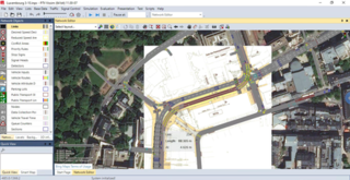
PTV Vissim is a microscopic multi-modal traffic flow simulation software package developed by PTV Planung Transport Verkehr AG in Karlsruhe, Germany. It was first developed in 1992. The name is derived from "Verkehr In Städten - SIMulationsmodell".
UrbanSim is an open source urban simulation system designed by Paul Waddell of the University of California, Berkeley and developed with numerous collaborators to support metropolitan land use, transportation, and environmental planning. It has been distributed on the web since 1998, with regular revisions and updates, from www.urbansim.org. Synthicity Inc coordinates the development of UrbanSim and provides professional services to support its application. The development of UrbanSim has been funded by several grants from the National Science Foundation, the U.S. Environmental Protection Agency, the Federal Highway Administration, as well as support from states, metropolitan planning agencies and research councils in Europe and South Africa. Reviews of UrbanSim and comparison to other urban modeling platforms may be found in references.
Open energy-system models are energy-system models that are open source. However, some of them may use third-party proprietary software as part of their workflows to input, process, or output data. Preferably, these models use open data, which facilitates open science.
Model order reduction (MOR) is a technique for reducing the computational complexity of mathematical models in numerical simulations. As such it is closely related to the concept of metamodeling, with applications in all areas of mathematical modelling.

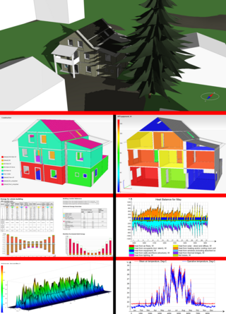
Building performance simulation (BPS) is the replication of aspects of building performance using a computer-based, mathematical model created on the basis of fundamental physical principles and sound engineering practice. The objective of building performance simulation is the quantification of aspects of building performance which are relevant to the design, construction, operation and control of buildings. Building performance simulation has various sub-domains; most prominent are thermal simulation, lighting simulation, acoustical simulation and air flow simulation. Most building performance simulation is based on the use of bespoke simulation software. Building performance simulation itself is a field within the wider realm of scientific computing.
Energy modeling or energy system modeling is the process of building computer models of energy systems in order to analyze them. Such models often employ scenario analysis to investigate different assumptions about the technical and economic conditions at play. Outputs may include the system feasibility, greenhouse gas emissions, cumulative financial costs, natural resource use, and energy efficiency of the system under investigation. A wide range of techniques are employed, ranging from broadly economic to broadly engineering. Mathematical optimization is often used to determine the least-cost in some sense. Models can be international, regional, national, municipal, or stand-alone in scope. Governments maintain national energy models for energy policy development.
Vensim is a simulation software developed by Ventana Systems. It primarily supports continuous simulation, with some discrete event and agent-based modelling capabilities. It is available commercially and as a free "Personal Learning Edition".

GAMA is a simulation platform with a complete modelling and simulation integrated development environment (IDE) for writing and experimenting spatially explicit agent-based models.

Michel Bierlaire is a Belgian-Swiss applied mathematician specialized in transportation modeling and optimization. He is a professor at EPFL and the head of the Transport and Mobility Laboratory.
Synthetic population is artificial population data that fits the distribution of people and their relevant characteristics living in a specified area as according to the demographics from census data. Synthetic populations are often a basis for microsimulation or also agent based models of population behavior. The latter can be used for simulation of disease transmission, traffic and similar.

Peter Kelly Senecal is a mechanical engineer, academic and author. He is a co-founder and Owner of Convergent Science and one of the original developers of CONVERGE, a computational fluid dynamics software. Additionally, he holds positions as a visiting professor at the University of Oxford, an adjunct professor at the University of Wisconsin–Madison, and a co-founder and Director of the Computational Chemistry Consortium (C3).

Evacuation models are simulation tools designed to predict the movement and behaviour of individuals during an emergency evacuation. These models are today used to simulate evacuations for several disasters, such as building fires, wildfires, hurricanes, and tsunamis. Thes models have been under development since the late 1970s and they are now widely to assess the time required to evacuate buildings, cities or wider regions.


