Siemiatycze is a town in north-eastern Poland, with 15,209 inhabitants (2004). It is situated in the Podlaskie Voivodeship ; previously it was in Białystok Voivodeship (1975–98). It is the capital of Siemiatycze County.

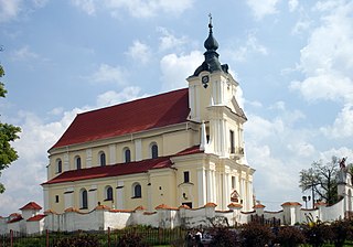
Mielnik is a village in Siemiatycze County, Podlaskie Voivodeship, in north-eastern Poland, close to the border with Belarus. It is the seat of the gmina called Gmina Mielnik. It lies approximately 17 kilometres (11 mi) south-east of Siemiatycze and 88 km (55 mi) south of the regional capital Białystok.

Smolugi is a village in the administrative district of Gmina Dziadkowice, within Siemiatycze County, Podlaskie Voivodeship, in north-eastern Poland. It lies approximately 22 kilometres (14 mi) north of Siemiatycze and 58 km (36 mi) south of the regional capital Białystok.
Krakówki-Dąbki is a village in the administrative district of Gmina Grodzisk, within Siemiatycze County, Podlaskie Voivodeship, in north-eastern Poland. It lies approximately 8 kilometres (5 mi) south-west of Grodzisk, 20 km (12 mi) north-west of Siemiatycze, and 73 km (45 mi) south-west of the regional capital Białystok.
Adamowo-Zastawa is a village in the administrative district of Gmina Mielnik, within Siemiatycze County, Podlaskie Voivodeship, in north-eastern Poland, close to the border with Belarus. It lies approximately 6 kilometres (4 mi) north-east of Mielnik, 19 km (12 mi) east of Siemiatycze, and 84 km (52 mi) south of the regional capital Białystok.
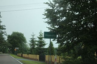
Homoty is a village in the administrative district of Gmina Mielnik, within Siemiatycze County, Podlaskie Voivodeship, in north-eastern Poland, close to the border with Belarus. It lies approximately 10 kilometres (6 mi) north-west of Mielnik, 8 km (5 mi) south-east of Siemiatycze, and 81 km (50 mi) south of the regional capital Białystok.
Mętna is a village in the administrative district of Gmina Mielnik, within Siemiatycze County, Podlaskie Voivodeship, in north-eastern Poland, close to the border with Belarus. It lies approximately 6 kilometres (4 mi) east of Mielnik, 21 km (13 mi) south-east of Siemiatycze, and 86 km (53 mi) south of the regional capital Białystok.
Moszczona Królewska is a village in the administrative district of Gmina Mielnik, within Siemiatycze County, Podlaskie Voivodeship, in north-eastern Poland, close to the border with Belarus. It lies approximately 7 kilometres (4 mi) north-west of Mielnik, 11 km (7 mi) south-east of Siemiatycze, and 83 km (52 mi) south of the regional capital Białystok.
Niemirów is a village in the administrative district of Gmina Mielnik, within Siemiatycze County, Podlaskie Voivodeship, in north-eastern Poland, close to the border with Belarus. It lies approximately 8 kilometres (5 mi) south-east of Mielnik, 25 km (16 mi) south-east of Siemiatycze, and 91 km (57 mi) south of the regional capital Białystok.

Oksiutycze is a village in the administrative district of Gmina Mielnik, within Siemiatycze County, Podlaskie Voivodeship, in north-eastern Poland, close to the border with Belarus. It lies approximately 11 kilometres (7 mi) north-west of Mielnik, 9 km (6 mi) east of Siemiatycze, and 79 km (49 mi) south of the regional capital Białystok.
Osłowo is a village in the administrative district of Gmina Mielnik, within Siemiatycze County, Podlaskie Voivodeship, in north-eastern Poland, close to the border with Belarus. It lies approximately 4 kilometres (2 mi) north-west of Mielnik, 13 km (8 mi) south-east of Siemiatycze, and 86 km (53 mi) south of the regional capital Białystok.

Pawłowicze is a village in the administrative district of Gmina Mielnik, within Siemiatycze County, Podlaskie Voivodeship, in north-eastern Poland, close to the border with Belarus. It lies approximately 9 kilometres (6 mi) north-west of Mielnik, 9 km (6 mi) east of Siemiatycze, and 81 km (50 mi) south of the regional capital Białystok.
Radziwiłłówka is a village in the administrative district of Gmina Mielnik, within Siemiatycze County, Podlaskie Voivodeship, in north-eastern Poland, close to the border with Belarus. It lies approximately 6 kilometres (4 mi) north of Mielnik, 13 km (8 mi) south-east of Siemiatycze, and 82 km (51 mi) south of the regional capital Białystok.
Sutno is a village in the administrative district of Gmina Mielnik, within Siemiatycze County, Podlaskie Voivodeship, in north-eastern Poland, close to the border with Belarus. It lies approximately 5 kilometres (3 mi) east of Mielnik, 22 km (14 mi) south-east of Siemiatycze, and 89 km (55 mi) south of the regional capital Białystok.
Wajków is a village in the administrative district of Gmina Mielnik, within Siemiatycze County, Podlaskie Voivodeship, in north-eastern Poland, close to the border with Belarus. It lies approximately 5 kilometres (3 mi) south-east of Mielnik, 21 km (13 mi) south-east of Siemiatycze, and 91 km (57 mi) south of the regional capital Białystok.
Wilanowo is a village in the administrative district of Gmina Mielnik, within Siemiatycze County, Podlaskie Voivodeship, in north-eastern Poland, close to the border with Belarus. It lies approximately 12 kilometres (7 mi) north-east of Mielnik, 24 km (15 mi) east of Siemiatycze, and 82 km (51 mi) south of the regional capital Białystok.
Baciki Bliższe is a village in the administrative district of Gmina Siemiatycze, within Siemiatycze County, Podlaskie Voivodeship, in north-eastern Poland. It lies approximately 5 kilometres (3 mi) north-east of Siemiatycze and 76 km (47 mi) south of the regional capital Białystok.
Baciki Dalsze is a village in the administrative district of Gmina Siemiatycze, within Siemiatycze County, Podlaskie Voivodeship, in north-eastern Poland. It lies approximately 6 kilometres (4 mi) north-east of Siemiatycze and 75 km (47 mi) south of the regional capital Białystok.
Turna Duża is a village in the administrative district of Gmina Siemiatycze, within Siemiatycze County, Podlaskie Voivodeship, in north-eastern Poland. It lies approximately 6 kilometres (4 mi) south of Siemiatycze and 84 km (52 mi) south of the regional capital Białystok.


