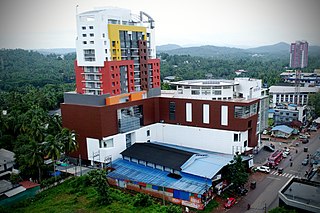
Malappuram is one of the 14 districts in the Indian state of Kerala, with a coastline of 70 km (43 mi). It is the most populous district of Kerala, which is home to around 13% of the total population of the state. The district was formed on 16 June 1969, spanning an area of about 3,554 km2 (1,372 sq mi). It is the third-largest district of Kerala by area, as well as the largest district in the state bounded by Western Ghats and Arabian Sea to the two sides. Malappuram is the third major contributing district to the Gross State Domestic Product of Kerala as of 2019, after Ernakulam and Thiruvananthapuram. The district is divided into seven Taluks - Eranad, Kondotty, Nilambur, Perinthalmanna, Ponnani, Tirur, and Tirurangadi. Economically booming towns in Malappuram district include Malappuram, Manjeri, Perinthalmanna, Kottakkal, Nilambur, Tirur, Parappanangadi, Kondotty, Chemmad, Puthanathani, Valanchery, Edappal, Wandoor, Areekode, and Edakkara. Having 12 municipalities in total, the district has the second-highest number of Municipal towns in the state lying just behind Ernakulam (13).
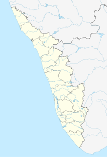
Nilambur is a major town, a municipality and a Taluk in the Malappuram district of the Indian state of Kerala. It is located close to the Nilgiris range of the Western Ghats on the banks of the Chaliyar River. This place is also known as 'Teak Town' because of the abundance of Nilambur teaks in this area; Which is a variety of a large, deciduous tree that occurs in mixed hardwood forests. Unlike many Municipalities of India; Nilambur is covered with large amounts of vegetation making it close to nature and hence make it very scenic and inspiring.

Chaliyar River is the fourth longest river in Kerala at 169 km in length. The Chaliyar is also known as Chulika River, Nilambur River or Beypore River as it nears the sea. Pothukal, Chungathara, Nilambur, Mampad, Edavanna, Kavanoor, Perakamanna, Areekode, Kizhuparamba, Elamaram, Cheekkode, Vazhakkad, Vazhayur, Cheruvadi, Edavannappara, Mavoor, Peruvayal, Feroke and Beypore are some of the towns/villages situated along the banks of Chaliyar. It mainly flows through Malappuram district. It's tributaries flow through both the districts of Malappuram and Kozhikode. The bank of river Chaliyar at Nilambur region is also known for natural Gold fields. Explorations done at the valley of the river Chaliyar in Nilambur has shown reserves of the order of 2.5 million cubic meters of placers with 0.1 gram per cubic meter of gold. It originates at Ilambaleri hills of Nilgiri Mountains in Nilgiris district, which is also near Wayanad-Malappuram district border. It flows mainly through the erstwhile region of Eranad, and finally empties into the Arabian Sea at Beypore port, opposite to Chaliyam harbour.

Kottakkal is a municipal town in Malappuram district in Kerala, southern India having 32 wards. it is a part of Malappuram metropolitan area and a growing city in Kerala. The town is best known for the Arya Vaidya Sala, one of the top Ayurvedic health centres of the world. Kottakkal is also a major growing commercial, educational, and healthcare hub in South Malabar. The town lies on Mumbai-Kanyakumari National Highway 66.

Tirur is a Town, a municipality, and the headquarters of Tirur Taluk, block, and Revenue Division in Malappuram district in the Indian state of Kerala. Tirur spread over an area of about 15 square kilometres (5.8 sq mi). It is one of the 12 municipalities in Malappuram district and is situated 26 kilometres (16 mi) southwest of Malappuram and 52.5 kilometres (32.6 mi) south of Kozhikode, on the Shoranur–Mangalore section of the Mangalore–Chennai railway line. Tirur Railway Station is the oldest Railway station in Kerala. The first railway line in Kerala was laid in 1861 from Tirur to Chaliyam through Tanur, Parappanangadi, Vallikkunnu, and Kadalundi. The second railway line was laid in same year from Tirur to Kuttippuram through Tirunavaya. Tirur is also the headquarters of a Revenue Division, a Taluk, a block, and a postal division of the same name. Tirur River and Conolly's Canal flow through Tirur. The medeival Kerala School of Astronomy and Mathematics was mainly based at Tirur. Notable people from Tirur include Thunchaththu Ezhuthachan, and Vallathol Narayana Menon. The Thunchath Ezhuthachan Malayalam University is headquartered at Tirur. Tirur was the main centre of the medieval Kerala School of Astronomy and Mathematics that flourished between 14th and 16th centuries of Common Era.

Malappuram is a city in the Indian state of Kerala, spread over an area of 58.20 km2 (22.47 sq mi). The first municipality in the district formed in 1969, Malappuram serves as the administrative headquarters of Malappuram district. Divided into 40 electoral wards, the city has a population density of 1,742 per square kilometre. According to the 2011 census, Malappuram metropolitan area is the fourth largest urban agglomeration in Kerala after Kochi, Calicut, and Thrissur urban areas and the 25th largest in India with a total population of 1.7 million. It is the fastest growing city in the world with a 44.1% urban growth between 2015 and 2020 as per the survey conducted by Economist Intelligence Unit (EIU) based on the urban area growth during January 2020. Malappuram is situated 54 km southeast of Calicut and 90 km northwest of Palakkad. It is the first Indian municipal body to provide free Wi-Fi connectivity to its entire residents. Malappuram is also the first Indian municipal body to achieve the International Organization for Standardization certificate. It is also the first complaint-free municipality in the state.
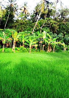
Ramanattukara is a Municipality census town in Kozhikode district in the Indian state of Kerala. This town was formerly called Kadungan Chira village. Ramanattukara is located 14 km away from Kozhikode city.

Edappal is a town which lies near to the city of Ponnani in Ponnani taluk, Malappuram district, Kerala state, India. Edappal is at a junction of two roads Thrissur-Kuttippuram and Palakkad-Ponnani state highways located 45 km from Malappuram. Edappal lies in two panchayaths, Vattamkulam, and Edappal. Edappal shares borders with Thuyyam, Polpakkara, Ayilakkadu, Vattamkulam, and Annakampadu. Sukapuram, one of the earliest Brahmin settlements in Kerala, lies in Edappal. The Azhvanchery Thamprakkal of Athavanad, had influence over the Nambudiris of Sukapuram (Chowwara), while the Kalpakanchery Thamprakkal of Kalpakanchery influenced the rival Nambudiris of Panniyoor. Edappal forms a portion of the Malappuram metropolitan area as of 2011 Census. Edappal lies in Ponnani Kole Wetlands and is surrounded by the Biyyam backwater lake of Ponnani. Bijoy P Padmanabhan is the current Edapal Panchayath President elected in November 2015.

Edakkara is a town located in Malappuram district of the Indian state of Kerala. It is an emerging commercial hub, and one of the busiest towns in Nilambur Taluk.

Kuttippuram is a town and a block headquarters, which is situated in the Tirur Taluk, Malappuram district of Kerala state, India. The town is located 34 kilometres south-west of Malappuram. The Bharathappuzha river flows through Kuttippuram. According to the last Census of India conducted in 2011, Kuttippuram forms a portion of the Malappuram metropolitan area.
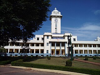
The importance and antiquity of education in Kerala is underscored by the state's ranking as among the most literate in the country. The educational transformation of Kerala was triggered by efforts of the Church Mission Society missionaries, who were the pioneers that promoted mass education in Kerala, in the early decades of the 19th century. The local dynastic precursors of modern-day Kerala—primarily the Travancore Royal Family, the Nair Service Society, Sree Narayana Dharma Paripalana Yogam and Muslim Educational Society (MES)—also made significant contributions to the progress on education in Kerala. Local schools were known by the general word kalaris, some of which taught martial arts,but other village schools run by Ezhuthachans or Asians were for imparting general education. Christian missionaries and British rule brought the modern school education system to Kerala.

Valanchery is a major town and one of the 12 municipalities in Malappuram district, Kerala, India. It is one of the four municipalities in Tirur Taluk, besides Tirur, Kottakkal, and Tanur. It is situated about 40 kilometres (25 mi) southeast to Karipur International Airport and 25 kilometres (16 mi) southwards to the district headquarters, and forms a part of Malappuram metropolitan area. It is also one of the major commercial towns under the Malappuram urban agglomeration. Valanchery, which was a part of the erstwhile princely state of the Valluvanad in the early medieval period, had been under the direct control of the Zamorin of Calicut following the Tirunavaya war of 14th century CE. During British Raj, Valanchery was included in the Ponnani Taluk of erstwhile Malabar District. Vattapara accident zone is an accident zone near Valanchery. Valanchery is situated on National Highway 66.

Vengara is a town in Malappuram district of Kerala state. It is situated in the Vengara Grama Panchayat and is located in Tirurangadi Taluk.

Karuvarakundu is a semi-urban area in the eastern part of Malappuram district, Kerala, India. It is situated 32 kilometres (20 mi) east of Manjeri, 26 kilometres (16 mi) northeast of Perinthalmanna and 30 km southeast of Nilambur. The Olippuzha River, a tributary of the Kadalundipuzha, flows through the town. Karuvarakundu is close to the Western Ghats and hence prone to landslides. The Silent Valley National Park was included in Karuvarakundu until 1990's.

Perinthalmanna is a major town, a municipality, and the headquarters of the Perinthalmanna taluk in Malappuram district, Kerala, India. It is also the headquarters of a block and a Revenue Division of the same name. The town is located 23 kilometres (14 mi) south-west to the city of Malappuram and 24 kilometres (15 mi) away from Manjeri, at the centre of the Kozhikode-Palakkad National Highway 966.
Perumbadappu is a village located in Ponnani taluk, Malappuram district, Kerala state, India. It is situated 15 kilometers south of Ponnani, bordering Thrissur district. Perumbadappu is also headquarters of one of the 15 Block Panchayats in the district and a police station. Perumbadappu is located south of Veliyankode, in the middle of Malabar Coast.

The Malappuram district has four types of administrative hierarchies:
Malappuram is one of the 14 districts in the South Indian state of Kerala. The district has a unique and eventful history starting from pre-historic times. During the early medieval period, the district was the home to two of the four major kingdoms that ruled Kerala. Perumpadappu was the original hometown of the Kingdom of Cochin, which is also known as Perumbadappu Swaroopam, and Nediyiruppu was the original hometown of the Zamorin of Calicut, which is also known as Nediyiruppu Swaroopam. Besides, the original headquarters of the Palakkad Rajas were also at Athavanad in the district.

South Malabar refers to a geographical area of the southwestern coast of India covering some parts of the present-day Kerala. South Malabar covers the regions included in present-day Kozhikode Taluk of Kozhikode district, whole area of Malappuram district, Chavakkad Taluk of Thrissur district, and Palakkad district excluding parts of Chittur Taluk. The Fort Kochi region of Kochi city also historically belongs to South Malabar. The term South Malabar refers to the region of the erstwhile Malabar District which lies south to the river Korapuzha and bears high cultural similarity with both the Cochin as well as the North Malabar region.
