Madogbo

Last updated
Madogbo
Sierra Leone adm location map.svg
Red pog.svg
Madogbo
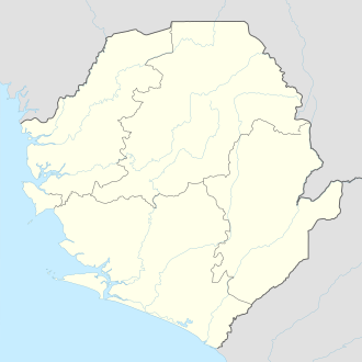
Location in Sierra Leone
Coordinates: 9°35′N11°33′W / 9.583°N 11.550°W / 9.583; -11.550
Country Sierra Leone
Province Northern Province
District Koinadugu District
ChiefdomFolosaba Dembelia
Government
  Paramount Chief Alhaji Fenda Modu Kamara
Time zone UTC-5 (GMT)

Madogbo is a mountainous Yalunka village in Folosaba Dembelia chiefdom in Koinadugu District in the Northern Province of Sierra Leone . The village lies about thirteen miles to Kabala, the main town in Koinadugu District. Madogbo is inhabited by the Yalunka people. The major industry in the village is farming .

The village of Madogbo is virtually all muslims and islam dominates the religious and cultural practices in the village. Traditional Islamic schools to learn the Quran are dominant in the village . Madogbo is home to one Sierra Leone government primary school.

Related Research Articles

<span class="mw-page-title-main">Sierra Leone</span> Country on the southwest coast of West Africa

Sierra Leone, officially the Republic of Sierra Leone, is a country on the southwest coast of West Africa. It is bordered to the southeast by Liberia and by Guinea to the north. Its land area is 71,740 km2 (27,699 sq mi). It has a tropical climate and environments ranging from savannas to rainforests. As of the 2015 census, Sierra Leone had a population of 7,092,113. Freetown is both its capital and its largest city. The country is divided into five administrative regions, which are further subdivided into 16 districts.

<span class="mw-page-title-main">Kabala, Sierra Leone</span> Place in Northern Province, Sierra Leone

Kabala is the capital and largest town of Koinadugu District in the Northern Province of Sierra Leone. Kabala is one of the main towns in Northern Sierra Leone and is set in a rural landscape, surrounded by mountains.

<span class="mw-page-title-main">Bombali District</span> Place in Northern Province, Sierra Leone

Bombali is a district in the Northern Province of Sierra Leone. Its capital and largest city is Makeni, which is also the largest city in the north. The Bombali district is one of the sixteen districts of Sierra Leone. Bombali is one of the largest districts in Sierra Leone by geographical area, after Koinadugu District, and is the second most populous district in the Northern part of Sierra Leone, after Port Loko district. In the 2015 Sierra Leone national census, the population of Bombali District was 606,183. Other major towns in Bombali District include Kamabai, Karina and Binkolo.

<span class="mw-page-title-main">Northern Province, Sierra Leone</span> Province of Sierra Leone

The Northern Province is one of the five provincial divisions of Sierra Leone. It is located in the Northern geographic region of Sierra Leone. It comprises the following four Districts: Bombali, Falaba, Koinadugu and Tonkolili. The Northern Province covers an area of 35,936 km2 (13,875 sq mi) with a population of 2,502,865, based on the 2015 Sierra Leone national census. Its administrative and economic center is Makeni. The North borders the North West Province to the West, the Republic of Guinea to the north-east, the Eastern Province and Southern Province to the south-east.

<span class="mw-page-title-main">Limba people (Sierra Leone)</span> Ethnic group in Sierra Leone

The Limba people are an ethnic group in Sierra Leone. They represent 12.4% of the total population, making them the third largest ethnic group in Sierra Leone. The Limba are based in the north of the country across seven provinces, but are predominantly found in the Northern Province of Sierra Leone.

<span class="mw-page-title-main">Kono District</span> Place in Eastern Province, Sierra Leone

Kono District is a district in the Eastern Province of Sierra Leone. Its capital and largest city is Koidu Town. Motema is the second most populous city in the district. The other major towns in the district include Yengema, Tombodu, Jaiama Nimikor and Sewafe. The district is the largest diamond producer in Sierra Leone. The population of Kono District is 505,767. Kono District borders Kenema District to the southwest, The Republic of Guinea to the east, Koinadugu District to the northeast and Kailahun District to the southeast. Kono District is divided into fourteen chiefdoms.

<span class="mw-page-title-main">Koinadugu District</span> Place in Northern Province, Sierra Leone

Koinadugu District is a district in the Northern Province of Sierra Leone. It is the largest District in Sierra Leone in geographical area, and one of the least densely populated. Its capital and largest city is Kabala, which is also one of the main cities in Northern Sierra Leone. The District of Koinadugu has a population of 404,097, based on the 2015 Sierra Leone national census; and has a total area of 12,121 km2 (4,680 sq mi). Koinadugu District is subdivided into eleven chiefdoms.

The Kuranko, also called Koranko, Kolanko, Kooranko, Koronko, Kouranko, Kulanko, Kurako, Kuronko, Kuranké, or Karanko, are a Mandeka people that occupy a large section in a mountainous region within northeastern Sierra Leone and southern Guinea. Within this geographical region, different dialects, as well as distinct social groupings can be found. In general, the Koranko are a peaceful people who have maintained a separate ethnic identity, despite years of tribal mixings. Each Kuranko village is led by a chief and a group of elders.

<span class="mw-page-title-main">Yalunka people</span> Ethnic group of West Africa

The Yalunka, or Dialonké, are a Mandé-speaking people and the original inhabitants of Futa Jallon, a mountainous region in Guinea, West Africa. The Yalunka people live primarily in Guinea, particularly in Faranah, while smaller communities are found in Kouroussa. Additional Yalunka are also located in northeastern Sierra Leone, southeastern Senegal, and southwestern Mali.

<span class="mw-page-title-main">Education in Sierra Leone</span>

Education in Sierra Leone is legally required for all children for six years at primary level and three years in junior secondary education, but a shortage of schools and teachers has made implementation impossible. The Sierra Leone Civil War resulted in the destruction of 1,270 primary schools and in 2001 67 percent of all school-age children were out of school. The situation has improved considerably since then with primary school enrollment doubling between 2001 and 2005 and the reconstruction of many schools since the end of the war. However, there is still a long ways to go. In 2004, Junior secondary school enrollment was only 17% of primary school enrollment, and senior secondary school enrollment was only 8% of primary school education.

Fula people of Sierra Leone is the fourth major ethnic group in Sierra Leone after the Temne, Mende and Limba ethnic groups and a branch of the Fula people of West Africa. The Fula make up about 3.4% of Sierra Leone's population. The Sierra Leone Fula people settled in the Western Area region of Sierra Leone more than four hundred years ago as settlers from the Fouta Djallon Kingdom that expanded to northern Sierra Leone.

Mandingo people of Sierra Leone is a major ethnic group in Sierra Leone and a branch of the Mandinka people of West Africa. Most Sierra Leonean Mandingo are the direct descendants of Mandinka settlers from Guinea, who settled in the north and eastern part of Sierra Leone, beginning in the late 1870s to the 1890s under the rule of prominent Mandinka Muslim cleric Samori Ture. Also later a significantly large population of Mandinka from Guinea migrated and settled in Eastern Sierra Leone and Northern Sierra Leone in the early to mid 20th century. The Mandingo people of Sierra Leone have a very close friendly and allied relationship with their neighbors the Mandingo people of Guinea and Liberia, as they share pretty much identical dialect of the Mandingo language, tradition, culture and food.

Danda Mohamed Kondeh is a Sierra Leonean economist and politician. He is currently a member of parliament of Sierra Leone from his home district of Koinadugu. He is a member of the ruling All People's Congress (APC).

<span class="mw-page-title-main">Religion in Sierra Leone</span>

Sierra Leone is officially a secular state, although Islam and Christianity are the two main and dominant religions in the country. The Sierra Leone Government is constitutionally forbidden from establishing a state religion, though Muslim and Christian prayers are usually held in the country at the beginning of major political occasions, including presidential inauguration.

Kaifala Marah is a Sierra Leonean politician, accountant, Governor of the Bank of Sierra Leone (2016–2017), and Minister of Finance (2013–2016). On 7 March 2017, Dr. Marah resigned as governor to seek the nomination of the All People's Congress (APC) for the presidential election of 2018.

<span class="mw-page-title-main">Ethnic groups in Sierra Leone</span> Ethnic groups living within the country of Sierra Leone

Sierra Leone is home to about sixteen ethnic groups, each with its own language. In Sierra Leone, membership of an ethnic group often overlaps with a shared religious identity. According to the 2004 census Temne is the largest ethnic group in Sierra Leone.

<span class="mw-page-title-main">Victor Bockarie Foh</span> Sierra Leonean politician

Victor Bockarie Foh is a Sierra Leonean politician who served as Vice President of Sierra Leone from 19 March 2015 to 4 April 2018. Foh replaced Samuel Sam-Sumana as vice president, after Sam-Sumana was sacked by President Ernest Bai Koroma.

<span class="mw-page-title-main">Falaba District</span> Place in Northern Province, Sierra Leone

Falaba District is a district in the Northern Province of Sierra Leone. It is one of the sixteen districts of Sierra Leone. Its capital and largest town is Bendugu. Other towns in Falaba District include Falaba, Sikunia, Krubola, Musaia Ganya and Mansadu. Falaba District is divided into thirteen chiefdoms. Falaba District is one of the largest districts in Sierra Leone in land area, However, it is one of the least most populous districts in the country. Falaba District is known for its mostly conservative Muslim population. Falaba District has a population of 205,353, based on 2018 estimate.

Walia is a rural remote village in Mongo Chiefdom, Falaba District in the Northern Province of Sierra Leone. Walia is located at the international border with the Republic of Guinea. The main economic activity in Walia is farming. The village of Walia is extremely remote and there is no accessible road transport by vehicle to Walia village.