Magharibi District

Last updated
Zanzibar West District
Tanzania location map.svg
Red pog.svg
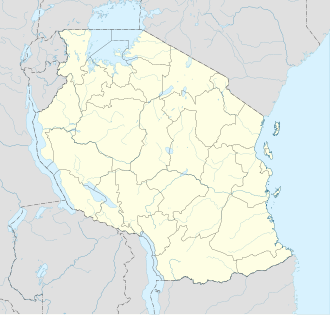
Zanzibar West District
Location in Tanzania
Coordinates: 06°10′S039°17′E / 6.167°S 39.283°E / -6.167; 39.283
CountryFlag of Tanzania.svg  Tanzania
Region Zanzibar Urban/West Region
Population
 (2012)
  Total370,645

Zanzibar West District is one of the two districts of the Zanzibar Urban/West Region of Tanzania. It is bordered to the north by the Zanzibar North Region, to the east by the Zanzibar Central/South Region, to the south by Kiwani Bay, and to the west by the Zanzibar Urban District.

Contents

As of 2002 Census, the population of the Zanzibar West District was 184,204, but by the 2012 Census it had more than doubled to 370,645 [1] [2]

Administrative subdivisions

Constituencies

For parliamentary elections, Tanzania is divided into constituencies. As of the 2010 elections the area for Zanzibar West District had nine of the nineteen constituencies in the region: [3]

Wards

As of 2012, the Zanzibar West District was administratively divided into thirty-nine wards: [1]

Nr.Ward (Shehia)Population
2012
Parliamentay
Constituency
Remarks
1Sharifu Msa4,975Bububu
2Kibweni7,115Bububu
3Mwanyanya9,683Bububu
4Bububu15,666Bububu
5Kihinani14,139Mfenesini
6Chuini6,158Mfenesini
7Kama2,921Mfenesini
8Mfenesini2,803Mfenesini
9Mwakaje2,907Mfenesini
10Mbuzini5,856Mfenesini"on the goat"
11Bumbwisudi2,269Dole
12 Kizimbani 3,304Dole
13Dole3,933Dole
14Kianga9,908Dole
15Mwera10,238Dole
16Mtufaani9,123Dole
17 Mtoni 6,571Mtoni"in the river"
18Mtoni Kidatu16,612Mtoni
19Mto Pepo16,440Mtoni
20Welezo13,119Magogoni
21Magogoni14,928Magogoni
22Kinuni11,333Magogoni
23Pangawe26,275Fuoni
24Fuoni Kibondeni15,40Fuoni
25Maungani4,048Fuoni
26Fuoni Kijito Upele19,374Fuoni
27Mwanakwerekwe20,215Mwanakwerekwe
28Meli Nne16,984Mwanakwerekwe
29Tomondo23,354Mwanakwerekwe
30Mombasa14,492Dimani
31Kisauni9,331Dimani
32Shakani2,760Dimani
33Nyamanzi1,287Dimani
35Dimani2,052Dimani
34Kombeni3,162Dimani
36Bweleo971Dimani
37Fumba981Dimani
38Kiembesamaki11,760Kiembesamaki
39Chukwani8,298Kiembesamaki
TotalZanzibar West370,645 

Notes

  1. 1 2 "2002 Population and Housing Census: General Report: Urban West: West". Archived from the original on 18 March 2004.
  2. National Bureau of Statistics Tanzania (web).
  3. "Organisations located in Zanzibar City - Tanzania". African Development Information. Archived from the original on 2012-09-04.


Related Research Articles

<span class="mw-page-title-main">Pwani Region</span> Region of Tanzania

Pwani Region is one of Tanzania's 31 administrative regions. The word "Pwani" in Swahili means the "coast". The regional capital is the town of Kibaha. The Region borders the Tanga Region to the north, Morogoro Region to the west, Lindi Region to the south, and surrounds Dar es Salaam Region to the east. The Indian Ocean also borders the region to its northeast and southeast. The region is home to Mafia Island, the Rufiji delta and Saadani National Park. The region is home to Bagamoyo town, a historical Swahili settlement, and the first colonial capital of German East Africa. According to the 2012 national census, the region had a population of 1,098,668, which was slightly lower than the pre-census projection of 1,110,917. From 2002 to 2012, the region's 2.2 percent average annual population growth rate was the seventeenth-highest in the country. It was also the 21st most densely populated region with 34 people per square kilometre., the region is slightly larger than Belgium.

<span class="mw-page-title-main">Unguja North Region</span> Region of Tanzania

Unguja North Region, Zanzibar North Region or North Zanzibar Region is one of the 31 regions of Tanzania. The region covers an area of 407 km2 (157 sq mi). The region is comparable in size to the combined land area of the nation state of Andorra. and the administrative region is located entirely on the island of Zanzibar. Unguja North Region is bordered on three sides to the north by Indian Ocean, southeast by Unguja South Region and southwest by Mjini Magharibi Region. The regional capital is the town of Mkokotoni. According to the 2012 census, the region has a total population of 187, 455. Zanzibar North is divided into two districts, Kaskazini A and Kaskazini B.

<span class="mw-page-title-main">Unguja South Region</span> Region of Tanzania

Unguja South Region, Zanzibar South Region or South Zanzibar Region is one of the 31 regions of Tanzania. The region covers an area of 854 km2 (330 sq mi). The region is comparable in size to the combined land area of the nation state of Kiribati. and the administrative region is located entirely on the island of Zanzibar. Unguja South Region is bordered on three sides to the south by Indian Ocean, northeast by Unguja North Region and northwest by Mjini Magharibi Region. The regional capital is the town of Koani. Besides being known for its Spinner dolphin populations, the region is also home to the oldest mosque in East Africa, the Kizimkazi Mosque and also historic Makunduchi town. According to the 2012 census, the region has a total population of 94,504.

<span class="mw-page-title-main">Mjini Magharibi Region</span> Region of Tanzania

Mjini Magharibi Region, Zanzibar Urban West Region or West Zanzibar Region is one of the 31 regions of Tanzania. The region covers an area of 230 km2 (89 sq mi). The region is located entirely on the island of Zanzibar and bordered to the west by the Indian Ocean, north by Unguja North Region and the east by Unguja South Region. The region is home to one of the seven World Heritage Sites located in Tanzania, namely; Stonetown of Zanzibar. The regional capital is Zanzibar City. According to the 2012 census, the region has a total population of 593,678.

<span class="mw-page-title-main">Kilombero District</span> District in Morogoro Region, Tanzania

Kilombero District is a district in Morogoro Region, south-western Tanzania.

<span class="mw-page-title-main">Magu District</span> District in Mwanza Region, Tanzania

Magu District is one of the seven districts of the Mwanza Region of Tanzania, East Africa. Its administrative centre is the town of Magu on the Simiyu River. It is bordered to the north by Lake Victoria and Busega District, to the east by Bariadi District, to the south by Itilima District, Maswa District, Kwimba District and Misungwi District, and to the west by the city of Mwanza, which consists of Nyamagana District and Ilemela District.

<span class="mw-page-title-main">Monduli District, Arusha</span> District of Arusha Region, Tanzania

'Monduli District is one of seven districts of the Arusha Region of Tanzania. It is bordered to the north by Longido District, to the east by Arusha Rural District, to the south by the Manyara Region and to the west by Ngorongoro District and Karatu District. The District covers an area of 6,993 km2 (2,700 sq mi). The town of Monduli is the administrative seat of the district. According to the 2002 Tanzania National Census, the population of the Monduli District was 185,237. By 2012, the population of the district was 158,929.

<span class="mw-page-title-main">Masasi District, Mtwara</span> District in Mtwara Region, Tanzania

Masasi is one of the six districts of the Mtwara Region of Tanzania. It is bordered to the north by the Lindi Region, to the east by the Newala District, to the south by the Ruvuma River and Mozambique and to the west by Nanyumbu District.

<span class="mw-page-title-main">Kilolo District</span> District of Iringa Region, Tanzania

Kilolo is one of the four districts of the Iringa Region of Tanzania. It is bordered to the north and east by the Morogoro Region, to the south by Mufindi District and to the west by the Iringa Rural District.

<span class="mw-page-title-main">Mufindi District</span> District in Iringa, Tanzania

Mufindi District is one of the four districts of the Iringa Region of Tanzania. It is bordered to the north by Kilolo District and Iringa Urban District, to the south by the Njombe Region, to the east by the Morogoro Region and to the west by the Singida Region.

<span class="mw-page-title-main">Kilosa District</span> District in Morogoro Region, Tanzania

Kilosa District is one of the six districts of the Morogoro Region of Tanzania. Its administrative seat is the town of Kilosa. Kilosa District covers 14,918 square kilometres (5,760 sq mi). It is bordered to the north by the Manyara Region, to the northeast by the Tanga Region, to the east by Mvomero District, to the southeast by Morogoro Rural District, to the south by Kilombero District, to the southwest by the Iringa Region and to the west by the Dodoma Region. Kilosa District is home to Mikumi National Park.

<span class="mw-page-title-main">Morogoro Rural District</span> District in Morogoro Region, Tanzania

Morogoro Rural District is one of the six districts of the Morogoro Region of Tanzania. Morogoro Rural District covers 19,056 square kilometres (7,358 sq mi). It is bordered to the north and east by the Pwani Region, to the south by Kilombero District, to the southwest by the Kilosa District and to the west by the Mvomero District and the Morogoro Urban District.

<span class="mw-page-title-main">Chunya District</span> District of Mbeya Region, Tanzania

Chunya District is one of the seven districts of Mbeya Region, Tanzania. It is bordered to the north by Tabora Region, to the northeast by Singida Region, to the east by Mbarali District, to the south by Mbeya Rural District, and to the west by Songwe District.

<span class="mw-page-title-main">Mbeya Rural District</span> District of Mbeya Region, Tanzania

Mbeya Rural District is one of the seven districts of Mbeya Region, Tanzania. It is bordered to the north by Mbarali District and Chunya District, to the south by Mbeya Urban District and Rungwe District, to the east by Iringa Region and to the west by Mbozi District.

<span class="mw-page-title-main">Unguja</span> Tanzanian island of the Zanzibar Archipelago

Unguja is the largest and most populated island of the Zanzibar archipelago, in Tanzania.

<span class="mw-page-title-main">Zanzibar City</span> District of Mjini Magharibi Region, Tanzania

Zanzibar City or Mjini District, often simply referred to as Zanzibar is one of two administrative districts of Mjini Magharibi Region in Tanzania. The district covers an area of 15.4 km2 (5.9 sq mi). The district is comparable in size to the land area of Nauru. The district has a water border to the west by the Indian Ocean. The district is bordered to the east by Magharibi District. The district seat is located in Stonetown. The city is largest city on the island of Zanzibar. It is located on the west coast of Unguja, the main island of the Zanzibar Archipelago, north of the much larger city of Dar es Salaam across the Zanzibar Channel. The city also serves as the capital of the Zanzibar Urban/West Region. In 2012 its population was 223,033.

<span class="mw-page-title-main">Wete District</span> District of Pemba North Region, Tanzania

Wete District is one of two administrative districts of Pemba North Region in Tanzania. The district covers an area of 295 km2 (114 sq mi). The district is comparable in size to the land area of Maldives. The district has a water border to the east and west by the Indian Ocean. The district is bordered to the north by Micheweni District. The district seat (capital) is the town of Wete. According to the 2012 census, the district has a total population of 107,916.

<span class="mw-page-title-main">Micheweni District</span> District of Pemba North Region, Tanzania

Micheweni District is one of two administrative districts of Pemba North Region in Tanzania. The district covers an area of 231.1 km2 (89.2 sq mi). The district is comparable in size to the land area of Cook Islands. The district has a water border to the east, north and west by the Indian Ocean. The district is bordered to the south by Wete District. The district seat (capital) is the town of Konde. According to the 2012 census, the district has a total population of 103,816.

<span class="mw-page-title-main">Ulanga District</span> District in Morogoro Region, Tanzania

Ulanga District is one of the six districts of the Morogoro Region of Tanzania. the administrative seat is in Mahenge. It covers 24,460 square kilometres (9,444 sq mi) of which 4,927 square kilometres (1,902 sq mi) is in forest reserves. Ulanga District is bordered to the north and west by the Kilombero District, to the east by the Lindi Region and to the south by the Ruvuma Region.

<span class="mw-page-title-main">Morogoro Urban District</span> District in Morogoro Region, Tanzania

Morogoro Urban District is one of the six districts of the Morogoro Region of Tanzania. It contains the city Morogoro, capital of the Morogoro Region, and no villages. Morogoro Urban District covers 260 square kilometres (100 sq mi). It is bordered to the east and south by the Morogoro Rural District and to the north and west by Mvomero District