
Bassas da India is an uninhabited, roughly circular atoll located in the southern Mozambique Channel, about halfway between Mozambique and Madagascar and around 110 km (68 mi) northwest of Europa Island. It is administered by France as part of the French Southern and Antarctic Lands, though it is claimed by Madagascar. The rim of the atoll averages around 100 metres (330 ft) in width and encloses a shallow lagoon of depth no greater than 15 m (49 ft). Overall, the atoll is about 10 km (6.2 mi) in diameter, rising steeply from the seabed 3,000 metres (9,800 ft) below to encircle an area of 80 km2 (31 sq mi). Its exclusive economic zone, 123,700 km2 (47,800 sq mi) in size, is contiguous with that of Europa Island.

Mozambique, officially the Republic of Mozambique, is a country located in southeast Africa bordered by the Indian Ocean to the east, Tanzania to the north, Malawi and Zambia to the northwest, Zimbabwe to the west, and Eswatini and South Africa to the southwest. The sovereign state is separated from the Comoros, Mayotte and Madagascar by the Mozambique Channel to the east. The capital and largest city is Maputo.

The Limpopo River rises in South Africa and flows generally eastward through Mozambique to the Indian Ocean. The term Limpopo is derived from Rivombo (Livombo/Lebombo), a group of Tsonga settlers led by Hosi Rivombo who settled in the mountainous vicinity and named the area after their leader. The river has been called the Vhembe by local Venda communities of the area where now that name has been adopted by the South African government as its District Municipality in the north, a name that was also suggested in 2002 as a possible title for the province but was voted against. The river is approximately 1,750 km (1,090 mi) long, with a drainage basin of 415,000 km2 (160,000 sq mi) in size. The mean discharge measured over a year is 170 m3/s (6,000 cu ft/s) to 313 m3/s (11,100 cu ft/s) at its mouth. The Limpopo is the second largest African river that drains to the Indian Ocean, after the Zambezi River.

Portuguese Mozambique or Portuguese East Africa were the common terms by which Mozambique was designated during the period in which it was a Portuguese colony. Portuguese Mozambique originally constituted a string of Portuguese possessions along the south-east African coast, and later became a unified colony, which now forms the Republic of Mozambique.

Maputo is the capital, and largest city of Mozambique. Located near the southern end of the country, it is within 120 kilometres of the borders with Eswatini and South Africa. The city has a population of 1,088,449 distributed over a land area of 347.69 km2 (134.24 sq mi). The Maputo metropolitan area includes the neighbouring city of Matola, and has a total population of 2,717,437. Maputo is a port city, with an economy centered on commerce. It is also noted for its vibrant cultural scene and distinctive, eclectic architecture. Maputo was formerly named Lourenço Marques until 1976.

Inhambane is a province of Mozambique located on the coast in the southern part of the country. It has an area of 68,615 km2 and a population of 1,488,676. The provincial capital is also called Inhambane.

Kruger National Park is a South African National Park and one of the largest game reserves in Africa. It covers an area of 19,623 km2 (7,576 sq mi) in the provinces of Limpopo and Mpumalanga in northeastern South Africa, and extends 360 km (220 mi) from north to south and 65 km (40 mi) from east to west. The administrative headquarters are in Skukuza. Areas of the park were first protected by the government of the South African Republic in 1898, and it became South Africa's first national park in 1926.

Sofala is a province of Mozambique. It has a population of 2,259,248. Beira is the capital of the province, named for the ruined port of Sofala which is 35 kilometres (22 mi) to the south.
Nampula is a province of northern Mozambique. It has an area of 79,010 km2 (30,510 sq mi) and a population of 5,758,920, making it the most populous province in Mozambique. Nampula is the capital of the province.

Gaza is a province of Mozambique. It has an area of 75,709 km2 and a population of 1,422,460, which is the least populous of all the provinces of Mozambique.
The Lubombo Transfrontier Conservation Area was born out of the Peace Park Foundation’s vision to establish a network of transfrontier conservation areas in southern Africa. It straddles the border between South Africa’s KwaZulu-Natal province, southern Mozambique, and Eswatini.

Chimanimani, originally known as Melsetter, is a mountainous district in Manicaland Province of eastern Zimbabwe. The district headquarters is the town of Chimanimani.

António Emílio Leite Couto, better known as Mia Couto, is a Mozambican writer. He won the Camões Prize in 2013, the most important literary award in the Portuguese language, and the Neustadt International Prize for Literature in 2014.

Komatipoort is a town situated at the confluence of the Crocodile and Komati Rivers in Mpumalanga province, South Africa. The town is 8 km from the Crocodile Bridge Gate into the Kruger National Park, just 5 km from the Mozambique border and 65 km from the Eswatini border.

Inhambane, also known as Terra de Boa Gente, is a city located in southern Mozambique, lying on Inhambane Bay, 470 km northeast of Maputo. It is the capital of the Inhambane Province and, according to the 2017 census, has a population of 79,724, growing from 54,157 in the 1997 census.

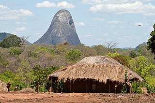
The wildlife of Mozambique consists of the flora and fauna of this country in southeastern Africa. Mozambique has a range of different habitat types and an ecologically rich and diverse wildlife. This includes 236 species of mammal, 740 species of bird and 5,692 species of vascular plant. The Maputaland-Pondoland-Albany hotspot, with significantly high levels of biodiversity, stretches from the southern tip of Mozambique into northeastern South Africa.

Banhine National Park is a protected area in northern Gaza Province, Mozambique. The park was established on 26 June 1973. In 2013 the limits of Park were updated to better reflect the realities on the ground, particularly the human presence in the area.

The Zambezian and mopane woodlands is a tropical and subtropical grasslands, savannas, and shrublands ecoregion of southeastern Africa.

LAM Mozambique Airlines Flight 470 was a scheduled international passenger flight from Maputo, Mozambique, to Luanda, Angola. On 29 November 2013, the Embraer E190 twinjet operating the service crashed into the Bwabwata National Park in Namibia, halfway through its flight, killing all 27 passengers and 6 crew on board.

