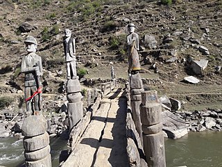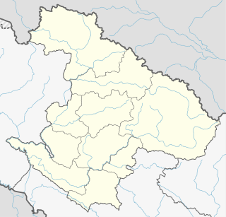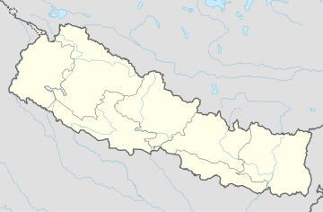
Jumla District, is one of the ten directly constituent districts of the Karnali province of Nepal. This district has Jumla as its headquarters, an area of 2,531 square kilometres (977 sq mi); it had populations of 89,427 and 108,921, respectively, in the national censuses of 2001 and 2011. Its territory lies between longitudes 81⁰ 28' and 82⁰ 18' East, and between latitudes 28⁰ 58' and 29⁰ 30' North.

Bhimapur is a town and market place in Rajapur Municipality in Bardiya District in the Bheri Zone of south-western Nepal. The former village development committee (VDC) was merged with Daulatpur, Naya Gaun, Badalpur, Bhimapur and Rajapur VDCs to form the new municipality on 18 May 2014. At the time of the 1991 Nepal census it had a population of 8,057 and had 1,012 houses in the town.
Daulatpur is a town and market place in Rajapur Municipality in Bardiya District in the Bheri Zone of south-western Nepal. The former village development committee (VDC) was merged with Daulatpur, Naya Gaun, Badalpur, Bhimapur and Rajapur VDCs to form the new municipality on 18 May 2014. At the time of the 1991 Nepal census it had a population of 5,888 and had 681 houses in the town.
Manpur Tapara is a town and marketplace in Rajapur Municipality in Bardiya District in the Bheri Zone of south-western Nepal. The former village development committee (VDC) was merged with Daulatpur, Naya Gaun, Badalpur, Bhimapur and Rajapur VDCs to form the new municipality on 18 May 2014. It is almost at the centre of river island called Bhawara Tappu of Karnali River.
Naya Gaun is a town and market place in Rajapur Municipality in Bardiya District in the Bheri Zone of south-western Nepal. The former village development committee (VDC) was merged with Daulatpur, Naya Gaun, Badalpur, Bhimapur and Rajapur VDCs to form the new municipality on 18 May 2014. At the time of the 1991 Nepal census it had a population of 4,741 and had 544 houses in the town.

Rajapur is a municipality in Bardiya District in the Bheri Zone of south-western Nepal. The municipality was established on 18 May 2014 merging the existing Daulatpur, Naya Gaun, Badalpur, Bhimapur, Manpur Tapara and Rajapur village development committees (VDCs). It is located on the border with Uttar Pradesh state, India. It has a customs checkpoint for goods. Indian and Nepalese nationals may cross the border without restriction.

Birat is a village development committee in Jumla District in the Karnali Zone of north-western Nepal. At the time of the 1991 Nepal census it had a population of 2770 persons living in 484 individual households.

Chandannath is a municipality in Jumla District in the Karnali province of Nepal. The municipality was established on 18 May 2014 by merging the existing Mahat Gaun, Talium, Kartik Swami (Jumla), and Chandannath village development committees (VDCs). At the time of the 1991 Nepal census it had a population of 5,842 persons living in 1,000 individual households.

Chhumchaur is a village development committee in Jumla District in the Karnali Zone of north-western Nepal. At the time of the 1991 Nepal census it had a population of 1409 persons living in 226 individual households.

Kankasundari is a rural municipality located in Jumla District of Karnali Province of Nepal.

Kartik Swami is the former name of the Village Development Committee of Jumla, a market center in Chandannath Municipality in Jumla District in the Karnali Zone of north-western Nepal. The former village development committee was merged with existing Mahat Gaun, Talium, Kartik Swami and Chandannath village development committees to form the new municipality of Chandannath. At the time of the 1991 Nepal census it had a population of 1749 persons living in 305 individual households.
Mahadev is a village development committee in Jumla District in the Karnali Zone of north-western Nepal. At the time of the 1991 Nepal census it had a population of 1828 persons living in 343 individual households.

Patarasi is a rural municipality located in Jumla District of Karnali Province of Nepal.

Talium is a market center in Chandannath Municipality in Jumla District in the Karnali Zone of north-western Nepal. The formerly village development committee was merged with existing Mahat Gaun, Talium, Kartik Swami, Chandannath village development committees to form the new municipality. At the time of the 1991 Nepal census it had a population of 3245 persons living in 585 individual households.

Bijuwar is a town and market center in Pyuthan Municipality in Pyuthan, a Middle Hills district of Rapti Zone, western Nepal. The former Village Development Committee along with Pyuthan Khalanga, Bijubar, Dakha Kwadi, Bijaya Nagar, Dharmawati, Maranthana and Khaira were merged to form the new municipality since 18 May 2014. Bijuwar is the main commercial center in the valley of Jhimruk Khola.

Dullu is an urban Municipality in Dailekh District of Karnali Pradesh in Nepal.

Ishworpur is a Municipality in Sarlahi District in the Janakpur Zone of south-eastern Nepal. The municipality was established on 18 May 2014 by merging the existing Bela, Bhaktipur, Gaurishankar and Ishwarpur VDCs. At the time of the 1991 Nepal census it had a population of 14,014 people living in 249 individual households.

Khalanga is market center in Sharada Municipality in Salyan District in the Rapti Zone of western-central Nepal. The place formerly existing as Village Development Committee was annexed to form a new municipality since 18 May 2014. It is the district headquarter of Salyan District. At the time of the 1991 Nepal census it had a population of 6380.

Birpur is a town in Shivaraj Municipality in Kapilvastu District in the Lumbini Zone of southern Nepal. The former village development committee was transformed into Municipality from 18 May 2014 by merging the existing Birpur, Nepal, Chanai, Bishunpur, Jawabhari and Shivapur village development committees. At the time of the 2001 Nepal census it had a population of 15255 people living in 1209 individual households.
Mahat is an Ekthariya (single-clan) Chhetri surname among Nepalese, of Khasa heritage. The name may have originated when one of the Jumli Malla kings in medieval times made his younger brother, Dharma Malla, chief of staff in the army. This granted Dharma Malla the title of MAHAT, and as a result, his descendants started using 'Mahat' as their surnames.


