The A41 is a major trunk road in England that links London and Birkenhead, although it has now in parts been superseded by motorways. It passes through or near various towns and cities including Watford, Kings Langley, Hemel Hempstead, Aylesbury, Solihull, Birmingham, West Bromwich, Wolverhampton, Newport, Whitchurch, Chester and Ellesmere Port.

The A46 is an A road in England. It starts east of Bath, Somerset and ends in Cleethorpes, Lincolnshire, but it does not form a continuous route. Large portions of the old road have been lost, bypassed, or replaced by motorway development. Between Leicester and Lincoln the road follows the course of the Roman Fosse Way, but between Bath and Leicester, two cities also linked by the Fosse Way, it follows a more westerly course.
The A45 is a major road in England. It runs east from Birmingham past the National Exhibition Centre and the M42, then bypasses Coventry and Rugby, where it briefly merges with the M45 until it continues to Daventry. It then heads to Northampton and Wellingborough before running north of Rushden and Higham Ferrers and terminating at its junction with the A14 road in Thrapston.
The A52 is a major road in the East Midlands, England. It runs east from a junction with the A53 at Newcastle-under-Lyme near Stoke-on-Trent via Ashbourne, Derby, Stapleford, Nottingham, West Bridgford, Bingham, Grantham, Boston and Skegness to the east Lincolnshire coast at Mablethorpe. It is approximately 147 miles (237 km) long.
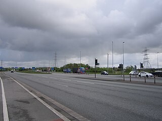
Switch Island is a major road junction near Aintree in Merseyside, England in the Metropolitan Borough of Sefton. The junction is at the western terminus of both the M57 and M58 motorways, which converge on the A59 trunk road, the north-south route from Liverpool. The junction is also the terminus of the A5036, a road which serves the Port of Liverpool and the A5758 road which serves as a bypass for the village of Thornton.
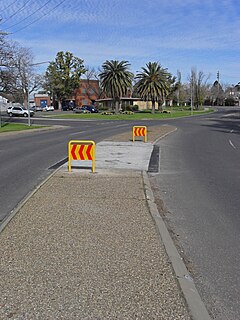
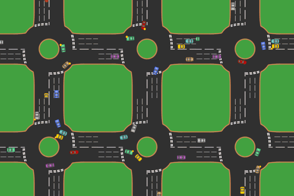
A traffic island is a solid or painted object in a road that channels traffic. It can also be a narrow strip of island between roads that intersect at an acute angle. If the island uses road markings only, without raised kerbs or other physical obstructions, it is called a painted island or ghost island. Traffic islands can be used to reduce the speed of cars driving through, or to provide a central refuge to pedestrians crossing the road.

The A127, also known as the Southend Arterial Road, is a major road in Essex, England. It was constructed as a new arterial road project in the 1920s, linking Romford with Southend-on-Sea, replacing the older A13. Formerly classified as a trunk road, it was "de-trunked" in 1997. It is known as the Southend Arterial Road except for part of its length in Southend-on-Sea. It is also streetlit for its whole length despite its majority coverage through rural land.

The A4540 is a Ring Road in Birmingham, England, also known as the Middle Ring Road, or the Middleway. There are proposals to make it a red route. It runs around the centre of the city at a distance of approximately 1 mile (1.6 km). Birmingham City Centre is the area within this ring road. The ring road was planned and designed by Herbert Manzoni. It is now simply known as the Ring Road due to the removal of the old Inner Ring Road.

The A43 is a primary route in the English Midlands, that runs from the M40 motorway near Ardley in Oxfordshire to Stamford in Lincolnshire. Through Northamptonshire it bypasses the towns of Northampton, Kettering and Corby which are the three principal destinations on the A43 route. The A43 also links to the M1 motorway.
The A5112 is a road in Shropshire, England that runs north-south through the town of Shrewsbury. It runs around the town centre, to the east, and acts as a quicker route through the town than going via the town centre.

The A148 is an English A road entirely in the county of Norfolk. It runs from King's Lynn to Cromer via Fakenham, which it bypasses to the north.
Tudor Creek is one of two main water bodies separating Mombasa Island from the Kenyan mainland.

The Nyali Bridge is a concrete girder bridge connecting the city of Mombasa on Mombasa Island to the mainland of Kenya. The bridge crosses Tudor Creek to the north-east of the island. The bridge is one of three road links out of Mombasa. The Likoni Ferry provides a third transport link to the island, and is situated at the southern tip. The mainland approach to the bridge serves as a police checkpoint in both directions.

Changamwe is a suburb of Mombasa, in Mombasa County, in the former Coast Province of Kenya.

The R826 road is a regional road in south Dublin, Ireland. The road runs from the Dundrum junction of the M50 as passes through or near Ballinteer, Dundrum and Balally before terminating at the junction with the R112 close to Goatstown. The route runs on mostly new road, built to facilitate the M50 and Dundrum Town Center and is 2.5 km long.

Longbridge Interchange is a major road and motorway junction between Warwick and Sherbourne, Warwickshire, connecting the A46 road and A429 road respectively to the M40 motorway at junction 15. For many years, it was deemed inadequate in handling the volume of traffic, which in 2009 was estimated to be in the region of 75,000 vehicles daily; a bypass was built during 2008-2009 which relieved congestion.
