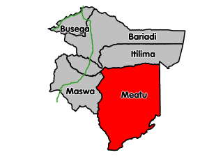
Meatu District CouncilWilaya Ya MeatuHalmashauri ya Wilaya Meatu

Hanang District is one of the six districts of the Manyara Region of Tanzania. It is bordered to the North by the Mbulu District and Babati Rural District, to the Southeast by the Dodoma Region and to the Southwest by the Singida Region. Mount Hanang is located within the boundaries of the district.
Kisiriri is an administrative ward in the Iramba district of the Singida Region of Tanzania. According to the 2002 census, the ward has a total population of 10,245.
Sepuka is an administrative ward in the Singida Rural district of the Singida Region of Tanzania. According to the 2002 census, the ward has a total population of 24,315.
Puma is an administrative ward in the Singida Rural district of the Singida Region of Tanzania. According to the 2002 census, the ward has a total population of 16,198.
Ntuntu is an administrative ward in the Singida Rural district of the Singida Region of Tanzania. According to the 2002 census, the ward has a total population of 13,983.
Ngimu is an administrative ward in the Singida Rural district of the Singida Region of Tanzania. According to the 2002 census, the ward has a total population of 14,974.
Mungaa is an administrative ward in the Singida Rural district of the Singida Region of Tanzania. According to the 2002 census, the ward has a total population of 15,841.
Mudida is an administrative ward in the Singida Rural district of the Singida Region of Tanzania. According to the 2002 census, the ward has a total population of 12,321.
Misughaa is an administrative ward in the Singida Rural district of the Singida Region of Tanzania. According to the 2002 census, the ward has a total population of 8,505.
Mgori is an administrative ward in the Singida Rural district of the Singida Region of Tanzania. According to the 2002 census, the ward has a total population of 10,777.
Merya is an administrative ward in the Singida Rural district of the Singida Region of Tanzania. According to the 2002 census, the ward has a total population of 15,865.
Mangonyi is an administrative ward in the Singida Rural district of the Singida Region of Tanzania. According to the 2002 census, the ward has a total population of 10,246.
Ilongero is an administrative ward in the Singida Rural district of the Singida Region of Tanzania. According to the 2002 census, the ward has a total population of 16,435.
Ihanja is an administrative ward in the Singida Rural district of the Singida Region of Tanzania. According to the 2002 census, the ward has a total population of 13,590.
Dungunyi is an administrative ward in the Singida Rural district of the Singida Region of Tanzania. According to the 2002 census, the ward has a total population of 10,747.
Kindai is an administrative ward in the Singida Urban district of the Singida Region of Tanzania. According to the 2002 census, the ward has a total population of 9,224.
Mandewa is an administrative ward in the Singida Urban district of the Singida Region of Tanzania. According to the 2002 census, the ward has a total population of 14,583.
Mtipa is an administrative ward in the Singida Urban district of the Singida Region of Tanzania. According to the 2002 census, the ward has a total population of 6,510.
Sanza is an administrative ward in the Manyoni district of the Singida Region of Tanzania. According to the 2002 census, the ward has a total population of 9,217.


