Dodoma Region is one of Tanzania's 31 administrative regions. The regional capital is the city of Dodoma. The region is located in central Tanzania, it is bordered by Singida Region to the west; Manyara Region to the north; Iringa Region to the south; and Morogoro Region to the east. Dodoma Region hosts the nation's capital city with where the legislative assembly or Bunge is based. Dodoma Region also hosts one of the largest University in Tanzania, University of Dodoma. The region is sole home of the Tanzanian wine industry, which is the second largest wine industry on the continent after South Africa. According to the 2022 national census, the region had a population of 3,085,625. 2012 national census, where by, 2012 had 2,083,588.

Singida Region is one of Tanzania's 31 administrative regions. The region covers a land area of 49,340 km2 (19,050 sq mi). The region is comparable in size to the combined land area of the nation state of Slovakia. The Region is bordered to the north by Shinyanga Region, Simiyu Region and Arusha Region, to the northeast by Manyara Region, to the east by Dodoma Region, to the southeast by Iringa Region, to the southwest by Mbeya Region and to the west by Tabora Region. The regional capital is the municipality of Singida. According to the 2012 national census, the region had a population of 1,370,637.
Iringa Region is one of Tanzania's 31 administrative regions. The region covers an area of 35,503 km2 (13,708 sq mi). The region is comparable in size to the combined land area of the nation state of Guinea Bissau. Iringa Region is bordered to the east by Morogoro Region and south by Njombe Region. On the west the region is bordered by Mbeya Region. Dodoma Region and Singida Region border Iringa on the north. The regional capital is the city Iringa for which the city is named after. According to the 2022 census, the region has a total population of 1,192,728. Iringa Region is home to Ruaha National Park, Tanzania's second national largest park.

Uyui District is one of the seven districts of the Tabora Region of Tanzania. It is bordered to the north by Nzega District and Igunga District as well as by the Shinyanga Region, to the south by Sikonge District, to the west by Urambo District and Kaliua District, and to the east by the Singida Region. Tabora Urban District is an enclave within the Uyui District. Its administrative seat is the city of Tabora.

Tabora Urban is one of the seven districts in the Tabora Region of Tanzania. This district is mostly the city of Tabora and its suburbs. It is bordered almost completely by the Uyui District. It has a small border with Nzega District to the north. Its administrative seat is the city of Tabora.

Iringa Rural District is one of the four districts of the Iringa Region of Tanzania, East Africa. It is bordered to the north by the Dodoma Region, to the east by Kilolo District and encircles Iringa Urban District, to the south by the Mufindi District, to the southwest by the Mbeya Region and to the northwest by the Singida Region.

Hanang District is one of the six districts of the Manyara Region of Tanzania. It is bordered to the north by the Mbulu District and Babati Rural District, to the southeast by the Dodoma Region and to the southwest by the Singida Region. Mount Hanang is located within the boundaries of the district.

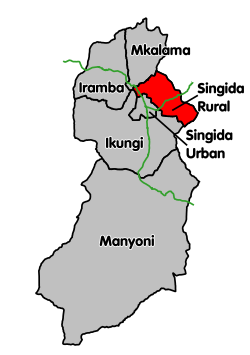
Ikungi District is one of the six districts of the Singida Region of Tanzania. It is one of the 20 new districts that were formed in Tanzania since 2010; it was split off from Singida Rural District. Ikungi District is bordered to the north by Iramba District, Singida Urban District and Singida Rural District, to the east by Manyara Region, to the south by Manyoni District and to the west by Tabora Region. Its administrative seat is the town of Ikungi.

Singida Urban District is one of the six districts of the Singida Region of Tanzania. It is bordered to the south and west by the Ikungi District and to the north and east by the Singida Rural District. Its administrative seat is the town of Singida.

Manyoni District is one of the six districts in the Singida Region of Tanzania. The district capital is the town of Manyoni. The district is bordered to the north by the Ikungi District, to the east by the Dodoma Region, to the south by the Iringa Region, to the southwest by the Mbeya Region and to the west by the Tabora Region. In 2015 the Itigi District was created from the Manyoni District, separating the Itigi Division that was the large portion of the south western of the district.
Kinyangiri is an administrative ward in the Mkalama District of the Singida Region of Tanzania. According to the 2002 census, the ward had a total population of 18,838. According to the 2012 census, the population had decreased to 13,475.
Muhintiri is an administrative ward in the Singida Rural district of the Singida Region of Tanzania. In 2016 the Tanzania National Bureau of Statistics report there were 9,761 people in the ward, from 8,896 in 2012.
Msisi is an administrative ward in the Singida Rural district of the Singida Region of Tanzania. In 2016 the Tanzania National Bureau of Statistics report there were 10,220 people in the ward, from 9,314 in 2012.
Maghojoa is an administrative ward in the Singida Rural district of the Singida Region of Tanzania. In 2016 the Tanzania National Bureau of Statistics report there were 9,857 people in the ward, from 8,983 in 2012.
Kinyeto is an administrative ward in the Singida Rural district of the Singida Region of Tanzania. In 2016 the Tanzania National Bureau of Statistics report there were 9,936 people in the ward, from 9,055 in 2012.
Ikungi is a town and an administrative ward in the Ikungi District of the Singida Region of Tanzania. It is the district's administrative seat. According to the 2002 census, the ward had a total population of 18,662. According to the 2012 Tanzania National Census, the population of Ikungi ward was 12,661.
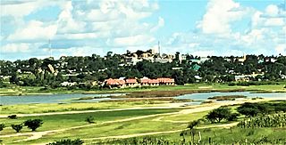
Singida is a city in central Tanzania. The city is the location of the regional headquarters of Singida Region as well as the district headquarters of Singida Urban District. The region and district are named after the city.

Mkalama District is one of the six districts of the Singida Region of Tanzania. It is one of the 20 new districts that were formed in Tanzania since 2010; it was split off from Iramba District. Mkalama District is bordered to the north by Simiyu Region and Arusha Region, to the east by Manyara Region, to the south by Singida Rural District and to the west by Iramba District.

Bahi District is one of the seven districts of the Dodoma Region of Tanzania. Bahi District is bordered to the north by Chemba District, to the east by Dodoma District and Chamwino District, and to the west by Singida Region. Its administrative seat is the town of Bahi.

Babati Urban District is one of the six districts of the Manyara Region of Tanzania. Babati Urban District is surrounded by Babati Rural District. The administrative capital of the district is Babati town.