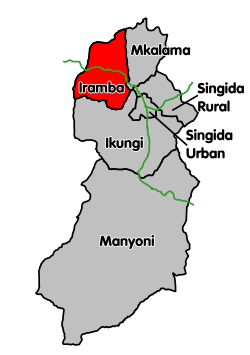
Singida Region is one of Tanzania's 31 administrative regions. The region covers a land area of 49,340 km2 (19,050 sq mi). The region is comparable in size to the combined land area of the nation state of Slovakia. The Region is bordered to the north by Shinyanga Region, Simiyu Region and Arusha Region, to the northeast by Manyara Region, to the east by Dodoma Region, to the southeast by Iringa Region, to the southwest by Mbeya Region and to the west by Tabora Region. The regional capital is the municipality of Singida. According to the 2022 national census, the region had a population of 2,008,058.

Bunda is one of the seven districts of Mara Region in the United Republic of Tanzania, East Africa. It is bordered to the north by the Musoma Rural District and Butiama District, to the east by Serengeti District, to the south by Bariadi District and Busega District, and to the west by Lake Victoria. The district administration town is also called Bunda, located on the north-south trans-national all tarmac highway from Kenya to Zambia via Tarime and the lakeside municipalities of Musoma, Mwanza, and thereon to Mbeya in southern Tanzania. The district has four divisions: Kenkombyo, Nansimo, Serengeti and Chamuriho.

Meatu District is one of the five districts of the Simiyu Region of Tanzania. It is bordered to the north by the Itilima District, to the west by the Maswa District and Shinyanga Region to the east by the Arusha Region, to the southeast by the Manyara Region and to the south by the Singida Region. Its district capital is the town of Mwanhuzi.
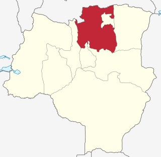
Nzega District is one of the seven districts of the Tabora Region of Tanzania. It is bordered to the north by Shinyanga Region, to the south and southwest by Uyui District and to the east by Igunga District. Its administrative seat is the town of Nzega.

Uyui District is one of the seven districts of the Tabora Region of Tanzania. It is bordered to the north by Nzega District and Igunga District as well as by the Shinyanga Region, to the south by Sikonge District, to the west by Urambo District and Kaliua District, and to the east by the Singida Region. Tabora Urban District is an enclave within the Uyui District. Its administrative seat is the city of Tabora.

Biharamulo District is one of the eight districts of the Kagera Region of Tanzania. It is bordered to the north by Karagwe District and Muleba District, to the east and south by Geita Region, to the west by Ngara District, and to the southwest by the Kigoma Region. Its administrative seat is Biharamulo town. Biharamulo Game Reserve is located within the borders of the district.
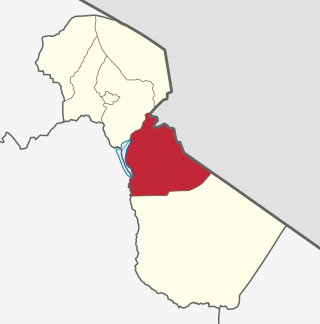
Mwanga is one of the seven districts of the Kilimanjaro Region of Tanzania. The district covers an area of 1,831 km2 (707 sq mi), It is bordered to the northeast by Kenya, to the northwest by the Moshi Rural District, to the southwest by Simanjiro District of Manyara Region, and to the south by the Same District. Its administrative seat is the town of Mwanga. The tallest peak in the district is Kindoroko at 2,100m in the North Pare Mountains that are located entirely within the district. According to the 2022 Tanzania National Census, the population of Mwanga District was 148,763.

Moshi Urban District is an administrative district located in Kilimanjaro Region of Tanzania. The district is home to regional capital of Kilimanjaro Region, namely Moshi. The district covers an area of 63.39 km2 (24.48 sq mi). The district is surrounded on the west by Moshi Rural District, to the east by the Hai District. According to the 2022 Tanzania National Census, the population of Moshi Urban District was 221,733.

Kongwa District is one of the seven districts of the Dodoma Region of Tanzania. It is bordered to the north by Manyara Region, to the east by Morogoro Region, to the south by Mpwapwa District, and to the west by Chamwino District. Its district capital is the town of Kongwa.
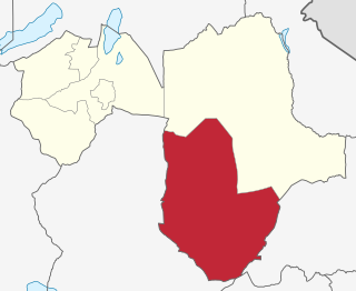
Kiteto District is one of the six districts of the Manyara Region of Tanzania. It is bordered to the north by the Simanjiro District, to the east by the Tanga Region and to the south and west by the Dodoma Region. The district headquarters are located in Kibaya.

Ikungi District is one of the six districts of the Singida Region of Tanzania. It is one of the 20 new districts that were formed in Tanzania since 2010; it was split off from Singida Rural District. Ikungi District is bordered to the north by Iramba District, Singida Urban District and Singida Rural District, to the east by Manyara Region, to the south by Manyoni District and to the west by Tabora Region. Its administrative seat is the town of Ikungi.
Kaselya is an administrative ward in the Iramba District of the Singida Region of Tanzania. In 2016 the Tanzania National Bureau of Statistics report there were 10,754 people in the ward, from 9,801 in 2012.
Kyengege is an administrative ward in the Iramba district of the Singida Region of Tanzania. In 2016 the Tanzania National Bureau of Statistics report there were 8,608 people in the ward, from 7,845 in 2012.
Mtoa is an administrative ward in the Iramba District of the Singida Region of Tanzania. In 2016 the Tanzania National Bureau of Statistics report there were 21,643 people in the ward, from 19,724 in 2012.
Tulya is an administrative ward in the Iramba District of the Singida Region of Tanzania. The ward is bounded to the north by Lake Kitangiri.
Urughu is an administrative ward in the Iramba District of the Singida Region of Tanzania. In 2016 the Tanzania National Bureau of Statistics report there were 14,682 people in the ward, from 13,380 in 2012.
Iramba, also known as Nilamba is a Bantu language of spoken by the Nilamba and Iambi people of the Iramba District in the Singida Region of Tanzania.
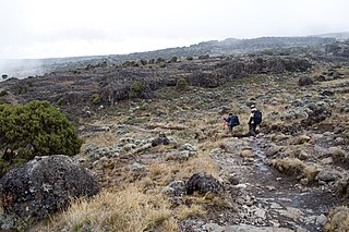
Siha is one of the seven administrative districts of Kilimanjaro Region in Tanzania. The district covers approximately 1,217 square kilometres (470 sq mi). It is bordered to the west by Meru District in Arusha Region and to the northeast by Rombo District and the southeast Hai District. The western part of Mount Kilimanjaro is located within the district's boundaries.
Ndulungu is an administrative ward in the Iramba District of the Singida Region of Tanzania. In 2016 the Tanzania National Bureau of Statistics report there were 11,390 people in the ward, from 10,380 in 2012.

Mkalama District is one of the six districts of the Singida Region of Tanzania. It is one of the 20 new districts that were formed in Tanzania since 2010; it was split off from Iramba District. Mkalama District is bordered to the north by Simiyu Region and Arusha Region, to the east by Manyara Region, to the south by Singida Rural District and to the west by Iramba District.
