Related Research Articles

Liwale is one of the six districts of the Lindi Region of Tanzania. It is the largest district in Lindi and one of the largest in districts in Tanzania. It is bordered to the north by the Pwani Region, to the east by the Kilwa District, to the south by the Ruangwa District and to the west by the Morogoro Region. Most of Liwale district is within the Nyerere National Park.
Ipinda is an administrative ward in the Kyela district of the Mbeya Region of Tanzania. According to the 2002 census, the ward has a total population of 16,756.
Isange is an administrative ward in the Busokelo District of the Mbeya Region of Tanzania. According to the 2002 census, the ward has a total population of 7,932. According to the 2012 census, the ward has a total population of 5,790 with a population density of 413.0/km²
Kabula is an administrative ward in the Busokelo District of the Mbeya Region of Tanzania. According to the 2002 census, the ward has a total population of 10,251.
Kiwira is an administrative ward in the Rungwe district of the Mbeya Region of Tanzania. According to the 2002 census, the ward has a total population of 20,119.
Lupata is an administrative ward in the Busokelo District of the Mbeya Region of Tanzania. According to the 2002 census, the ward has a total population of 8,126.
Nkunga is an administrative ward in the Rungwe district of the Mbeya Region of Tanzania. According to the 2002 census, the ward has a total population of 14,685.
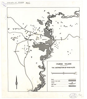
Itumba is an administrative ward in Ileje District, Songwe Region, Tanzania. According to the 2002 census, the ward has a total population of 12,668. It is home to the Ndali people, who occupy that region of Tanzania and parts of Malawi.
Lubanda is an administrative ward in Ileje District, Songwe Region, Tanzania. According to the 2002 census, the ward has a total population of 7,952.
Ngulilo is an administrative ward in Ileje District, Mbeya Region, Tanzania. According to the 2002 census, the ward has a total population of 3,820. The official language is Swahili, and much of the population does not know how to speak English.
Ngulugulu is an administrative ward in Ileje District, Songwe Region, Tanzania. According to the 2002 census, the ward has a total population of 5,346.
Sange is an administrative ward in Ileje District, Songwe Region, Tanzania. According to the 2002 census, the ward has a total population of 4,396.
Mwakibete is an administrative ward in the Mbeya Urban district of the Mbeya Region of Tanzania. According to the 2002 census, the ward has a total population of 13,774.
Santilya is an administrative ward in the Mbeya Rural district of the Mbeya Region of Tanzania. According to the 2002 census, the ward has a total population of 15,271.
Ulenje is an administrative ward in the Mbeya Rural district of the Mbeya Region of Tanzania. According to the 2002 census, the ward has a total population of 11,519, having Safwa community as common indigenous.
Kisiriri is an administrative ward in the Iramba district of the Singida Region of Tanzania. According to the 2002 census, the ward has a total population of 10,245.
Mudida is an administrative ward in the Singida Rural district of the Singida Region of Tanzania. According to the 2002 census, the ward has a total population of 12,321.
Makuro is an administrative ward in the Singida Rural district of the Singida Region of Tanzania. According to the 2002 census, the ward has a total population of 15,533.
Mtamaa is an administrative ward in the Singida Urban district of the Singida Region of Tanzania. According to the 2002 census, the ward has a total population of 6,250.
Itale is an administrative ward in Ileje District, Songwe Region, Tanzania. According to the 2012 census, the ward has a total population of 7,609, up from 6,720 in 2002.
References
- ↑ "2002 Population and Housing Census General Report". Government of Tanzania. Archived from the original on 2006-06-08. Retrieved 2008-08-18.
Coordinates: 9°26′S33°56′E / 9.433°S 33.933°E
| | This Mbeya Region location article is a stub. You can help Wikipedia by expanding it. |