
Location of Makwate
Makwate is a village in Central District of Botswana. The village is located close to river Limpopo and the border with South Africa, and it has primary school. The population was 5,687 in 2011 census. [1]
Makwate is a village in Central District of Botswana. The village is located close to river Limpopo and the border with South Africa, and it has primary school. The population was 5,687 in 2011 census. [1]

Lincoln is a city in Placer County, California, United States, part of the Sacramento metropolitan area. Located 10 miles (16 km) north of Roseville in an area of rapid suburban development, it grew 282 percent between 2000 and 2010, making it the fastest-growing city over 10,000 people in the U.S. Its 2019 population was estimated to be 48,275.

East Cape Girardeau is a village in Alexander County, Illinois, United States. The population was 289 at the 2020 census. It is part of the Cape Girardeau–Jackson, MO-IL Metropolitan Statistical Area.

Oaklawn-Sunview is a census-designated place (CDP) in Sedgwick County, Kansas, United States. As of the 2020 census, the population was 2,880. It is located on the south side of Wichita along the west side of K-15 and 47th Street South intersection.
Richland Township is a township in Cambria County, Pennsylvania, United States. The population was 12,814 at the 2010 census. It is part of the Johnstown, Pennsylvania Metropolitan Statistical Area.
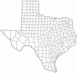
Laguna Vista is a town in Cameron County, Texas, United States. The population was 3,520 at the 2020 census. It is included as part of the Brownsville–Harlingen–Raymondville and the Matamoros–Brownsville metropolitan areas.
Pokrovske is a village in Holovanivsk Raion of Kirovohrad Oblast, Ukraine, located at 48°16′43″N029°48′47″E. It belongs to Haivoron urban hromada, one of the hromadas of Ukraine.
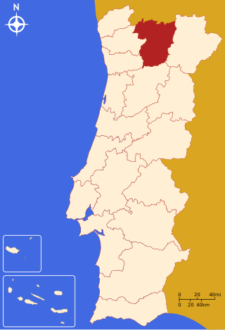
The District of Vila Real is a district of northern Portugal. With an area of 4,239 km2 (1,637 sq mi), the district is located east of the port city of Porto and north of the Douro River. Vila Real has always belonged to the historical province of Trás-os-Montes. Approximate population in the 2001 census was 230,000. The population has shown negative rates in recent years due to emigration and aging. Many of the villages have lost population and have become deserted while the district capital has gained in population. It is bordered by Spain (Galicia) in the north and east, Braga District and Porto District in the west, Viseu District in the south and Bragança District in the east.

Sall is a village and a church parish in the Favrskov municipality in the Danish region of Midtjylland. In former times the village has been known as Sal, Sald (Pontoppidan) and Salle (Trap). The village itself has a population of 211 and is situated centrally in Sall Parish. It is at 56°16′43″N9°49′30″E.
Missouri's 1st congressional district is in the eastern portion of the state. It includes all of St. Louis City and much of northern St. Louis County, including the cities of Maryland Heights, University City, Ferguson and Florissant. With a Cook Partisan Voting Index rating of D+27, it is the most Democratic district in Missouri. Roughly half of the district's population is African American.
O'Donnell Heights is a neighborhood named for a public housing development in the far southeastern part of the city of Baltimore, Maryland, United States. It is located south and east of Interstate 95, just west of the border with Baltimore County, and north of the St. Helena neighborhood.

Seneca Township is located in McHenry County, Illinois. As of the 2020 census, its population was 2,893 and it contained 1,102 housing units.
Kalenga is an administrative ward in the Iringa Rural district of the Iringa Region of Tanzania. In 2016 the Tanzania National Bureau of Statistics reported its population to be 7,286, up from 6,963 in 2012.
Crveni Breg is a village in the municipality of Bela Palanka, Serbia. According to the 2002 census, the village had a population of 371 people.
Kuru is a village in Alutaguse Parish, Ida-Viru County in northeastern Estonia.
Kyengera is a town in the Central Region of Uganda. It is one of the urban centers in Wakiso District.

Calzada de Oropesa is a municipality and village in the province of Toledo and autonomous community of Castile-La Mancha, Spain.

Washoe Valley is a census-designated place (CDP) in Washoe County, Nevada, United States. It corresponds closely to the unincorporated community of New Washoe City. The population was 3,019 at the 2010 census. It is part of the Reno–Sparks Metropolitan Statistical Area. The CDP takes its name from the Washoe Valley, a region between Reno and Carson City centered on Washoe Lake.
Praça do Carmo is a region of Rio de Janeiro, but not officially recognized as a neighborhood.
Bulakavas Manor is a former residential manor in Bulotiškė village, Lazdijai District Municipality, Lithuania.
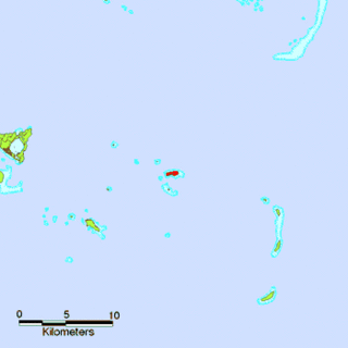
Fonoifua is an island in Tonga. Among neighbouring islands are Kelefesia, Nukutula, Tonumea, Nomuka, Telekitonga.
23°17′46″S27°16′43″E / 23.29611°S 27.27861°E
| | This Botswana location article is a stub. You can help Wikipedia by expanding it. |