
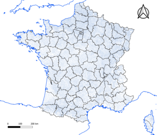
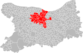
In the administrative divisions of France, the department is one of the three levels of government under the national level, between the administrative regions and the communes. There are ninety-six departments in metropolitan France, with an additional five overseas departments, which are also classified as overseas regions. Departments are further subdivided into 333 arrondissements and 2,054 cantons. These last two levels of government have no political autonomy, instead serving as the administrative basis for the local organisation of police, fire departments as well as, in certain cases, elections.

Allier is a department in the Auvergne-Rhône-Alpes region that borders Cher to the west, Nièvre to the north, Saône-et-Loire and Loire to the east, Puy-de-Dôme to the south, and Creuse to the south-west. Named after the river Allier, it had a population of 334,872 in 2021. Moulins is the prefecture; Montluçon and Vichy are the subprefectures. Its INSEE and post code is 03.
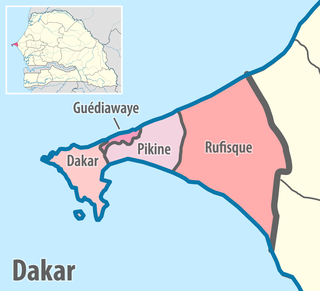
Dakar region is the smallest and most populated region of Senegal, encompassing the capital city of the country, Dakar, and all its suburbs along the Cap Vert peninsula, Africa's most westerly point.
The commune is a level of administrative division in the French Republic. French communes are analogous to civil townships and incorporated municipalities in the United States and Canada, Gemeinden in Germany, comuni in Italy, or municipios in Spain. The UK equivalent are civil parishes. Communes are based on historical geographic communities or villages and are vested with significant powers to manage the populations and land of the geographic area covered. The communes are the fourth-level administrative divisions of France.
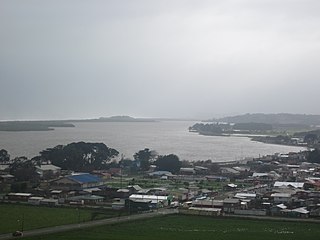
Saavedra is a commune of Chile in Cautín Province, Araucanía Region. The principal community and administrative centre of the commune is the town of Puerto Saavedra. The commune is named after the Chilean soldier General Cornelio Saavedra Rodríguez who was placed in charge of the occupation of the Araucanía in 1860. It has the highest percentage—though not the largest number—of Mapuche people in the region. Location for the 1991 movie "La frontera".

Natitingou, informally referred to as Nati, is a city and commune in north western Benin and the capital of Atakora Department. The commune covers an area of 3045 square kilometres and as of 2013 had a population of 104,010 people.
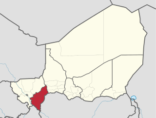
Dosso is one of the eight Regions of Niger. The region has an area of 31,002 square kilometres (11,970 sq mi), with a population of 2,754,500 as of 2020.

A commune is the lowest level of administrative subdivision in Romania. There are 2,686 communes in Romania. The commune is the rural subdivision of a county. Urban areas, such as towns and cities within a county, are given the status of city or municipality.

The 14 regions of Senegal are subdivided into 46 departments and 103 arrondissements and by collectivités locales which elect administrative officers.

Les Ulis is a commune in the Essonne department located in the southwestern suburbs (banlieue) of Paris, France. It is 23 km (14 mi) from the centre of Paris.
The communauté urbaine Caen la Mer is the communauté urbaine, an intercommunal structure, centred on the city of Caen. It is located in the Calvados department, in the Normandy region, northwestern France. It was created in January 2017, replacing the previous Communauté d'agglomération Caen la Mer and two communautés de communes. Its area is 362.9 km2. Its population was 268,470 in 2018, of which 105,512 in Caen proper.
The departments of Senegal are subdivided into arrondissements. As of 2008 there were 133. The arrondissements are listed below, by department:

Linguère department is one of the 46 departments of Senegal, one of the three making up the Louga region. Its capital is Linguère, and it encompasses an area of 15,375 km2 (5,936 sq mi).
The Communes of Senegal are the fourth-level administrative divisions in Senegal. There are some 121 communes in Senegal which have urban status, apart from 46 communes d'arrondissement in the large towns and 370 rural communities in the countryside.
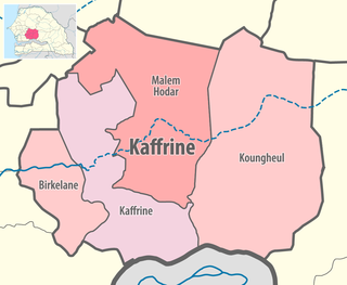
Malem Hodar department is one of the 46 departments of Senegal, and is located in the Kaffrine region. It was created as part of the new region in 2008.
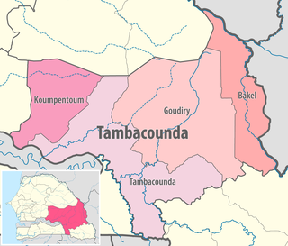
Koumpentoum department is one of the 46 departments of Senegal, located here, one of the four in the Tambacounda Region of east Senegal. It was created in 2008.
Rural communities (CR) are the fourth-level administrative divisions in Senegal. They are administrative subdivisions comprising the villages, but are distinct from the urban communes and municipalities concerning medium or large towns.
Malem-Hodar Arrondissement is an arrondissement of the Kaffrine Department in the Kaffrine Region of Senegal.
Birkilane is a town and urban commune in Senegal. It is the principal municipality and administrative centre of Birkilane Department in Kaffrine Region, about 30 km from the town of Kaolack.
Darou Minam is an arrondissement of Malem Hodar Department in the Kaffrine Region of Senegal.

