This article needs additional citations for verification .(November 2024) |
Malema | |
|---|---|
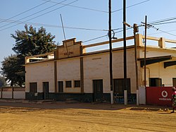 Train station of Malema | |
 Seal | |
 Malema | |
| Coordinates: 14°56′55″S37°24′52″E / 14.94861°S 37.41444°E | |
| Country | |
| Provinces | Nampula Province |
| District | Malema District |
| Population (2015 (projected)) | |
• Total | 195,077 |
| Time zone | CAT |
Malema is a town in the district of Malema. [1] It is situated within the province of Nampula in Mozambique. The district borders the districts of: Ribaue, Lalaua, Alto Molocue, Gurue, Cuamba, and others. The district is dependent on agricultural production and the main sources are sourgum, corn, peanuts, and onions.