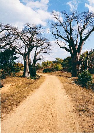
Transportation in Malawi is poorly developed. The country of almost 14 million has 39 airports, 6 with paved runways and 33 with unpaved runways. It has 797 kilometres of railways, all narrow-gauge and about 45 percent of its roads are paved. Though it is landlocked, Malawi also has 700 km (435 mi) of waterways on Lake Malawi and along the Shire River.

Mozambique, officially the Republic of Mozambique, is a country located in southeastern Africa bordered by the Indian Ocean to the east, Tanzania to the north, Malawi and Zambia to the northwest, Zimbabwe to the west, and Eswatini and South Africa to the southwest. The sovereign state is separated from the Comoros, Mayotte and Madagascar by the Mozambique Channel to the east. The capital and largest city is Maputo.

Modes of transport in Mozambique include rail, road, water, and air. There are rail links serving principal cities and connecting the country with Malawi, Zimbabwe and South Africa. There are over 30,000km of roads, but much of the network is unpaved.

Portuguese Mozambique or Portuguese East Africa were the common terms by which Mozambique was designated during the period in which it was a Portuguese colony. Portuguese Mozambique originally constituted a string of Portuguese possessions along the south-east African coast, and later became a unified colony, which now forms the Republic of Mozambique.
Nampula is the capital city of Nampula Province in Northern Mozambique. With a population of 743,125, it is the third-largest city in Mozambique after Maputo and Matola. The city is located in the interior of Nampula Province, approximately 200 kilometers from the coast and is surrounded by plains and rocky outcrops. The city is a major regional centre for the entire Northern region of Mozambique, as well as parts of Central Mozambique and border areas of Malawi and Tanzania.
Nacala, also known as Cidade de Nacala or Nacala-Porto is a city on the northern coast of Mozambique. Located in the southwestern indentation of inner Fernao Veloso Bay, it is the deepest natural port on the east coast of Africa. Nacala serves as the terminal for the Nacala railway, a rail line to the landlocked Malawi. South of Nacala is Mozambique Island, at one time the capital of Mozambique and now a World Heritage Site.

Lichinga is the capital city of Niassa Province of Mozambique. It lies on the Lichinga Plateau at an altitude of 1,360 metres (4,460 ft), east of Lake Niassa. The town was founded as Vila Cabral as a farming and military settlement. It is served by Lichinga Airport. The province borders Ruvuma Region in Tanzania.
Moatize is the principal town and administrative center of Moatize District in western Mozambique's Tete Province. It is located on the eastern side of the Zambezi River at the confluence of the Moatize and Revuboe Rivers. After Tete, it is the second largest urban area, by population, in western Mozambique.

Portos e Caminhos de Ferro de Moçambique is a state-owned company that oversees the railway system of Mozambique and its connected ports.
Railway stations in Mozambique include:
Malawi Railways is the national rail network in Malawi, run by a government corporation until privatisation in 1999. As of 1 December 1999 the Central East African Railways, a consortium led by Railroad Development Corporation, won the right to operate the network.
The Port of Nacala, also called the Nacala port complex, is a Mozambican port located in the cities of Nacala and Nacala-a-Velha. Is the deepest port in Southern Africa. The natural deep harbour serves landlocked Malawi with a 931-kilometre (578 mi) railway.
Cuamba Airport is an airport serving Cuamba, a city in the Niassa Province in Mozambique. The airport is in the southern part of the city and is a major airport in the province of Niassa in central Mozambique.

The history of rail transport in Mozambique began in the latter years of the nineteenth century.
CLIN, or the Sociedade do Corredor Logístico Integrado do Norte, is a business company related to logistics, whose main business is railway management in Mozambique and Malawi. The company is a joint venture.

The history of rail transport in Malawi began shortly after the turn of the twentieth century.

Nacala railway, also known as Northern Corridor railway and Nacala Corridor railway, is a railway line that operates in northern Mozambique on a 912 kilometres (567 mi) line that runs west from the port city of Nacala, crossing the central region of Malawi, connecting with the coal belt of Moatize, in northwest Mozambique. It is connected to the Dona Ana-Moatize railway branch and the Sena railway (Chipata-Lilongwe-Blantyre-Nhamayabue-Dondo). It also has a 262 kilometres (163 mi) branch line from Cuamba to Lichinga.
The Nacala Logistics Corridor is a logistical mega-enterprise for connecting areas in Southeast Africa, which includes the creation and management of railways, highways, ports and airports, which directly serve Mozambique and Malawi, and indirectly to Zambia and Zimbabwe.

Sena railway, also called Shire Highlands railway, Dondo-Malawi railway and North-South Malawi railway, is a railway that connects Dondo, Mozambique, to Chipata, in Zambia. It is c. 1000 km long, in a 1067 mm gauge.
Cuamba Solar Power Station (CSPS), is a 20 megawatts (27,000 hp) solar power plant in Mozambique. The power station was developed by a consortium that comprises a British independent power producer and a Mauritian investor. A storage system consisting of lithium batteries with a capacity of 1.86 MVA/7.42 MW/h, is incorporated in the design. The storage system regulates the rate of delivery of the power into the national grid and thereby stabilize the network. TSK Group, a Spanish engineering and construction conglomerate was awarded the engineering, procurement, and construction (EPC) contract in May 2021.

