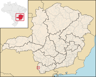
Albertina is a city in the Brazilian state of Minas Gerais. In 2004 its population was estimated to be 3,023.

Kasalice is a village in the Pardubice Region of the Czech Republic. It has around 190 inhabitants.
Zlonín is a village in the Prague-East District, Central Bohemian Region of the Czech Republic. On the date July 3, 2006 it has 231 inhabitants. First written notice about village is from year 1367. It is a member of Mikroregion Povodí Mratínského potoka.

Chichakli ; formerly known as Kizilvank, is an abandoned village in the Gegharkunik Province of Armenia, located near the village of Makenis.
Jiliza is a village in the Lori Province of Armenia.

Kajetanówka is a village in the administrative district of Gmina Biłgoraj, within Biłgoraj County, Lublin Voivodeship, in eastern Poland. It lies approximately 10 kilometres (6 mi) north-east of Biłgoraj and 73 km (45 mi) south of the regional capital Lublin.
Potok Wielki is a village in Janów Lubelski County, Lublin Voivodeship, in eastern Poland. It is the seat of the gmina called Gmina Potok Wielki. It lies approximately 17 kilometres (11 mi) north-west of Janów Lubelski and 57 km (35 mi) south-west of the regional capital Lublin.
Nowe Krzewo is a village in the administrative district of Gmina Zawady, within Białystok County, Podlaskie Voivodeship, in north-eastern Poland.
Białogorce is a village in the administrative district of Gmina Krynki, within Sokółka County, Podlaskie Voivodeship, in north-eastern Poland, close to the border with Belarus.

Maşanlı is a village in the Jabrayil Rayon of Azerbaijan.
Govşatlı is a village in the Fizuli Rayon of Azerbaijan.
Zərgər is a village in the Fizuli Rayon of Azerbaijan.
Ulu Qarabəy is a village in the Tartar Rayon of Azerbaijan.
Gartatowice is a village in the administrative district of Gmina Kije, within Pińczów County, Świętokrzyskie Voivodeship, in south-central Poland. It lies approximately 5 kilometres (3 mi) south-east of Kije, 8 km (5 mi) north-east of Pińczów, and 35 km (22 mi) south of the regional capital Kielce.
Czerwonka is a village in Maków County, Masovian Voivodeship, in east-central Poland. It is the seat of the gmina called Gmina Czerwonka. It lies approximately 9 kilometres (6 mi) north-east of Maków Mazowiecki and 77 km (48 mi) north of Warsaw.
Tańsk-Kiernozy is a village in the administrative district of Gmina Dzierzgowo, within Mława County, Masovian Voivodeship, in east-central Poland. It lies approximately 4 kilometres (2 mi) west of Dzierzgowo, 18 km (11 mi) east of Mława, and 110 km (68 mi) north of Warsaw.
Pałubin is a village in the administrative district of Gmina Stara Kiszewa, within Kościerzyna County, Pomeranian Voivodeship, in northern Poland. It lies approximately 4 kilometres (2 mi) east of Stara Kiszewa, 21 km (13 mi) south-east of Kościerzyna, and 50 km (31 mi) south-west of the regional capital Gdańsk.
Juba Stadium is a multi-use stadium in Juba, South Sudan. It is the home ground of the South Sudan national football team. It is currently undergoing renovations. It has also hosted matches for the 2009 CECAFA U-17 Championship. The 7,000-capacity stadium opened in 1962. A new 35,000-capacity stadium in Juba will be built soon.

The International Police Caps Collection is a permanent exhibition of an international collection of police hats in the former railway station of the Slochteren Woldjerspoor in Slochteren. The collection is owned by the Department of the Groningen International Police Association.
Vanchikivtsi is a commune (selsoviet) in Novoselytsia Raion, Chernivtsi Oblast, Ukraine. It is composed of two villages, Vanchikivtsi and Vanchinets.


