
Challapalli, officially known as Challapalle, is a village in Krishna district of the Indian state of Andhra Pradesh. It is located in Challapalli mandal of Machilipatnam revenue division. Challapalli is one of the villages in the mandal to be a part of Andhra Pradesh Capital Region.
Tirupati (rural) mandal is one of the 66 mandals in Chittoor district of Andhra Pradesh in India. It has its headquarters at Tirupati (rural) town. The mandal is bounded by Chandragiri mandal, Tirupati (urban) mandal, Renigunta mandal, Kammapalle mandal and Vadamalapeta mandal.

Chandarlapadu mandal is one of the 50 mandals in Krishna District of the Indian state of Andhra Pradesh. It is under the administration of Vijayawada revenue division and headquarters located at Chandarlapadu. The mandal is situated on the banks of Krishna River, bounded by Jaggayyapeta, Nandigama, Kanchikacherla mandals.

Mangalagiri mandal is one of the 57 mandals in Guntur district of the Indian state of Andhra Pradesh. It is under the administration of Guntur revenue division and the headquarters are located at Mangalagiri town. The mandal is bounded by Thullur, Tadepalle, Tadikonda, Pedakakani and Duggirala mandals and a portion of the mandal lies on the banks of Krishna River.
Tenali mandal is one of the 57 mandals in Guntur district of the Indian state of Andhra Pradesh. It is under the administration of Tenali revenue division, headquartered at Tenali. The mandal is located in Velanadu region, bounded by Pedakakani, Duggirala, Kollipara, Vemuru, Amruthalur, Tsundur and Chebrole mandals.

Repalle mandal is one of the 57 mandals in Guntur district of the state of Andhra Pradesh, India. It is under the administration of Tenali Revenue Division and the headquarters are located at Repalle. The mandal is situated on the banks of Krishna River of Velanadu region and is bounded by Bhattiprolu, Nagaram and Nizampatnam mandals.
Tadepalle mandal is one of the 57 mandals in Guntur district of the Indian state of Andhra Pradesh. It is under the administration of Guntur Revenue Division and the headquarters are located at Tadepalle town. The mandal is situated on the banks of Krishna River, bounded by Thullur and Mangalagiri mandals. from the mandal are under the jurisdiction of Andhra Pradesh Capital City.

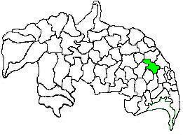
Duggirala mandal is one of the 57 mandals in Guntur district of the Indian state of Andhra Pradesh. It is under the administration of Tenali revenue division and the headquarters are located at Duggirala. The mandal is bounded by Mangalagiri, Pedakakani, Tenali and Kollipara mandals. Krishna River lies to the northeast of the Duggirala mandal.

Nizampatnam mandal is one of the 57 mandals in Guntur district of the state of Andhra Pradesh, India. It is under the administration of Tenali Revenue Division and the headquarters are located at Nizampatnam. The mandal is bounded by Repalle, Nagaram, Pittalavanipalem and Karlapalem mandals. The mandals lies on the shore of Bay of Bengal and a portion of the mandal lies on the banks of Krishna River.

Gannavaram mandal is one of the 50 mandals in Krishna district of the Indian state of Andhra Pradesh. It is under the administration of Nuzvid revenue division and the headquarters are located at Gannavaram. The mandal is bounded by Agiripalle, Bapulapadu, Unguturu, Vijayawada (rural) and Kankipadu mandals. The mandal is also a part of the Andhra Pradesh Capital Region under the jurisdiction of APCRDA.
Kollipara mandal is one of the 57 mandals in Guntur district of the state of Andhra Pradesh, India. It is under the administration of Tenali revenue division and the headquarters are located at Kollipara. The mandal is situated on the banks of the Krishna River, bordered by Duggirala, Tenali, Vemuru and Kollur mandal.

Narasaraopet mandal is one of the 57 mandals in Guntur district of the India state of Andhra Pradesh. It is under the administration of Narasaraopet revenue division and the headquarters are located at Narasaraopet city. The mandal is bounded by Rompicherla, Nekarikallu, Muppalla, Phirangipuram, Nadendla and Chilakaluripeta. It also borders Prakasam district.

Thullur mandal is one of the 57 mandals in Guntur district of the Indian state of Andhra Pradesh. It is under the administration of Guntur Revenue Division and the headquarters are located at Thullur. The mandal is situated on the banks of Krishna River, bounded by Amaravathi, Tadikonda, Tadepalle and Mangalagiri mandals. The mandal is also a part of the new capital city of Andhra Pradesh to be developed. 18 villages from the mandal fall under the jurisdiction of Andhra Pradesh Capital City.
Kamalapuram mandal is one of the 50 mandals in Kadapa district of the Indian state of Andhra Pradesh. It is under the administration of Kadapa revenue division and the headquarters are located at Kamalapuram. The mandal is bounded by Yerraguntla, Proddutur, Chapad, Khajipet, Vallur, Pendlimarri and Veerapunayunipalle mandals.

Vemuru mandal is one of the 57 mandals in Guntur district of the state of Andhra Pradesh in India. It is under the administration of Tenali Revenue Division and the headquarters are located at Vemuru. The mandal is bounded by Tenali, Kollipara and Kollur, Amruthalur, Cherukupalle and Bhattiprolu mandals. The mandal is also a part of the Andhra Pradesh Capital Region under the jurisdiction of APCRDA.

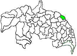
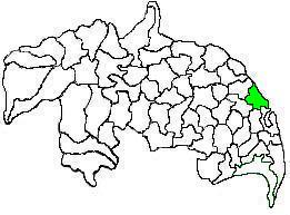
Pedakakani mandal is one of the 57 mandals in Guntur district of the Indian state of Andhra Pradesh. It is under the administration of Guntur Revenue Division and the headquarters are located at Pedakakani. The mandal is bounded by Tadikonda, Mangalagiri, Duggirala, Tenali, Chebrole and Guntur mandals.

Sattenapalle mandal is one of the 57 mandals in Guntur district of the Indian state of Andhra Pradesh. It is under the administration of Guntur revenue division and the headquarters are located at Sattenapalle. The mandal is bounded by Krosuru, Pedakurapadu, Rajupalem, Medikonduru, Muppalla and Phirangipuram.

Bhattiprolu mandal is one of the 57 mandals in Guntur district of the Indian state of Andhra Pradesh. It is under the administration of Tenali revenue division and the headquarters are located at Bhattiprolu. The mandal is situated on the banks of Krishna River, bounded by Kollur, Vemuru, Cherukupalle, Nagaram and Repalle mandals. The mandal headquarters ten villages are included in Andhra Pradesh Capital Region.

Tsundur mandal is one of the 57 mandals in Guntur district of the Indian state of Andhra Pradesh. It is under the administration of Tenali revenue division and the headquarters are located at Tsundur. The mandal is bounded by Chebrolu, Tenali, Amruthalur and Ponnur mandals. The mandal is a part of Andhra Pradesh Capital Region.

Macherla mandal is one of the 57 mandals in Guntur district of the Indian state of Andhra Pradesh. It is under the administration of Gurazala revenue division and the headquarters are located at Macherla. The mandal is bounded by Rentachintala, Durgi and Veldurthi mandals and a portion of the mandal also borders the state of Telangana.


