Mallee Catchment Management Authority

Last updated


The Mallee Catchment Management Authority (CMA) region is the largest catchment area in Victoria, Australia, covering approximately 3.9 million hectares – almost one-fifth of the State.

Catchment Management Authority (Victoria)

The Catchment Management Authorities (CMAs) were established in Victoria, Catchment and Land Protection Act 1994. Originally known as Catchment and Land Protection Boards, the CMAs were changed to their present name in 1997.

Victoria (Australia) State in Australia

Victoria is a state in south-eastern Australia. Victoria is Australia's smallest mainland state and its second-most populous state overall, making it the most densely populated state overall. Most of its population lives concentrated in the area surrounding Port Phillip Bay, which includes the metropolitan area of its state capital and largest city, Melbourne, Australia's second-largest city. Victoria is bordered by Bass Strait and Tasmania to the south, New South Wales to the north, the Tasman Sea to the east, and South Australia to the west.

Australia Country in Oceania

Australia, officially the Commonwealth of Australia, is a sovereign country comprising the mainland of the Australian continent, the island of Tasmania and numerous smaller islands. It is the largest country in Oceania and the world's sixth-largest country by total area. The neighbouring countries are Papua New Guinea, Indonesia and East Timor to the north; the Solomon Islands and Vanuatu to the north-east; and New Zealand to the south-east. The population of 25 million is highly urbanised and heavily concentrated on the eastern seaboard. Australia's capital is Canberra, and its largest city is Sydney. The country's other major metropolitan areas are Melbourne, Brisbane, Perth and Adelaide.
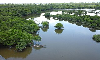
Mallee Region

The regional population is approximately 65,000, with Mildura the major urban centre. The north and east of the region is bordered by the River Murray, its anabranches, tributary channels, floodplains and associated wetland systems. In the south, north flowing intermittent streams, including the Yarriambiack Creek and Tyrrell Creek terminate in a number of ephemeral wetland complexes including the Wirrengren Plain, Lake Corrong and Lake Tyrrell.

Wetland A land area that is permanently or seasonally saturated with water

A wetland is a distinct ecosystem that is inundated by water, either permanently or seasonally, where oxygen-free processes prevail. The primary factor that distinguishes wetlands from other land forms or water bodies is the characteristic vegetation of aquatic plants, adapted to the unique hydric soil. Wetlands play a number of functions, including water purification, water storage, processing of carbon and other nutrients, stabilization of shorelines, and support of plants and animals. Wetlands are also considered the most biologically diverse of all ecosystems, serving as home to a wide range of plant and animal life. Whether any individual wetland performs these functions, and the degree to which it performs them, depends on characteristics of that wetland and the lands and waters near it. Methods for rapidly assessing these functions, wetland ecological health, and general wetland condition have been developed in many regions and have contributed to wetland conservation partly by raising public awareness of the functions and the ecosystem services some wetlands provide.

Lake Tyrrell lake in Australia

Lake Tyrrell is a shallow, salt-crusted depression in the Mallee district of north-west Victoria, in Australia. The word is derived from the local Wergaia word for 'sky', the Boorong Aboriginal people of the area being distinguished for their interest in star-lore. The Boorong people, with their astronomical traditions, told stories connected with constellations in the night sky.

There are over 900 wetlands in the Mallee CMA region, 14 of which are listed as ‘nationally significant’ in the Directory of Important Wetlands in Australia. In addition, the wetland and floodplain ecosystems of the Hattah Lakes and Lindsay, Wallpolla and Mulcra Islands have been recognised by the Murray Darling Ministerial Council as “icon sites” to receive environmental water under the Murray Darling Basin Commission’s Living Murray initiative.

A Directory of Important Wetlands in Australia (DIWA) is a list of wetlands of national importance to Australia. Intended to augment the list of wetlands of international importance under the Ramsar Convention, it was formerly published in report form, but is now essentially an online publication. Wetlands that appear in the Directory are commonly referred to as "DIWA wetlands" or "Directory wetlands".

Hattah-Kulkyne National Park Protected area in Victoria, Australia

The Hattah-Kulkyne National Park is a national park in the Mallee district of Victoria, Australia. The 48,000-hectare (120,000-acre) national park is situated adjacent to the Murray River, approximately 417 kilometres (259 mi) northwest of Melbourne with the nearest regional centre being Mildura. The national park was proclaimed on 7 June 1960 and is a popular destination for bushwalkers and school camping trips.

Land use in the Mallee is diverse with agriculture the most economically important industry and the River Murray a major influence. The region’s semi-arid climate supports primary industries including cereals, prime lambs, citrus, nuts, vegetables, vine and fruit growing activities. Many of these horticultural sectors have faced a challenging period in recent years due to the drought.

Program Highlights

A key focus for the Mallee CMA over the past decade has been helping communities to develop and increase their ability to engage in the process of protecting and improving the areas natural resources. Initiatives such as Landcare, Waterwatch, the Frontage Action Plan Project, Environmental Action Planning, and indigenous programs have all been instrumental in building community capacity and knowledge of regional natural resource management issues.

The voluntary involvement of over 150 local farmers in such programs as the Environmental Management Action Planning project signals a turning point in the direction of farming to include environmental considerations, while the voluntary contributions of Landcare groups, local schools and other community organisations in restoring frontages along the River Murray highlights the capacity of the community to implement environmental change.

Indigenous Cultural Heritage has become a key consideration of the Authority across all units, programs and projects. The Indigenous Cultural Heritage training program has boosted the capacity of the local indigenous community to identify key cultural heritage sites to ensure their ongoing protection. Undertaking research to inform future decisions in terms of natural resource management in the Mallee region has also been a key focus of the CMA over the past decade. With salinity one of the most significant threats to be faced by the Mallee region over the next 20 years, the aerial mapping of over 25,500 kilometres from Nyah to the South Australian border will provide data essential for future decision making in this area.

Future Challenges

The challenges of the vast Mallee region are both diverse and complex, demanding strong leadership, strategic planning and coordination. The future looks set to present many challenges with the continuing prolonged drought, low inflows into the Murray system, demand for water resources, rising salinity levels and climate change. Changing socioeconomic conditions, urban migration and land-use change will also present challenges for the Mallee region in the future. The Mallee CMA plans to continue to demonstrate its commitment and ability to embrace the challenges of increased natural resource management responsibilities through its key goals of business excellence, leadership and partnership and community engagement.