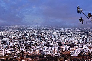
Nashik ) is a city in the northern region of the Indian state of Maharashtra. Situated on the banks of the river Godavari. The population of Nashik city is around 2.2 million and is emerging as one of the fastest-growing cities in India. Nashik is located about 165 km (103 mi) northeast of the state capital Mumbai, and about 210 km (130 mi) north of Pune. The Mumbai-Pune-Nashik region is called the "Golden Triangle of Maharashtra". With its high agricultural production, Nashik is dubbed the Napa Valley of India and the "Wine Capital of India" as more than half of India's vineyards and wineries are located here. Around 90% of all Indian wine comes from the Nashik Valley. Nashik is one of the Hindu pilgrimage sites of the Kumbh Mela, which is held every 12 years.

The Satpura Range is a range of hills in central India. The range rises in eastern Gujarat running east through the border of Maharashtra and Madhya Pradesh and ends in Chhattisgarh. The range parallels the Vindhya Range to the north, and these two east–west ranges divide Indian Subcontinent into the Indo-Gangetic plain of northern India and the Deccan Plateau of the south. The Narmada River originates from north-eastern end of Satpura in Amarkantak, and runs in the depression between the Satpura and Vindhya ranges, draining the northern slope of the Satpura range, running west towards the Arabian Sea. The Tapti River originates in the eastern-central part of Satpura, crossing the range in the center and running west at the range's southern slopes before meeting the Arabian Sea at Surat, draining the central and southern slopes of the range. Multai, the place of Tapti river origin is located about 465 kilometer far, south-westerly to Amarkantak, separated across by the hill range. The Godavari River and its tributaries drain the Deccan plateau, which lies south of the range, and the Mahanadi River drains the easternmost portion of the range. The Godavari and Mahanadi rivers flow into the Bay of Bengal. At its eastern end, the Satpura range meets the hills of the Chotanagpur Plateau. The Satpura Range is a horst mountain and is flanked by Narmada Graben in the north and much smaller but parallel Tapi Graben in the south.
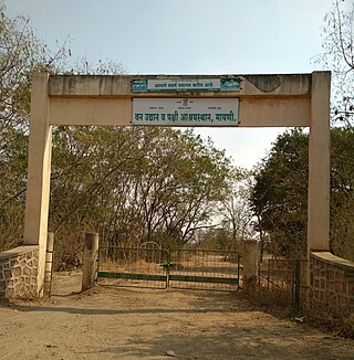
Mayani Bird Conservation Reserve is located in Mayani, Vaduj Forest Range of Satara Forest Division of Satara district. It came into existence with the notification WLP1220/CR-246/F-1 dated 15 March 2021. It is about 71 km from Satara.
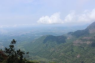
The Nilgiri Biosphere Reserve is a biosphere reserve in the Nilgiri Mountains of the Western Ghats in South India. It is the largest protected forest area in India, spreading across Tamil Nadu, Karnataka and Kerala. It includes the protected areas Mudumalai National Park, Mukurthi National Park, Sathyamangalam Wildlife Sanctuary in Tamil Nadu; Nagarhole National Park, Bandipur National Park, both in Karnataka; Silent Valley National Park, Aralam Wildlife Sanctuary, Wayanad Wildlife Sanctuary, and Karimpuzha Wildlife Sanctuary in Kerala.

Kali Tiger Reserve is a protected area and tiger reserve. It is located in Uttara Kannada district, in Karnataka, India. The park is a habitat of Bengal tigers, black panthers and Indian elephants, amongst other distinctive fauna. The Kali River flows through the tiger reserve and is the lifeline of the ecosystem and hence the name. The tiger reserve is spread over an area of 1300 square kilometres.
Abohar is a city and municipal corporation in the Fazilka district of the Indian state of Punjab, southeast of Fazilka city and northeast of Sri Ganganagar. It is near the India-Pakistan border. Abohar's population is 145,302 as of 2011. The city is known for kinnow production and accounts for 60% of the country's produce.

Kottiyoor is a Township, Village and Grama Panchayat situated in eastern hilly area of Kannur district in Kerala state. Kottiyoor is the 23rd Wildlife Sanctuary of Kerala, located in the serene hills of Western Ghats. The ancient pilgrimage conducted here yearly, called 'Kottiyoor Vysakha Mahotsavam' attracts around 50,000 devotees every year. The Vavali river flows through Kottiyoor.
Meghamalai, commonly known as the High Wavy Mountains, is a mountain range located in the Western Ghats in the Theni district near Kumily, Tamil Nadu. It is dotted with cardamom plantations and tea plantations. The mountain range is 1,500 metres above sea level, and it is rich in flora and fauna. The area, now mostly planted with tea plants, includes cloudlands, high wavys, venniar, and the manalar estates belonging to the Woodbriar Group. Access is largely restricted and includes largely untouched remnants of evergreen forest.
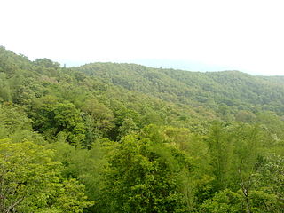
Parambikulam Tiger Reserve, which also includes the erstwhile Parambikulam Wildlife Sanctuary, is a 643.66 square kilometres (248.5 sq mi) protected area lying in Palakkad district and Thrissur district of Kerala state, South India. The Wildlife Sanctuary, which had an area of 285 square kilometres (110 sq mi) was established in part in 1973 and 1984. It is in the Sungam range of hills between the Anaimalai Hills and Nelliampathy Hills. Parambikulam Wildlife Sanctuary was declared as part of the Parambikulam Tiger Reserve on 19 February 2010. Including the buffer zone, the tiger reserve has a span of 643.66 km2. The Western Ghats, Anamalai Sub-Cluster, including all of Parambikulam Wildlife Sanctuary, has been declared by the UNESCO World Heritage Committee as a World Heritage Site. The Tiger Reserve is the home of four different tribes of indigenous peoples including the Kadar, Malasar tribe, Muduvar and Mala Malasar settled in six colonies. Parambikulam Tiger Reserve implements the Project Tiger scheme along with various other programs of the Government of India and the Government of Kerala. The operational aspects of administering a tiger reserve is as per the scheme laid down by the National Tiger Conservation Authority. People from tribal colonies inside the reserve are engaged as guides for treks and safaris, and are provided employment through various eco-tourism initiatives. Parambikulam Tiger Reserve is among the top-ten best managed Tiger Reserve in India. The tiger reserve hosts many capacity building training programmes conducted by Parambikulam Tiger Conservation Foundation in association with various organisations.
Nandgaon is a town and a municipal council in Nashik district in the Indian state of Maharashtra. It has a population of 23604 according to the 2011 census. Nandgaon is the headquarters of the Nandgaon taluka.

Maharashtra attracts tourists from other Indian states and foreign countries. It was the second most visited Indian state by foreigners and fifth most visited state by domestic tourists in the country in 2021. Aurangabad is the tourism capital of Maharashtra.
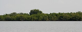
Krishna Wildlife Sanctuary is a wildlife sanctuary and estuary located in Andhra Pradesh, India. It is one of the rarest eco-regions of the world because it harbors vast tracts of pristine mangrove forests. It is believed by conservationists to be one of the last remaining tracts of thick primary mangrove forests of South India, which is rapidly disappearing due to absence of protective measures.

The Mhadei Wildlife Sanctuary is a 208.5-km2 (80.5-mi2) protected area in the Indian state of Goa in the Western Ghats of South India. It is located in the North Goa District, Sattari taluka near the town of Valpoi. The sanctuary is an area of high biodiversity, and is being considered to become a Project Tiger tiger reserve because of the presence of Bengal tigers.
Kotgarh Wildlife Sanctuary is situated in the Baliguda subdivision of Kandhamal district of Odisha state in India. It is classified as an Eastern Highlands moist deciduous forest. Around 52 tribal villages such as Kutia Kondh and Desia Kondh inhabit the sanctuary.
Panewadi is a village in Nandgaon Taluka near Manmad, belongs to Khandesh and Northern Maharashtra region in Nashik district. It is located 95 km towards East from District headquarters Nashik, 260 km from State capital Mumbai. Khadgaon (6), Mohegaon (6), Karhi (6), Kundalgaon (9), and Laxminagar (9) are the nearby villages to Panewadi. Panewadi is surrounded by Yeola Taluka to the south, Chandwad Taluka to the west, Malegaon Taluka to the north, and Deola Taluka to the west. It is one of the 100 villages of Nandgaon Block of Nashik district. The village is home to 2842 people, among them 1472 (52%) are male and 1370 (48%) are female. 78% of the whole population are from general caste, 10% are from schedule caste and 12% are schedule tribes. Child population of Panewadi village is 16%, among them 54% are boys and 46% are girls. According to the administration register, the village code of Panewadi is 550317. The village has 498 houses.
The Koka Wildlife Sanctuary is located in Bhandara District, near Bhandara Town of Maharashtra state. The sanctuary is spread over an area of 92.34 square kilometres. This sanctuary is a part of Nawegaon nagzira Tiger Reserve.

Raimona National Park is located in extreme western part of Assam, India. It is spread across Gossaigaon and Kokrajhar subdivisions of Kokrajhar district of Bodoland Territorial Region.

The Tansa Wildlife Sanctuary is located in Shahapur and Bhiwandi taluka of Thane district and Wada taluka of Palghar district. The sanctuary is spread over an area of 320 square km. This sanctuary is spread around the catchment area of Tansa, Vaitarna and Modak Sagar lakes which are major source of water to the Mumbai, Thane and Bhiwandi cities. There are about 60 villages in the sanctuary area. The forest area is hilly with dense patches of forest.
The AnerDam Wildlife Sanctuary is located in Shirpur talukas of Dhule district, India. The sanctuary is spread over southwestern side of Satpura hill ranges. This sanctuary is spread around the catchment area of Aner river specially above the high flood level around the Aner Dam. This sanctuary has common boundary with Yawal Wildlife Sanctuary in Jalgaon district and forest area of Khargone district in Madhyapradesh.
The Yedshi Ramling Ghat Wildlife Sanctuary is located in Osmanabad district. Yedshi Ramling Sanctuary has headquarters at Yedshi. It is situated 20 km from Osmanabad city and 95 km from Beed city. The Latur-Barshi highway passes through the sanctuary. The sanctuary is situated in Kalamb, Bhansgaon and Wadgaon villages of Osmanabad and Kalamb Tehsil of Osmanabad district. It is situated in the Balaghat mountain range of the Sahyadri. In 1997, the government declared an area of 2237.5 hectares as 'Ramling Ghat' Sanctuary for the protection of various plants, animals and birds. It is also known as hill station as it is high above sea level.


