
pronunciation (help·info) is one of the towns in Nashik district in the state of Maharashtra in India. It is the third largest city in Nashik district, with a population of approximately 80,000. Geographically it lies within Nandgaon Tehsil in Nashik District. Though it has a larger area and population than most Tehsils in the district, it does not have a Tehsil office.

Navsari is an administrative district in the state of Gujarat in India, with its headquarters at the city of Navsari. The district covers an area of 2,211 square kilometres, and had a population of 1,329,672 in 2011. The district was formed in 1997 after Valsad district was bifurcated into Valsad and Navsari districts.
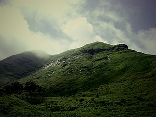
Nashik district, also known as Nasik district, is a district in Maharashtra, India. The city of Nashik is the administrative headquarters of the district. Nashik is well known for the production of wine. Nashik is also known as Mini Maharashtra, because the climate and soil conditions of Surgana, Peth, Igatpuri resembles with Konkan. Niphad, Sinnar, Dindori, Baglan blocks are like Western Maharashtra and Yeola, Nandgaon, Chandwad blocks are like Vidarbha Region. Nashik, Malegaon, Manmad, Igatpuri, sinnar are some of the big cities situated in the Nashik District.
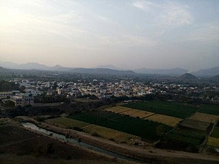
Niphad is the name both of the town and the Taluka headquartered there. It is within the Nashik District of Maharashtra, India. The Marathi name signifies "a place without mountains", and indeed the taluka's topography is fairly level, with hardly any hills. It is served by Niphad railway station. Niphad's latitude and longitude coordinates are 20°5′0″N74°7′0″E. Located northeast of Nashik city, the Taluka borders Sinnar, Nashik, Dindori, Chandwad, and Yeola Talukas and Ahmednagar District, and has no direct access to the sea. The Niphad Sub-Division is composed of Niphad, Sinnar and Yeola Talukas.
Akkalkotpronunciation (help·info) is a City and a municipal council in Solapur district in the Indian state of Maharashtra. It is situated 40 km southeast of Solapur and very close to the border between Maharashtra and Karnataka states.
Kankavli is a city in Sindhudurg district in the Indian state of Maharashtra. It is an important City due to its central location in the Sindhudurg district. All talukas are at an equal distance from Kankavli city. There is a temple of Shri Bhalchandra Maharaj and Swyambhu Ravalnath. The Kankavli city is situated in between two west flowing rivers which carry roaring gushing waters on their rockbed to Arabian sea in monsoon.It is a culturally, educationally and socially rich and vibrant major city.A veteran Gandhian Shri Appasaheb Patwardhan founded Gopuri Ashram near Kankavli city with principles of Swadeshi,Swatchhata,Swawlamban and Sarvodaya in 1948.Kankavli is equally located from Kolhapur and Ratnagiri.This is one of the important railway stations on Konkan railway route and major towns on NH 66.Maharashtra's ex- Chief Minister Shri.Narayan Rane also hails from this area.
Sillod is a city and also name of a Taluka in the Aurangabad District of the Indian state of Maharashtra with an average elevation of 612 metres (2,008 ft).
Karmala is a city and a municipal council in Solapur district in the Indian state of Maharashtra.

Pawai is a town and a nagar panchayat in the Panna district of Madhya Pradesh state in central India. It is mostly surrounded by rocky area.
Sadalga is a municipal town in Chikodi Taluka in the Belagavi district of Karnataka, India.
Vaijapur is a city and a municipal council in Aurangabad district in the Indian state of Maharashtra. It is bordered by the Nashik districts to the west, Kannad tehsil to the north, Gangapur tehsil to the east, and Ahmednagar districts to the south. Vaijapur is the headquarters of Vaijapur tehsil and also known as the Gateway of Marathwada.

Chandwad (IPA:Cāndavaḍa) is a town located in the Nashik district in Maharashtra. It is 250 km from Mumbai. The 11th-century Jain Caves, Renuka devi mandir, Chandreshwar temple and Rangmahal are in Chandwad.
Maan is not a city name. Dahiwadi taluka is called as Maan taluka because land it's situated on Maan river that reason it's called Maan.Sub division dahiwadi is in Satara district of Maharashtra in India. Dahiwadi is tehsil place of maan taluka.
Jath is a town and taluka headquarters in Miraj subdivision of Sangli district in southern Maharashtra. Jath is one of the largest tehsils in Maharashtra state. Demographically, it has historically been a part of Man Desh. It is spelled in different ways like जत in Marathi and Jat or Jath in English.
Wategaon is a town in Sangli district, Maharashtra, India. Wategaon is a village in walva taluka lying 16 km west of Islampur and 9.65 km north-west of Peth. It was once an alienated village and was held by a Brahman Kemavisdar under the Kurundvad chief to whom it belonged, it has sprung up on either side of the Bhogavati Ganga, a stream, and has better roads and streets as compared to other villages of its size. It is connected with Islampur and Peth by a good made road. There are a few traders trading in raw sugar and tobacco and other agricultural produce. Vateganv has a primary school, a high school, two private dispensaries and a post office. Wells and the Bhogavati Ganga stream provide drinking water.
Abhona is a village in Kalwan tehsil of Nashik district in the Indian state of Maharashtra. It belongs to the North Maharashtra region.
Pimpalas is the name both of the town. It is within the Nashik District of Maharashtra, India. The Marathi name signifies "a place without mountains", and indeed the taluka's topography is fairly level, with hardly any hills. It is served by Kasabe Sukena railway station.pimpalas's latitude and longitude coordinates are 20°5′0″N74°7′0″E. Located northeast of Nashik city, the Taluka borders Sinnar, Nashik, Dindori, Chandwad, and Yeola Talukas and Ahmednagar District, and has no direct access to the sea.
Vadgaon is a census town in Nashik district in the Indian state of Maharashtra. It is located 119 km towards East from District headquarters Nashik. 4 km from Malegaon. 289 km from State capital Mumbai. Nilgawan, Camp, Dnyane, Osiya Nagar, Lendane are the nearby Villages to Vadgaon. Vadgaon is surrounded by Baglan Taluka towards west, Nandgaon Taluka towards South, Deola Taluka towards west, Chandwad Taluka towards South .Malegaon, Satana, Manmad are the nearby Cities to Vadgaon. Vadgaon is also have sub Village Vaitagwadi,dadawadi
Pilode is a village and located in Amalner Tehsil of Jalgaon district in Maharashtra, India. It is situated 10 km away from sub-district headquarter Amalner and 65 km away from district headquarter Jalgaon.
Panewadi is village in Nandgaon Taluka near manmad, belongs to Khandesh and Northern Maharashtra region in Nashik district. It is located 95 KM towards East from District head quarters Nashik, 260 KM from State capital Mumbai. Khadgaon, Mohegaon, Karhi, Kundalgaon, Laxminagar are the nearby Villages to Panewadi. Panewadi is surrounded by Yeola Taluka towards South, Chandwad Taluka towards west, Malegaon Taluka towards North, Deola Taluka towards west. it is one of the 100 villages of Nandgaon Block of Nashik district.The village is home to 2842 people, among them 1472 (52%) are male and 1370 (48%) are female. 78% of the whole population are from general caste, 10% are from schedule caste and 12% are schedule tribes. Child population of Panewadi village is 16%, among them 54% are boys and 46% are girls. According to the administration register, the village code of Panewadi is 550317. The village has 498 houses.
