Mandanahalli

Last updated

Mandanahalli, Mysore Mandanahalli. .-1.jpg
Mandanahalli, Mysore
Mandanahalli village Mandanahalli.-1.jpg
Mandanahalli village

Mandanhalli is a small village near Mysore in Karnataka state, India.

Mysore Metropolis in Karnataka, India

Mysore, officially Mysuru, is a city in the state of Karnataka, India. Mysore city is geographically located between 12° 18' 26” North Latitude and 76° 38' 59'' East Longitude. It is located at an altitude of 2427 feet.

Karnataka State in southern India

Karnataka is a state in the south western region of India. It was formed on 1 November 1956, with the passage of the States Reorganisation Act. Originally known as the State of Mysore, it was renamed Karnataka in 1973. The state corresponds to the Carnatic region. The capital and largest city is Bangalore (Bengaluru).

Contents

Location

Mandanahalli is located on Mananthavady Road.

Demographics

Mandanahalli has a population of 969 people. Children form 12 per cent of the total population. There are 215 houses in the village.

Administration

Mandanahalli village is part of Harohalli gram panchayath in Mysore tehsil. The total area of the village is 222 hectares (550 acres).

See also

Anthara Santhe village cluster in Karnataka, India

Anthare Santhe is a small town near Nagarhole National Park in Heggadadevankote Taluk of Mysore district, Karnataka province, India.

Daripura, Mysore human settlement in India

Daripura is a small village in Mysore, Karnataka province, India.

Harohalli village in Karnataka, India

Harohalli is a village in the southern state of Karnataka, India. It is located in the harohalli taluk of ramanagar district in Karnataka.

Related Research Articles

Kanakapura city in Karnataka, India

Kanakapura is a city and the headquarters of Kanakapura Taluk in the Ramanagara district in the state of Karnataka, India. Situated 55 km from the city Bengaluru, this city is famous for the production of silk and granite. It is located among the lush green forests of the state of Karnataka and The town is a tourism hotspot and an often visited tourist favorite in the entire state of Karnataka, as it has something for everyone ranging from avid trekkers to history buffs and wildlife enthusiasts.

Pandavapura city in Karnataka, India

Pandavapura is a panchayat town in Mandya district in the Indian state of Karnataka.

Yachenahalli village in Karnataka, India

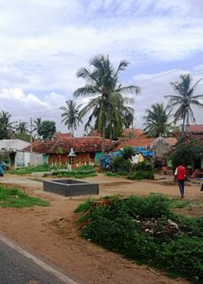
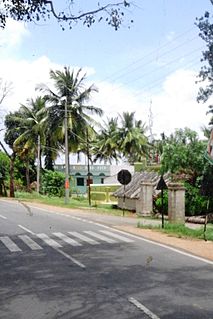
Yachenahalli is a panchayat town in Mysore district in the state of Karnataka, India.

Lokur is a village in Athni tehsil, Belgaum district, in the state of Karnataka, India. According to Census 2011 information the location code or village code of Lokur village is 597287. It is 32 kilometres (20 mi) from the sub-district headquarters at Athni and 122 kilometres (76 mi) from the district headquarters at Belgaum. As per 2009 stats, Mangasuli is the gram panchayat of Lokur village.


Ballekere is a village near Kadur of Chikkamagaluru district of Karnataka, India.

Hanamasagar Village in Karnataka, India

Hanamasagar (Halasagar) is a village in the southern state of Karnataka, India. It is located in Vijayapur taluk, of Vijayapur district, Karnataka and is nearly 40 km from the district headquarters Vijayapur. It is a small village and pilgrim, having the post office at Kambagi and Babaleshwar hobli.

Kenchalagudu Place in Karnataka, India

Kenchalagudu is a small village near manandavadi road Mysore city in Karnataka province of India.

Jayapura, Mysore human settlement in India

Jayapura is a small village near Mysore in Karnatakaprovince, India.

Gurur Place in Karnataka, India

Gurur is a small village in Mysore district, Karnataka, India.

Panchavalli Place in Karnataka, India

Panchavalli is a village near Hunsur in Mysore district of Karnataka state in India.

Muthurayana Hosahalli Kaval Place in Karnataka, India

Muthurayana Hosahalli Kaval is a small village in Mysore district of Karnataka state, India.

Saragooru Nanjangud Mysore district, Karnataka, India

Saragooru Nanjangud is a small village in Mysore district of Karnataka state, India.

Nagarle

Nagarle is a village in Mysore district of Karnataka state, India.

Konanur, Mysore Konanur is a village in Nanjangud taluk, Mysore district, Karnataka state, India.

Konanur or Paduvalamarahalli is a village in Nanjangud taluk of Mysore district, Karnataka state, India.

Chikkahalli Choranahalli

Chikkalli Choranalli is a twin village near Mysore city, Karnataka state, India.

Kodagahalli

Kodagahalli is a small village in Mysore district of Karnataka state, India.

Mududi

Mududi is a village in Arsikere taluk of Hassan district in India.

Kantharajapura

Kantharajapura is a village in Hassan district of Karnataka state, India.

References

    Coordinates: 12°09′N76°31′E / 12.150°N 76.517°E / 12.150; 76.517

    Geographic coordinate system Coordinate system

    A geographic coordinate system is a coordinate system that enables every location on Earth to be specified by a set of numbers, letters or symbols. The coordinates are often chosen such that one of the numbers represents a vertical position and two or three of the numbers represent a horizontal position; alternatively, a geographic position may be expressed in a combined three-dimensional Cartesian vector. A common choice of coordinates is latitude, longitude and elevation. To specify a location on a plane requires a map projection.