Anthara Santhe

Last updated

Anthara Santhe
village cluster
Antharasanthe. Hosamala2.jpg
Antharasanthe village
Anthara Santhe
Coordinates: 12°01′06″N76°17′57″E / 12.018418°N 76.299185°E / 12.018418; 76.299185
CountryFlag of India.svg  India
State Karnataka
District Mysore
This article needs additional citations for verification. Please help improve this article by adding citations to reliable sources. Unsourced material may be challenged and removed.
Find sources: "Anthara Santhe" - news * newspapers * books * scholar * JSTOR (May 2025) (Learn how and when to remove this message)
Karappuram village, Anthare Santhe Karapuram. Anthare Santhe.jpg
Karappuram village, Anthare Santhe

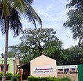
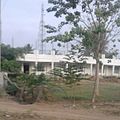
Anthare Santhe is a small town near Nagarhole National Park in Heggadadevankote, Mysore district, Karnataka, India. [1]

Contents

Location

Anthare Santhe is the nucleus of a series of villages situated deep inside the Nagerhole forest of Karnataka state. Kabini river and reservoir lies on the eastern side of all these villages.

Balle Elephant Camp

Balle Elephant Camp is located near the Anthare Santhe village. It is part of the Nagerhole national forest and it is located at the Balle checkpost.

Education

Honnamannakatte High School is the main educational organization in Anthara Santhe.

Suburbs and villages

See also

References

  1. "Primary Census Abstract Data Tables – India: Final Population Totals". Office of the Registrar General & Census Commissioner, India. Ministry of Home Affairs, Government of India. 2011. Archived from the original on 11 July 2022. Retrieved 27 April 2025.