Related Research Articles
The Waioeka River is found in the north of New Zealand's North Island. It flows north for 65 kilometres (40 mi) from Te Urewera National Park to reach the sea at Ōpōtiki. It shares its estuary with the Ōtara River.

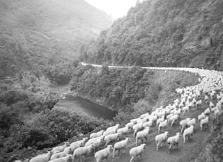
The Ōtara River is found in the north of New Zealand's North Island. It flows north for 35 kilometres (22 mi), reaching the sea at Ōpōtiki in the eastern Bay of Plenty. It shares its estuary with the Waioeka River.

The Wairoa River of the Hawke's Bay region in New Zealand runs south for 65 kilometres from the inland east coast region of the North Island, west of Gisborne, before flowing into northern Hawke Bay at the town of Wairoa.
Mount Arowhana is a 1440-metre (4724 ft) mountain that is part of the backbone of the Raukumara Range in the northeast of New Zealand's North Island. The range forms part of a line of mountains extending along the eastern side of the North Island between the Gisborne District and Wellington.
Maungahaumi is a mountain in the Raukumara Range in the northeast of New Zealand's North Island.
Ormond is a small settlement inland from Gisborne, in the northeast of New Zealand's North Island. It is located on State Highway 2 in the valley of the Waipaoa River, halfway between Gisborne and the township of Te Karaka.
Whatatutu is a small settlement in the northeast of New Zealand's North Island. It is located north of Te Karaka on the upper reaches of the Waipaoa River, close to its meeting with its tributaries, the Mangatu River and Waingaromia River.

Rere is a small community in the northeast of New Zealand's North Island. it is located in the upper valley of the Wharekōpae River in remote country in the foothills of the Huiarau Range, inland from Gisborne. It is notable for the Rere Falls and Rere Rock Slide, both on the Wharekopae River.
Puha or Puhatikotiko is a locality between the Waipaoa River and the Waikohu River in the Gisborne District of New Zealand's North Island. It is located close to the confluence of the two rivers on State Highway 2 close to Te Karaka, inland from the city of Gisborne.
Waikohu is a small settlement in the northeast of New Zealand's North Island. It is located close to the confluence of the Wharekopae and Waikohu Rivers on State Highway 2 to the west of Te Karaka, inland from Gisborne.
The Koranga River is a river of the northeast of New Zealand's North Island. It lies to the east of Te Urewera National Park, to the southwest of the settlement of Matawai, and flows northwest to reach its outflow into the Waioeka River.
The Mangatu River is a river of the Gisborne Region of New Zealand's North Island. It flows south from its sources in rough hill country northeast of Matawai to reach the Waipaoa River at Whatatutu.
The Nukuhou River is a river of the Bay of Plenty Region of New Zealand's North Island. It flows north from its origins 20 kilometres (12 mi) southwest of Ōpōtiki, reaching the Bay of Plenty at Ohiwa Harbour, halfway between Ōpōtiki and Whakatāne.
The Ruakituri River is a river of the Gisborne and Hawke's Bay Region of New Zealand's North Island. It initially flows northeast from its sources north of Lake Waikareiti. Within its course are the 72 m high Waitangi Falls. Afterwards it turns southeast for the majority of its course, reaching the settlement of Te Reinga, 25 kilometres (16 mi) north of Wairoa. It merges with the Hangaroa River resulting in the Wairoa River.
The Te Arai River is a river of the Gisborne Region of New Zealand's North Island. It flows generally north from its origins in rough hill country 20 kilometres (12 mi) north of Nūhaka before veering northeast past the township of Manutuke to reach the Waipaoa River five kilometres from the latter's outflow into Poverty Bay. Since 16 July 2020 the official name of the river has been Te Ārai River.

The Waikaretāheke River is a river of the Hawke's Bay region of New Zealand's North Island. It serves as the outflow of Lake Waikaremoana, flowing southeast from the lake's southeastern shore to reach the Waiau River 20 kilometres (12 mi) northwest of Wairoa. State Highway 38 follows the river's course for much of its length.
The Waingaromia River is a river of the Gisborne Region of New Zealand's North Island. It flows generally southwest from its origins 25 kilometres (16 mi) west of Tolaga Bay to reach the Waipaoa River close to Whatatutu.
The Waiotahe River is a river of the Bay of Plenty Region of New Zealand's North Island. It flows north from its origins west of Oponae and east of Matahi to reach the Bay of Plenty 5 kilometres (3 mi) west of Ōpōtiki.
The Waikare River is a river in the Bay of Plenty Region of New Zealand' North Island. It flows north from its origins between the peaks of Matawhio and Papakai north of Lake Waikaremoana to reach the Whakatane River 25 kilometres (16 mi) east of Murupara.
Mōtū is a rural community in the Gisborne District of New Zealand's North Island. It is located north of Matawai and State Highway 2. The community is centred around Mōtū River and Mōtū Falls.
References
- ↑ "Place name detail: Mangaaruhe River". New Zealand Gazetteer. New Zealand Geographic Board . Retrieved 21 April 2010.
38°50′25″S177°21′33″E / 38.8403°S 177.359195°E