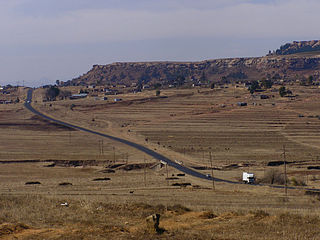
Manka, Lesotho

Last updated
Manka
Community Council
Lesotho adm location map.svg
Red pog.svg
Manka
Geographic Center of Community
Coordinates: 28°59′38″S27°49′17″E / 28.99389°S 27.82139°E / -28.99389; 27.82139
CountryFlag of Lesotho.svg  Lesotho
District Leribe District
Elevation
[1]
6,033 ft (1,839 m)
Population
 (2006)
  Total20,693
Time zone UTC+2 (CAT)
Coordinates computed from Lesotho Villages file. [2]

Manka is a community council located in the Leribe District of Lesotho. Its population in 2006 was 20,693. [3]

Contents

Villages

The community of Manka includes the villages of Ha 'Musi, Ha Eleke (Peka), Ha Fako, Ha Foka, Ha Hlaname, Ha Keenya, Ha Kotola, Ha Leburu, Ha Leburu (Peka), Ha Lechesa, Ha Lepholisa, Ha Letsika, Ha Liteboho, Ha Mabote, Ha Mahlomola (Tabola), Ha Makoae (Liphakoeng), Ha Malebo, Ha Marana, Ha Masakale, Ha Mashape, Ha Mokhethi, Ha Mokhomo (Tabola), Ha Mokhoro, Ha Mokhosi (Fobane), Ha Monnanyane, Ha Monyane, Ha Mosae, Ha Mosamo, Ha Motako, Ha Motlau, Ha Mpeke, Ha Mpetsana (Fobane), Ha Napo, Ha Napo (Hlokoa-Lelle), Ha Nkokoane, Ha Ntahli, Ha Patsa, Ha Qhomane, Ha Ralebona, Ha Ralikariki, Ha Ramaboella, Ha Ramochana, Ha Ramohai, Ha Ramohapi, Ha Ramosalla, Ha Rantho, Ha Rantuba, Ha Seetsa, Ha Thipane, Ha Tjopa, Ha Tjopa (Peka), Ha Tšiea, Ha Tumo (Fobane), Masaleng (Peka), Molumong, Motimposo (Peka) and Nkanyane. [4]

Related Research Articles

Leribe District District in Lesotho

Leribè is a district of Lesotho. It has an area of 2,828 km² and a population in 2016 of approximately 337,500. Hlotse is the capital or camptown of the district. The district has one additional town, namely Maputsoe. In the west, Leribe borders on the Free State Province of South Africa. Domestically, it borders Butha-Buthe District in the north, Mokhotlong District in the east, Thaba-Tseka District in southeast and Berea District in southwest.

Semonkong Community Council in Maseru District, Lesotho

Semonkong is a community council located in the Maseru District of Lesotho. Semonkong, meaning "Place of Smoke", was established in the 1880s as a refuge for Basotho displaced by the Gun War. It is located close to several major natural features, including the Maletsunyane Falls and the 3096-metre peak of Thaba Putsoa. The population in 2006 was 7,781.

Sehonghong Community Council in Thaba-Tseka District, Lesotho

Sehonghong is a community council located in the Thaba-Tseka District of Lesotho. Its population in 2006 was 5,814. The village of Sehonghong is located between Taung and Matebeng on the Senqu River.

Mazenod, Lesotho Community Council in Maseru District, Lesotho

Mazenod is a community council located in the Maseru District of western Lesotho. The population in 2006 was 27,553. It is located to the south-east of the capital Maseru. Points of interest include Moshoeshoe I International Airport, Lesotho's only international airport.

Kanana Community Council in Berea District, Lesotho

Kanana is a community council located in the Berea District of Lesotho. Its population in 2006 was 19,311.

Mathula Community Council in Mafeteng District, Lesotho

Mathula is a community council located in the Mafeteng District of Lesotho. Its population in 2006 was 17,867.

Metsi-Maholo Community Council in Mafeteng District, Lesotho

Metsi-Maholo is a community council located in the Mafeteng District of Lesotho. Its population in 2006 was 21,480.

Ratau Community Council in Maseru District, Lesotho

Ratau is a community council located in the Maseru District of Lesotho. Its population in 2006 was 26,582.

Mosenekeng Community Council in Qachas Nek District, Lesotho

Mosenekeng is a community council located in the Qacha's Nek District of Lesotho. Its population in 2006 was 2,279.

MkhOno Community Council in Quthing District, Lesotho

Mk'hono is a community council located in the Quthing District of Lesotho. Its population in 2006 was 9,840.

Matsooana Community council in Thaba-Tseka District, Lesotho

Thaban'a Mahlanya is a community council located in the Thaba-Tseka District of Lesotho. Its population in 2006 was 14,416.

Makheka Community Council in Maseru District, Lesotho

Makheka is a community council located in the Maseru District of Lesotho. The population in 2006 was 5,473.

Abia Community Community Council / Constituency in Maseru District, Lesotho

Abia is a constituency and community council in the Maseru Municipality located in the Maseru District of Lesotho. The population in 2006 was 17,449.

Motimposo Community Council / Constituency in Maseru District, Lesotho

Motimposo is a constituency and community council in the Maseru Municipality located in the Maseru District of Lesotho. The population in 2006 was 24,714.

Qoaling Community Council / Constituency in Maseru District, Lesotho

Qoaling is a constituency and community council in the Maseru Municipality located in the Maseru District of Lesotho. The population in 2006 was 33,989.

Maseepho Community Council in Qachas Nek District, Lesotho

Maseepho is a community council located in the Qacha's Nek District of Lesotho. Its population in 2006 was 7,879.

Matebeng Council Community Council in Qachas Nek District, Lesotho

Matebeng is a community council located in the Qacha's Nek District of Lesotho. Its population in 2006 was 1,735.

Ramatšeliso Community Council in Qachas Nek District, Lesotho

Ramatšeliso is a community council located in the Qacha's Nek District of Lesotho. Its population in 2006 was 6,189.

Ratšoleli Community Council in Qachas Nek District, Lesotho

Ratšoleli is a community council located in the Qacha's Nek District of Lesotho. Its population in 2006 was 6,633.

Thaba-Litšoene Community Council in Qachas Nek District, Lesotho

Thaba-Litšoene is a community council located in the Qacha's Nek District of Lesotho. Its population in 2006 was 5,036.

References

  1. GTOPO30 via GeoNames. Retrieved 2010-08-17.
  2. Google Earth Download Site Retrieved 2010-07-21.
  3. Statoids.com
  4. Lesotho Bureau of Statistics, Village List Archived 2009-11-13 at the Wayback Machine , 2006.