
Nepal measures about 880 kilometers (547 mi) along its Himalayan axis by 150 to 250 kilometers across. It has an area of 147,516 km2 (56,956 sq mi).
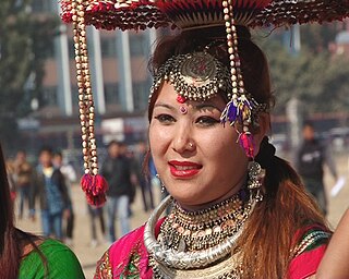
The Tharu people are an ethnic group indigenous to the Terai in southern Nepal and northern India. They are recognized as an official nationality by the Government of Nepal.

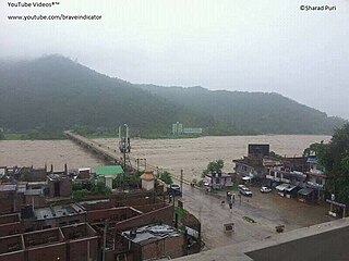
Ghaghara, also called Karnali is a perennial trans-boundary river originating on the Tibetan Plateau near Lake Manasarovar. It cuts through the Himalayas in Nepal and joins the Sharda River at Brahmaghat in India. Together they form the Ghaghara River, a major left bank tributary of the Ganges. With a length of 507 kilometres (315 mi) it is the longest river in Nepal. The total length of Ghaghara River up to its confluence with the Ganges at Revelganj in Bihar is 1,080 kilometres (670 mi). It is the largest tributary of the Ganges by volume and the second longest tributary of the Ganges by length after Yamuna.

Banke District (Nepali: बाँके जिल्ला[bãke], a part of Lumbini Province, is one of the 77 districts of Nepal. The district, located in midwestern Nepal with Nepalganj as its district headquarters, covers an area of 2,337 km2 and had a population of 385,840 in 2001 and 491,313 in 2011. There are three main cities in the Banke District: Nepalganj, Kohalpur and Khajura Bajaar.

Bardiya District, one of the seventy-seven Districts of Nepal, is part of Lumbini Province of Nepal. The district, with Gulariya as its headquarters, covers an area of 2,025 km2 (782 sq mi) and according to the 2001 census the population was 382,649 in 2011 it has 426,576.

Humla District, a part of Karnali Pradesh, is one of the seventy-seven districts of Nepal. The district, with Simikot as its district headquarters, covers an area of 5,655 km2 (2,183 sq mi) and has population of 50,858 as per the census of 2011. Humla is the 2nd largest district of Nepal. The Southern part and middle of Humla District is inhabited by Khas people, originating from Sinja valley, whereas the North border is mostly inhabited by Tibetans. Northern part of this district is administered by China since border skirmishes with India in 2020.
Rautahat District, a part of Province No. 2, is one of the seventy-seven districts of Nepal. The district headquarter is Gaur, including municipalities like Garuda, Chandrapur, Paroha, covers an area of 1,126 km² and had a population of 545,132 in 2001 and 686,722 in 2011. This district has a total of 2 VDCs and 16 municipalities. Among other districts, Rautahat has the largest percent of Muslims in Nepal, about 19.465%. The most muslim densely Village Bairiya is an example for secularism in Nepal. Sri Ram Sugar Mill is the only sugar mill located in Garuda municipality. The well known shiva temple located in Shivnagar, which run by giri family. The historical temple of Goddess Durga is in Matsarri.Late Shri Gulab Narayan Jha, the first person to represent madhesis in politics, was permanent resident of this village. There is a place called Najarpur in Chandrapur, Rautahat where whole village is vegetarian. They are not even allowed to buy or sell any alcoholic beverages and buying and selling of tobacco products is also prohibited.
Surkhet District is the province capital of Karnali province. Surkhet is the one of the ten districts of Karnali located about 600 kilometres (373 mi) west of the national capital Kathmandu. The district's area is 2,488.64 square kilometres (960.87 sq mi)which is longest in Nepal. It had 288,527 population in 2001 and 350,804 in 2011 which male comprised 169,461 and female 181,381. It is the district headquarters of surkhet and commercial hub of the Karnali state of the new federal republic.
Nepalgunj, also spelled Nepalganj, is a Sub-Metropolitan City in Banke District, Nepal. It lies on the Terai plains near the southern border with Bahraich district in Uttar Pradesh, India. Nepalgunj is 153 kilometers south-west of Ghorahi and 16 km south of Kohalpur. Former Village Development Committee: Udayapur, Bhawaniyapur, Piprahawa, Jaispur, Paraspur, Indrapur, Khaskarkado, Bashudevpur, Manikapur and Puraina were added to territory in order to make it Sub metropolitan city on 2071 Paush 28 and later Puraini was also added in list on 2072 Paush 21. Further, while restructuring of local levels nationwide, ward no. 23 was taken out to Janaki Rural Municipality and ward no. 7 of Hirminiya VDC was added to Nepalgunj.

Kohalpur is a municipality in Banke District of Lumbini province of Nepal. The municipality was established on 18 May 2014 merging the existing two Village Development Committees i.e. Rajhena and Kohalpur. The town is in East-West highway and one of the fastest developing places in Nepal. A neighboring city Nepalgunj is on South (16 km), with Ghorahi city (135 km) to west in Dang District and further 6 km is the Indian border. In fact it is a growing city in the western region of Nepal. It has a junction to diverse the roadway transport to east, west, north and south from the city.
Bhimapur is a town and market place in Rajapur Municipality in Bardiya District in Lumbini Province of south-western Nepal. The former village development committee (VDC) was merged with Daulatpur, Naya Gaun, Badalpur, Bhimapur and Rajapur VDCs to form the new municipality on 18 May 2014. At the time of the 1991 Nepal census it had a population of 8,057 and had 1,012 houses in the town.
Daulatpur is a town and market place in Rajapur Municipality in Bardiya District in Lumbini Province of south-western Nepal. The former village development committee (VDC) was merged with Daulatpur, Naya Gaun, Badalpur, Bhimapur and Rajapur VDCs to form the new municipality on 18 May 2014. At the time of the 1991 Nepal census it had a population of 5,888 and had 681 houses in the town.
Naya Gaun is a town and market place in Rajapur Municipality in Bardiya District in Lumbini Province of south-western Nepal. The former village development committee (VDC) was merged with Daulatpur, Naya Gaun, Badalpur, Bhimapur and Rajapur VDCs to form the new municipality on 18 May 2014. At the time of the 1991 Nepal census it had a population of 4,741 and had 544 houses in the town.

Rajapur is a municipality in Bardiya District in Lumbini Province of south-western Nepal. The municipality was established on 18 May 2014 merging the existing Daulatpur, Naya Gaun, Badalpur, Bhimapur, Manpur Tapara and Rajapur village development committees (VDCs). It is located on the border with Uttar Pradesh state, India. It has a customs checkpoint for goods. Indian and Nepalese nationals may cross the border without restriction.

The Mid-Western Development Region was one of the largest and formerly one of Nepal's five development regions. Westward from the Central region surrounding Kathmandu were the Western, Mid-Western and finally Far-Western regions. Counter-intuitively, Mid-Western lay west of Western.

Phidim Municipality is the headquarters of the Panchthar District in the Mechi Zone of eastern Nepal. Phidim was upgraded to a 'municipality' from a 'village', when a development committee merged with other VDCs - including the Phidim, Chokmagu and Siwa villages - on May 18, 2014. It offers a route for trekkers and locals, who travel to and from the Taplejung district bordering with the Tibetan Autonomous Region of China. It is also a commercial hub for the rural surroundings.

Padampur is a municipality in Chitwan District in the Narayani Zone of southern Nepal. At the time of the 1991 Nepal census it had a population of 8,884 people living in 1,559 individual households. It was transferred in new location named Saguntol by Government of Nepal and completed with in 8 years i.e. from 2050 BS to 2058 BS. Previously it was at the lap of Rapati river and inside the Chitwan National Park. Flood of Rapati river in monsoon season destroy farmers crops. Wild animals also harmed their crops. Transportation, electricity, road and educational facilities were beyond people's access. It was known as one of the remote areas of the Chitwan district. In a view of agriculture, It was the best place for farmers. After the new dawn of democracy in 2046, New government was asked to shift this village for peoples safety and conservation of forest and wild animal. The cabinet of Girija Prasad Koirala was assured to shift in a convenience place soon and started the task immediately. This task was successfully done by the politician Baburam Puri of the Nepali Congress. The late Sailaja Acharya visited the people and understood their griefs and proposed to shift it next to Sagoontol near Jutpani VDC. This was a very difficult task to accomplish successfully. People from the Western Chitwan were stood against it but government took bold decision in favour of people of Padampur. Now it is about 2.5 km (1.6 mi) east to Bharatpur, district headquarters of Chitwan. Electricity, roads and transportation facility are comparatively better here. 2,800 households were there now. According to the 2001 census, the total population of the VDC was 11,336 with total households 2,137. Tharus are the dominant ethnic group with 45.89% of the total VDC population. Brahman, Kshetri, Tamang, Gurung and Newar are other castes here. Mainly banana, maize and oil are farmed here. Except ward no 1 there are deep tubewells to Irrigate farmlands. Poultry, dairy, epiculture, mushroom farming and goat keeping have great potentials here. A campus, A higher secondary school, a secondary boarding school and other 7 primary and lower secondary schools are providing education here. Health post, and Post office are too doing their best for providing services to locals. Drinking water is provided in better and modern way. Pipelines of drinking water are available within all roads (113 km) of Padampur. An NGO veterinary office is also serving and helping farmers. Since last 5 years this VDC is starting to be known as one of pocket areas of commercial banana farming of the nation. Nobody is landless here and this is the special feature here. Padampur is very attractive location for migratory view and daily people are migrating here. It is like a colonial place for settlement of people. Government has sifted it in a well planned way and that is why it is the second model VDC of Nepal. Now this village has merged in Kalika Municipality and shares 4 wards in it i.e. Kalika -9, Kalika-10, Kalika-11 and Kalika-12.
West Rapti drains Rapti Zone in Mid-Western Region, Nepal, then Awadh and Purvanchal regions of Uttar Pradesh state, India before joining the Ghaghara—a major left bank tributary of the Ganges known as the Karnali inside Nepal.
Lumbini Province is one of the seven provinces established by the constitution of Nepal. The province is Nepal's fourth most populous province and third largest province by area. Lumbini is bordered by Gandaki Province and Karnali Province to the north, Sudurpashchim Province to the west, Uttar Pradesh and Bihar of India to the south. Lumbini is one of the two Nepalese provinces to have an international border only with India. Lumbini's capital, Deukhuri, is near the geographic centre of the province; it is a small town which is currently being developed to meet the prerequisite of provincial capital. The major cities in this province are Butwal and Siddharthanagar in Rupandehi District, Nepalgunj in Banke District, Tansen in Palpa District, and Ghorahi and Tulsipur in Dang District.
Bheri Babai Diversion Multipurpose Project (BBDMP) is a multi-basin irrigation cum hydropower project lying in Surkhet District of Karnali Province in Mid-West Nepal. The water is diverted from the Bheri River and discharged to Babai River. The project aims to irrigate 51,000 ha of land in Banke and Bardiya District throughout the year. The elevation difference between the intake and irrigation area provided an opportunity to install 46.8 MW firm electricity. The project has a tunnel 12208 meters long that was constructed using a tunnel boring machine (TBM) for the first time in Nepal. The project is owned by the Ministry of Energy, Water Resources and Irrigation. Construction of the project commenced in 2015 and is expected to complete in 2023. The project is estimated to cost NPR 30,00,000,0000.