
Martin Waldseemüller was a German cartographer and humanist scholar. Sometimes known by the Hellenized form of his name, Hylacomylus, his work was influential among contemporary cartographers. His collaborator Matthias Ringmann and he are credited with the first recorded usage of the word America to name a portion of the New World in honour of Italian explorer Amerigo Vespucci in a world map they delineated in 1507. Waldseemüller was also the first to map South America as a continent separate from Asia, the first to produce a printed globe, and the first to create a printed wall map of Europe. A set of his maps printed as an appendix to the 1513 edition of Ptolemy's Geography is considered to be the first example of a modern atlas.
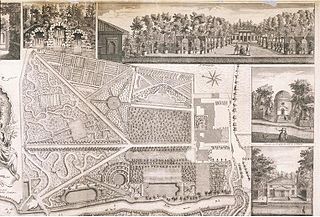
John Rocque was a French-born British surveyor and cartographer, best known for his detailed map of London published in 1746.
Raleigh Ashlin Skelton is best known for his work on the history of cartography and particularly his attempts to prove the authenticity of the Vinland map.
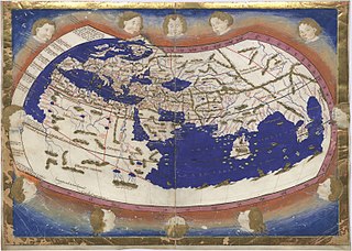
Nicolaus Germanus was a German cartographer who modernized Ptolemy's Geography by applying new projections, adding additional maps, and contributing other innovations that were influential in the development of Renaissance cartography.
Robert Morden was an English bookseller, publisher, and mapmaker, globemaker and engraver. He was among the first successful commercial map makers.

Georg Braun was a German topo-geographer. From 1572 to 1617, he edited the Civitates orbis terrarum, which contains 546 prospects, bird's-eye views and maps of cities from all around the world. As principal editor of the work, he acquired the tables, hired the artists, and wrote the texts. He died as an octogenarian in 1622, the only survivor of the original team to witness the publication of volume VI in 1617.

Sidney Hall (1788?–1831) was a British engraver and cartographer well known and popular for his early nineteenth century atlases containing maps of the United Kingdom and of the ancient world reproduced from Hall's engravings. Hall made engravings for a number of international atlases at a time when cartography and atlases were very popular. He also engraved a series of cards for the various constellations, published c.1825 in a boxed set called Urania's Mirror.

Picturesque Europe was a lavishly illustrated set of books published by D. Appleton & Co. in the mid-1870s based on their phenomenally successful Picturesque America. An edited form was reprinted in Europe by Cassell & Co. The books depicted nature and tourist haunts in Europe, with text descriptions and numerous steel and wood engravings. J.W. Whymper was among the engravers and directed the other artists on the project.

Augustine Ryther was an English engraver and translator. He engraved some of Christopher Saxton's maps of English counties. He also made scientific instruments.
George Lily was an English Roman Catholic priest, humanist scholar, biographer, topographer and cartographer.

Justus Danckerts I was a Dutch engraver and print publisher who along with other members of the Danckerts family created one of the leading Dutch geographical map and atlas publishing houses.
The Beudeker Collection is a collection of maps and views of the Netherlands and Belgium in the British Library, created by the Dutch merchant Christoffel Beudeker.
John Gibson was an English cartographer, geographer, draughtsman and engraver.

Ronald Vere Tooley was an English map dealer, an authority on early maps and cartographers, a noted compiler of catalogues on maps, cartography and antiquarian books, author of Maps and Map-makers, and founder of the Map Collectors' Circle which published a series of monographs on historical cartography in the period 1963-1975. He is considered the founder of the antiquarian map trade.
Selina Hall (1780?–1853) was a British engraver and printer in London who prepared maps for several well-known works including John Gorton's A Topographical Dictionary, Charles Black's 1840 General Atlas and several Chapman & Hall publications.
Ann Lea, sometimes "Anne", (1661–1728) was a British lithographer, map and globe seller and publisher in London. She prepared maps for several works including Christopher Saxton's The Traveller's Guide being the best map of the Kingdom of England and Principality of Wales and Robert Morden's A new mapp of the West-Indies, or the islands of America 1702.

Philip Lea was an English cartographer, globemaker, instrument maker, and publisher. He was a prolific printer and reviser of maps, frequently collaborating with other contemporary mapmakers including Herman Moll, Robert Morden, John Ogilby, and John Seller.
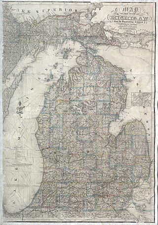
John Farmer was an American educator and cartographer.
George Willdey (1676–1737) was a British engraver and optical instrument maker. Willdey made engravings for a number of mapmakers. His shop sold maps, optical instruments, toys, china, glass, and earthenware.