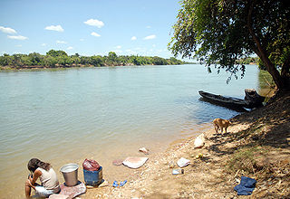
Maranhão mangroves (NT1419) | |
---|---|
Igarapé (shallow channel) in Maranhão | |
Ecology | |
Realm | Neotropical |
Biome | Mangrove |
Geography | |
Area | 11,300 km2 (4,400 sq mi) |
Country | Brazil |
Coordinates | 1°37′30″S44°45′07″W / 1.625°S 44.752°W Coordinates: 1°37′30″S44°45′07″W / 1.625°S 44.752°W |
Climate type | Af: equatorial, fully humid |
The Maranhão mangroves (in Portuguese: Reentrâncias Maranhenses) is a mangrove ecoregion of northern Brazil. It supports half of the shorebird population of the country. The combination of flat land, heavy rainfall and high tides causes the mangroves to extend up to 40 kilometres (25 mi) inland, where they are interspersed with other rainforest species.
A mangrove is a shrub or small tree that grows in coastal saline or brackish water. The term is also used for tropical coastal vegetation consisting of such species. Mangroves occur worldwide in the tropics and subtropics, mainly between latitudes 25° N and 25° S. The total mangrove forest area of the world in 2000 was 137,800 square kilometres (53,200 sq mi), spanning 118 countries and territories.
An ecoregion is an ecologically and geographically defined area that is smaller than a bioregion, which in turn is smaller than an ecozone. All three of these are either less or greater than an ecosystem. Ecoregions cover relatively large areas of land or water, and contain characteristic, geographically distinct assemblages of natural communities and species. The biodiversity of flora, fauna and ecosystems that characterise an ecoregion tends to be distinct from that of other ecoregions. In theory, biodiversity or conservation ecoregions are relatively large areas of land or water where the probability of encountering different species and communities at any given point remains relatively constant, within an acceptable range of variation.
The ecoregion covers and area of 11,300 square kilometers (4,400 sq mi) on the Atlantic coast of Maranhão state. [1] The ecoregion is part of the 31,855 square kilometres (12,299 sq mi) Guianan-Amazon Mangroves global ecoregion, which also contains the Guianan mangroves, Amapá mangroves and Pará mangroves ecoregions. [2] The land is flat and tides may be as high as 8 metres (26 ft) in same places, so salt water may reach inland along the many estuaries and rivers for as far as 40 kilometres (25 mi). [1]
Maranhão is a northeastern state of Brazil. To the north lies the Atlantic Ocean. Maranhão is neighboured by the states of Piauí, Tocantins and Pará. The people of Maranhão have a distinctive accent inside the common Northeastern Brazilian dialect. Maranhão is described in books such as The Land of the Palm Trees by Gonçalves Dias and Casa de Pensão by Aluísio Azevedo.
The Guianan mangroves (NT1411) is a coastal ecoregion of southeastern Venezuela, Guyana, Suriname and French Guiana. The mangroves provide an important habitat for migrating birds that winter in the area. Large areas are intact, although they are threatened by destruction of the trees for timber and to make way for agriculture, and from upstream agricultural and industrial pollution.
The Amapá mangroves (NT1402) is an ecoregion along the Atlantic coast of the state of Amapá in Brazil. The low coastal plain has been formed from recent sedimentation, including sediments deposited by the rivers and sediments carried northward from the mouth of the Amazon River by strong currents and deposited by the tides. The extensive mangroves grow on the newly formed coastal mudflats and along the edges of estuaries. They merge into freshwater várzea flooded forests further inland. The ecoregion is generally well-preserved, although excessive extraction of natural resources including timber and shrimps is a concern.
The ecoregion may be divided into eastern and western parts. The western part extends from the Pará boundary along the coast of western Maranhão state to the Baía de São Marcos. Here the coastline is made up of hundreds of islands and mudflats, made up of fine silt deposited by the Amazon River. The eastern part extends from the Baía de São Marcos along the eastern coast of Maranhão to the mouth of the Parnaíba River. Here the coast is dominated by extensive sand dunes, interspersed with pockets of mangroves in bays and river mouths. [1]
The Baía de São Marcos is a bay of the Atlantic Ocean in Maranhão state of northeastern Brazil.
The Amazon River in South America is the largest river by discharge volume of water in the world, and by some definitions it is the longest.
The Parnaíba River is a river in Brazil, which forms the border between the states of Maranhão and Piauí. Its main course is 1,400 km (870 mi) long and the Parnaíba River Basin covers 344,112 km2 (132,862 sq mi). The Parnaíba River rises in the Chapada das Mangabeiras range, and flows northeastward to empty into the Atlantic Ocean, being the longest river entirely located within Brazil's Northeast Region. The middle and upper regions of this river are separated by waterfalls, but is otherwise navigable.
The ecoregion has a hot and humid.climate. Mean annual temperature is 26 °C (79 °F). Annual rainfall averages 2,500 millimetres (98 in) and may be as high as 4,000 millimetres (160 in). [1]
The ecoregion holds about 36% of all mangroves in Brazil. In the western part the mangroves cover the mudflats and islands along the coast and extend inland as far as 40 kilometres (25 mi) along the many rivers, bays and estuaries. The heavy rainfall and inputs from many rivers in the region reduce salinity, so that palms (Arecaceae family) and freshwater macrophytes often grow with the mangroves. Towards the east of the ecoregion there are longer dry seasons and higher salinity, so the mangroves are less developed. [1]
The Arecaceae are a botanical family of perennial plants. Their growth form can be climbers, shrubs, trees and stemless plants, all commonly known as palms. Those having a tree form are colloquially called palm trees. They are flowering plants, a family in the monocot order Arecales. Currently 181 genera with around 2600 species are known, most of them restricted to tropical and subtropical climates. Most palms are distinguished by their large, compound, evergreen leaves, known as fronds, arranged at the top of an unbranched stem. However, palms exhibit an enormous diversity in physical characteristics and inhabit nearly every type of habitat within their range, from rainforests to deserts.
The most common mangrove species is Rhizophora mangle , which is found nearest to the coast and grows to as high as 25 metres (82 ft). Other mangrove species are Avicennia germinans , Avicennia schaueriana , Rhizophora racemosa , Rhizophora harrisonii , Laguncularia racemosa and Conocarpus erectus . Flora that grow on the margins of the mangroves include Spartina alterniflora on the seaward side and Hibiscus tiliaceus and Acrostichum aureum on the landward side and dry patches within the mangroves. Flora that grow with the mangroves due to the low salinity include Dalbergia brownei , Rhabdadenia biflora , Montrichardia arborescens , Mora oleifera , açaí palm (Euterpe oleracea) and Attalea speciosa . [1]
Rhizophora mangle, known as the red mangrove, is distributed in estuarine ecosystems throughout the tropics. Its viviparous "seeds," in actuality called propagules, become fully mature plants before dropping off the parent tree. These are dispersed by water until eventually embedding in the shallows.
Avicennia germinans, the black mangrove, is a shrub in the acanthus family, Acanthaceae. It grows in tropical and subtropical regions of the Americas, on both the Atlantic and Pacific coasts, and on the Atlantic coast of tropical Africa, where it thrives on the sandy and muddy shores that seawater reaches. It is common throughout coastal areas of Texas and Florida, and ranges as far north as southern Louisiana and coastal Georgia in the United States.
Rhizophora racemosa is a species of mangrove tree in the family Rhizophoraceae. It has a patchy distribution on the Pacific coast of Central and South America, occurs in places on the Atlantic coast of that continent, and has a more widespread range on the Atlantic coast of West Africa.
The Maranhão mangroves are home to half the total population of shorebirds in Brazil, and 7% of all shorebirds in South America. They are also important areas for feeding and breeding for herons (family Ardeidae) and roseate spoonbills (Platalea ajaja). [1] Rare and endangered species include scarlet ibis (Eudocimus ruber), wattled jacana (Jacana jacana), tucuxi (Sotalia fluviatilis), West Indian manatee (Trichechus manatus) and several species of sea turtle that use the mangroves as a breeding area. [1]
The World Wildlife Fund gives the ecoregion the status of "Vulnerable". It is inaccessible and has a low human population, so is mostly intact. The mangroves are used by many artisanal fishermen for subsistence crab collection. The mangrove wood is used for fuel, housing and boats, and tannin from the bark is used as a dye. In some areas mangroves have been replaced by rice fields or used for urban development. Commercial over-fishing, industrial waste and pollution from gold mining are concerns. [1]
Protected areas include the Bacanga State Park and the Lençóis Maranhenses National Park, a Ramsar Convention wetland of international importance and a Western Hemisphere Shorebird Reserve Network site. [1]
The Orinoco Delta is a vast river delta of the Orinoco River, located in eastern Venezuela.
Guaraqueçaba Ecological Station is an ecological station in the municipality of Guaraqueçaba, Paraná, Brazil.
The Bahia Mangroves is a tropical ecoregion of the Mangrove forests Biome, and the South American Atlantic Forest biome, located in Northeastern Brazil.
The Central African mangroves ecoregion consists of the largest area of mangrove swamp in Africa, located on the coasts of West Africa, mainly in Nigeria.
The Guinean mangroves are a coastal ecoregion of mangrove swamps in rivers and estuaries near the ocean of West Africa from Senegal to Sierra Leone.
Madagascar mangroves are a coastal ecoregion in the mangrove forest biome found on the west coast of Madagascar. They are included in the WWF's Global 200 list of most outstanding ecoregions.
The Southern Africa mangroves are an ecoregion of mangrove swamps in rivers and estuaries on the eastern coast of South Africa.
The Gurupi-Piriá Marine Extractive Reserve is a coastal marine extractive reserve in the state of Pará, Brazil.
The Marajó várzea (NT0138) is an ecoregion of seasonally and tidally flooded várzea forest in the Amazon biome. It covers a region of sedimentary islands and floodplains at the mouth of the Amazon that is flooded twice daily as the ocean tides push the river waters onto the land. The flooded forests provide food for a wide variety of fruit-eating fish, aquatic mammals, birds and other fauna. It has no protected areas and is threatened by cattle and water-buffalo ranching, logging and fruit plantations.
The Tocantins-Araguaia-Maranhão moist forests (NT0170), also called the Tocantins/Pindaré moist forests, is an ecoregion in the north of Brazil to the south of the mouth of the Amazon River. It is part of the Amazon biome. The ecoregion contains the city of Belém, capital of the state of Pará. It is the most developed part of the Amazon region, and is one of the most severely degraded natural habitats of the region.
The Amazon-Orinoco-Southern Caribbean mangroves (NT1401) is an ecoregion along the coasts of Colombia, Venezuela, Guyana, Suriname, French Guiana and Brazil.
The Pará mangroves (NT1427) is an ecoregion along the Atlantic coast of the state of Pará in Brazil. They constitute the western extension of the Maranhão mangroves ecoregion. The mangroves are relatively intact, although they are under some pressure from agriculture and logging.
The South American Pacific mangroves (NT1405), or Panama Bight mangroves, is an ecoregion along the Pacific coast of Panama, Colombia, Ecuador and Peru.
The Gulf of Panama mangroves (NT1414) is an ecoregion along the Pacific coast of Panama, Colombia. The mangroves experience seasonal flooding with high levels of sediment, and occasional extreme storms or very low rainfall due to El Niño effects. They are important as a breeding or nursery area for marine species. Areas of the mangroves have been recognized as Important Bird Areas and Ramsar wetlands. The ecoregion has been severely degraded by clearance of mangroves for agriculture, pasturage and shrimp farming, by urban pressure around Panama City, and by pollution related to the Panama Canal.
The Esmeraldas-Pacific Colombia mangroves (NT1409) is an ecoregion of mangrove forests along the Pacific coast of Colombia and Ecuador. It is threatened by human population growth, leading to over-exploitation for wood and clearance for farming and aquaculture.
The Manabí mangroves (NT1418) is an ecoregion along the Pacific coast of Ecuador. The mangroves serve important functions in the marine and terrestrial ecology. They have been severely degraded and fragmented, particularly in the northern region. Construction of shrimp farms caused much damage in the past, but is now banned. Sedimentation caused by overgrazing in higher lands is an issue, as are human activities such as port and highway construction, urbanization, waste disposal and so on.