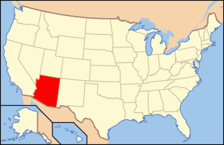
Grand Canyon National Park, located in northwestern Arizona, is the 15th site in the United States to have been named as a national park. The park's central feature is the Grand Canyon, a gorge of the Colorado River, which is often considered one of the Wonders of the World. The park, which covers 1,217,262 acres of unincorporated area in Coconino and Mohave counties, received more than 4.7 million recreational visitors in 2022, which is the second highest count of all American national parks after Great Smoky Mountains National Park. The Grand Canyon was designated a World Heritage Site by UNESCO in 1979. The park celebrated its 100th anniversary on February 26, 2019.

The Grand Canyon is a steep-sided canyon carved by the Colorado River in Arizona, United States. The Grand Canyon is 277 miles (446 km) long, up to 18 miles (29 km) wide and attains a depth of over a mile.
Black Canyon may refer to:

The Colorado Plateau, also known as the Colorado Plateau Province, is a physiographic and desert region of the Intermontane Plateaus, roughly centered on the Four Corners region of the southwestern United States. This province covers an area of 336,700 km2 (130,000 mi2) within western Colorado, northwestern New Mexico, southern and eastern Utah, northern Arizona, and a tiny fraction in the extreme southeast of Nevada. About 90% of the area is drained by the Colorado River and its main tributaries: the Green, San Juan, and Little Colorado. Most of the remainder of the plateau is drained by the Rio Grande and its tributaries.

U.S. Route 89 is a north–south United States Numbered Highway with two sections, and one former section. The southern section runs for 848 miles (1,365 km) from Flagstaff, Arizona, to the southern entrance of Yellowstone National Park. The northern section runs for 404 miles (650 km) from the northern entrance of Yellowstone National Park in Montana, ending at the Canadian border. Unnumbered roads through Yellowstone connect the two sections. Before 1992, US 89 was a Canada–Mexico, border-to-border highway that ended at Nogales, Arizona, on its southern end.
Hells Gate or Hell's Gate or Hell Gate may refer to:

Navajo Bridge is the name of twin steel spandrel arch bridges that cross the Colorado River in the Grand Canyon National Park in northern Coconino County, Arizona, United States. The newer of the two spans carries vehicular traffic on U.S. Route 89A (US 89A) over Marble Canyon between Bitter Springs and Jacob Lake, allowing travel into a remote Arizona Strip region north of the Colorado River including the North Rim of Grand Canyon National Park.

Marble Canyon is the section of the Colorado River canyon in northern Arizona from Lee's Ferry to the confluence with the Little Colorado River, which marks the beginning of the Grand Canyon.

Northern Arizona is an unofficial, colloquially-defined region of the U.S. state of Arizona. Generally consisting of Apache, Coconino, Mohave, Navajo, and Gila counties, the region is geographically dominated by the Colorado Plateau, the southern border of which in Arizona is called the Mogollon Rim.
Chimney Rock can refer to one of the following sites in the United States and Canada:
Grand Canyon most often refers to:

The Navajo Sandstone is a geological formation in the Glen Canyon Group that is spread across the U.S. states of southern Nevada, northern Arizona, northwest Colorado, and Utah as part of the Colorado Plateau province of the United States.

The Vermilion Cliffs are the second "step" up in the five-step Grand Staircase of the Colorado Plateau, in northern Arizona and southern Utah in the southwestern United States. They extend west from near Page, Arizona, for a considerable distance, in both Arizona and Utah.

The following is an alphabetical list of articles related to the U.S. state of Arizona.

Marble Canyon is an unincorporated community along the Colorado River in Coconino County, Arizona, United States. It is partially located within the Glen Canyon National Recreation Area and the Grand Canyon National Park.

Bridge Canyon Dam, also called Hualapai Dam, was a proposed dam in the lower Grand Canyon of the Colorado River, in northern Arizona in the United States. It would have been located near Bridge Canyon Rapids in an extremely rugged and isolated portion of the canyon, 235 miles (378 km) downstream of Lees Ferry and at the uppermost end of Lake Mead.

The Colorado River is a major river of the western United States and northwest Mexico in North America. Its headwaters are in the Rocky Mountains where La Poudre Pass Lake is its source. Located in north central Colorado it flows southwest through the Colorado Plateau country of western Colorado, southeastern Utah and northwestern Arizona where it flows through the Grand Canyon. It turns south near Las Vegas, Nevada, forming the Arizona–Nevada border in Lake Mead and the Arizona–California border a few miles below Davis Dam between Laughlin, Nevada and Needles, California before entering Mexico in the Colorado Desert. Most of its waters are diverted into the Imperial Valley of Southern California. In Mexico its course forms the boundary between Sonora and Baja California before entering the Gulf of California. This article describes most of the major features along the river.
The Marble Canyon Dam, also known as the Redwall Dam, was a proposed dam on the Colorado River in Arizona. The dam was intended to impound a relatively small reservoir in the central portion of Marble Canyon to develop hydroelectric power. Plans centered on two sites between miles 30 and 40 in the canyon. At one point a 38-mile (61 km) tunnel was proposed to a site just outside Grand Canyon National Park to develop the site's full power generation potential, reducing the Colorado River to a trickle through the park.


