Zamboanga was a province of the Philippines located in the western region of the southern island of Mindanao, Philippines.

Zamboanga Peninsula is an administrative region in the Philippines, designated as Region IX. It consists of three provinces including four cities and the highly urbanized Zamboanga City. The region was previously known as Western Mindanao before the signing of Executive Order No. 36 of 2001. The city of Zamboanga was designated as the regional center until Pagadian was designated as its new regional center, although Zamboanga City remains the region's cultural, economic, and educational center.

Dipolog, officially known as the City of Dipolog, is a 3rd class component city and capital of the province of Zamboanga del Norte, Philippines. According to the 2020 census, it has a population of 138,141 people.

Pagadian, officially known as the City of Pagadian, is a 2nd class component city and the capital of the province of Zamboanga del Sur, Philippines. It is the regional center of Zamboanga Peninsula and the second-largest city in the region and in the province, after the independent city of Zamboanga. According to the 2020 census, it has a population of 210,452 people. The city will be converted to a highly-urbanized city by the virtue of Proclamation No. 1247, signed by President Rodrigo Duterte dated November 8, 2021, but shall take effect after the ratification in a plebiscite.

Mahayag, officially the Municipality of Mahayag, is a 3rd class municipality in the province of Zamboanga del Sur, Philippines. According to the 2020 census, it has a population of 48,258 people.

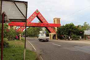
Molave, officially known as the Municipality of Molave, is a 1st class municipality in the province of Zamboanga del Sur, Philippines. In the 2020 census, it had 53,140 people. It is in the eastern part of the province of Zamboanga del Sur, and has an area of 21,685 hectares. The name "Molave" refers to the tree that was common in the area. Its economy is focused on agricultural production, and 1,378.5 hectares of fertile land is irrigated and planted with rice. Corn, coconut, cassava, banana, camote and various vegetables are also grown. These are marketed to neighboring towns and cities, and reach Cebu. Due to its strategic location, Molave is becoming the commercial hub of the Salug Valley.

Vincenzo A. Sagun, officially the Municipality of Vincenzo A. Sagun, is a 5th class municipality in the province of Zamboanga del Sur, Philippines. According to the 2020 census, it has a population of 24,852 people.

The Pan-Philippine Highway, also known as the Maharlika Highway, is a network of roads, expressways, bridges, and ferry services that connect the islands of Luzon, Samar, Leyte, and Mindanao in the Philippines, serving as the country's principal transport backbone. Measuring 3,379.73 kilometers (2,100.07 mi) long excluding sea routes, it is the longest highway in the Philippines that forms the country's north–south backbone component of National Route 1 (N1) of the Philippine highway network. The entire highway is designated as Asian Highway 26 (AH26) of the Asian Highway Network.

María Clara Rafols Lorenzo Lobregat was the first female mayor and also a representative to the Philippine Congress of Zamboanga City.
The legislative districts of Zamboanga City are the representations of the highly urbanized city of Zamboanga in the various national legislatures of the Philippines. The city is currently represented in the lower house of the Congress of the Philippines through its first and second congressional districts.

Zamboanga Peninsula Polytechnic State University is a state university in Zamboanga City, Philippines. It is just a few meters from another state university, Western Mindanao State University and about 500 metres (1,600 ft) from Pilar College along R.T. Lim Boulevard. It is nestled along the university belt of the city where most of the colleges are.

Local elections were held in Zamboanga City on May 13, 2013, within the Philippine general election. The voters elected for the elective local posts in the city: the mayor, vice mayor, and eight councilors per district.

Celso L. Lobregat, III, is a Filipino politician having served as Zamboanga City's mayor and congressman.
Local elections was held in Zamboanga City on May 14, 2007, within the Philippine general election. The voters elected for the elective local posts in the city: the mayor, vice mayor, and eight councilors per district. Previously, the city voters elected 12 councilors and one representative from its lone district.

Senator Gil J. Puyat Avenue, also known simply as Gil Puyat Avenue and formerly and still referred to as Buendia Avenue, is a major arterial thoroughfare which travels east–west through the cities of Makati and Pasay in western Metro Manila, Philippines. It is one of the busiest avenues in Metro Manila linking the Makati Central Business District with the rest of the metropolis.
Local elections were held in Zamboanga City on May 10, 2004, within the Philippine general election. The voters elected for the elective local posts in the city: the mayor, vice mayor, 12 councilors and one representative from its lone district.
National Route 1 (N1) is a primary national route that forms part of the Philippine highway network, running from Luzon to Mindanao. Except for a 19-kilometer (12 mi) gap in Metro Manila and ferry connections, the highway is generally continuous. Most sections of N1 forms the Pan-Philippine Highway except for sections bypassed by expressways.

The Ozamiz–Pagadian Road, also known as Aurora–Ozamis Road, is a 70-kilometer (43 mi) two-to-four lane road network connecting the cities of Ozamiz in Misamis Occidental and Pagadian in Zamboanga del Sur. It traverses through Tangub and the municipality of Bonifacio at Misamis Occidental and the municipalities of Tambulig, Molave, Ramon Magsaysay, and Aurora at Zamboanga del Sur.

The Butuan–Cagayan de Oro–Iligan Road, or Butuan–Cagayan de Oro–Iligan–Tukuran Road and also known as Lanao–Pagadian–Zamboanga City Road in the Zamboanga del Sur section, is a 416-kilometer (258 mi), two-to-six lane major thoroughfare, connecting the provinces of Agusan del Norte, Misamis Oriental, Lanao del Norte, and Zamboanga del Sur.