Mariano Balleza

Last updated
Mariano Balleza
(San Pablo Balleza)
Town
Balleza en Chihuahua.svg
Mariano Balleza is located within Balleza Municipality
Mexico States blank map.svg
Red pog.svg
Mariano Balleza
Location in Mexico
Coordinates: 26°57′N106°21′W / 26.950°N 106.350°W / 26.950; -106.350 Coordinates: 26°57′N106°21′W / 26.950°N 106.350°W / 26.950; -106.350
CountryFlag of Mexico.svg  Mexico
State Chihuahua
Municipality Balleza
Founded (mission) 1640
Population (2010)
  Total 2,087

Mariano Balleza is a town in the Mexican state of Chihuahua, close to the border with Durango. It serves as the municipal seat for the surrounding municipality of Balleza.

Chihuahua (state) State of Mexico

Chihuahua, officially the Free and Sovereign State of Chihuahua, is one of the 31 states of Mexico. It is located in Northwestern Mexico and is bordered by the states of Sonora to the west, Sinaloa to the southwest, Durango to the south, and Coahuila to the east. To the north and northeast, it has a long border with the U.S. adjacent to the U.S. states of New Mexico and Texas. Its capital city is Chihuahua City.

Durango State of Mexico

Durango, officially Free and Sovereign State of Durango, is a state in northwest Mexico. With a population of 1,632,934, Durango has Mexico's second-lowest population density, after Baja California Sur. The city of Victoria de Durango is the state's capital, named after the first president of Mexico, Guadalupe Victoria.

Balleza Municipality Municipality in Chihuahua, Mexico

Balleza is one of the 67 municipalities of Chihuahua, in northern Mexico. The municipal seat lies at Mariano Balleza. The municipality covers an area of 7,073.6 km².

As of 2010, the town had a total population of 2,087, [1] up from 1,990 as of 2005. [2]

History

It was in this vicinity that Juan Fontes founded the first Jesuit mission to the Tarahumara in 1607, however that mission was abandoned during the Tepehuan war against the SPanish starting in 1616. [3]

This specific settlement was founded as a Jesuit mission, with the name San Pablo Tepehuanes, in 1640, as part of the efforts to evangelise the local Tepehuan people; this was one of the earliest missions in that part of New Spain. In 1830 the State Congress renamed it in honour of Fr. Mariano Balleza, who fought alongside Miguel Hidalgo in the War of Independence. The town is still informally known as San Pablo Balleza.

Tepehuán JevkzobeelUnrkud

The Tepehuán are an indigenous people of Mexico. They live in Northwestern, Western, and some parts of North-Central Mexico. The indigenous Tepehuán language has three branches: Northern Tepehuan, Southeastern Tepehuan, Southwestern Tepehuan. The heart of the Tepehuan territory is in the Valley of Guadiana in Durango, but they eventually expanded into southern Chihuahua, eastern Sinaloa, and northern Jalisco, Nayarit, and Zacatecas. By the time of the Spanish conquest of Mexico, Tepehuan lands spanned a large territory along the Sierra Madre Occidental. Tepehuán groups are divided into the Ódami, Audam, and O'dam, each with their own language, culture, and beliefs.

New Spain viceroyalty of the Spanish Empire (1535-1821)

The Viceroyalty of New Spain was an integral territorial entity of the Spanish Empire, established by Habsburg Spain during the Spanish colonization of the Americas. It covered a huge area that included territories in North America, South America, Asia and Oceania. It originated in 1521 after the fall of Mexico-Tenochtitlan, the main event of the Spanish conquest, which did not properly end until much later, as its territory continued to grow to the north. It was officially created on 8 March 1535 as a viceroyalty, the first of four viceroyalties Spain created in the Americas. Its first viceroy was Antonio de Mendoza y Pacheco, and the capital of the viceroyalty was Mexico City, established on the ancient Mexico-Tenochtitlan.

Mexican War of Independence armed conflict which ended the rule of Spain in the territory of New Spain

The Mexican War of Independence was an armed conflict, and the culmination of a political and social process which ended the rule of Spain in 1821 in the territory of New Spain. The war had its antecedent in Napoleon's French invasion of Spain in 1808; it extended from the Cry of Dolores by Father Miguel Hidalgo y Costilla on September 16, 1810, to the entrance of the Army of the Three Guarantees led by Agustín de Iturbide to Mexico City on September 27, 1821. September 16 is celebrated as Mexican Independence Day.

Related Research Articles

Michoacán State of Mexico

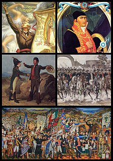
Michoacán, formally Michoacán de Ocampo, officially the Free and Sovereign State of Michoacán de Ocampo, is one of the 31 states which, with the Federal District, comprise the 32 Federal Entities of Mexico. The State is divided into 113 municipalities and its capital city is Morelia. The city was named after José María Morelos, one of the main heroes of the Mexican War of Independence.

State of Mexico State of Mexico

The State of Mexico is one of the 32 federal entities of Mexico. It is the most populous, as well as the most densely populated state. It is divided into 125 municipalities and its capital city is Toluca de Lerdo.

Querétaro State of Mexico

Querétaro, officially the Free and Sovereign State of Querétaro, is one of the 32 federal entities of Mexico. It is divided into 18 municipalities. Its capital city is Santiago de Querétaro.

Tepehuanes Municipality is a municipality in the Mexican state of Durango. It is located in the North West of Durango at 25°12'"-26°25'"N 105°23'"-106°40'"W, at an elevation of about 1,830 meters (6000 feet).

Mapimí, Durango City & municipal seat in Durango, Mexico

Mapimí is a city and municipal seat of the Mapimí Municipality in the Mexican state of Durango. As of 2010, the town of Mapimí had a population of 5,623.

Tultitlán de Mariano Escobedo Town & Municipality in State of Mexico, Mexico

Tultitlán de Mariano Escobedo is the seat of the municipality of Tultitlán located in the northeastern part of the State of México in Mexico. It lies adjacent to the northern tip of the Federal District and is part of the Greater Mexico City urban area. Both the city and the municipality are interchangeably known as San Antonio Tultitlán or simply Tultitlán, a name which comes from Náhuatl meaning "among the tule plants". "de Mariano Escobedo" was added to the city's name in 1902 in honor of the general who fought in the Mexican–American War and for the liberals during the period of La Reforma with Benito Juárez.

Cucurpe is the municipal seat of Cucurpe Municipality in the Mexican state of Sonora.

Tubutama Place in Sonora, Mexico

Tubutama is a town in Tubutama Municipality, in the north-west of the Mexican state of Sonora. Eusebio Kino, SJ, founded Mission San Pedro y San Pablo del Tubutama in 1691. Tubutama was the headquarters of religious administration for the entire Pimería Alta during much of the Jesuit and Franciscan period of Spanish colonial rule.

Tepehuán Revolt

The Tepehuán Revolt broke out in Mexico in 1616. The Tepehuán Indians attempted to break free from Spanish rule. The revolt was crushed by 1620 after a large loss of life on both sides.

Guachochi City in Chihuahua, Mexico

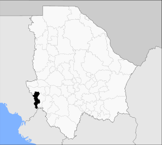
Guachochi is a municipality and a city in the south-western portion of the Mexican state of Chihuahua. The city of Guachochi serves as the municipal seat for the surrounding municipality of the same name.

Carichí Town in Chihuahua, Mexico

Carichí is a town in the Mexican state of Chihuahua. It serves as the municipal seat of the surrounding municipality of the same name.

Chínipas de Almada Town in Chihuahua, Mexico

Chínipas de Almada is a town in the south-western portion of the Mexican state of Chihuahua, in the Sierra Madre Occidental. It serves as the municipal seat of the surrounding municipality of Chínipas.

Meoqui Municipality Municipality in Chihuahua, Mexico

Meoqui is one of the 67 municipalities of Chihuahua, in northern Mexico. The municipal seat lies at Pedro Meoqui. The municipality covers an area of 370 km², making it one of the smallest in the state but one of the most densely populated.

San Francisco Javier de Satevó Municipal seat in Chihuahua, Mexico

San Francisco Javier de Satevó is a village in the Mexican state of Chihuahua. It serves as the municipal seat for the surrounding municipality of Satevó.

San Francisco del Mezquital Municipal seat and city in Durango, Mexico

Mezquital is a city and seat of the Municipality of Mezquital in the state of Durango, north-western Mexico. It is situated in the northeast of the municipality, near the boundary with the Municipality of Suchil. As of 2010, the town had a population of 1,742.

San Pablo Huitzo Municipality and town in Oaxaca, Mexico

San Pablo Huitzo is a town and municipality in Oaxaca in south-western Mexico. The municipality covers an area of 63.80 km². It is part of the Etla District in the Valles Centrales region. As of 2005, the municipality had a total population of 5,242.

Arroyo Seco Municipality Municipality in Querétaro, Mexico

Arroyo Seco Municipality is a municipality in Querétaro in central Mexico.

Rayón, San Luis Potosí Municipality and town in San Luis Potosí, Mexico

Rayón is a town and municipality in San Luis Potosí in central Mexico.

References

  1. "Balleza". Catálogo de Localidades. Secretaría de Desarrollo Social (SEDESOL). Retrieved 23 April 2014.
  2. "Balleza". Enciclopedia de los Municipios de México. Instituto Nacional para el Federalismo y el Desarrollo Municipal . Retrieved August 18, 2008.
  3. Edward C. Spicer, Cycloes of Conquest (Tucson: University of Arizona Press, 1962), p. 26-28