Maripa, Venezuela

Last updated
Maripa
Country Flag of Venezuela.svg Venezuela
State Bolívar
Municipality Sucre Municipality
Population
  Total c 5,000
Time zone VST

Maripa is a town in the state of Bolívar, Venezuela. It is the municipal seat of the Sucre Municipality.

Bolívar (state) State of Venezuela

Bolívar is one of the 23 states into which Venezuela is divided. The state capital city is Ciudad Bolívar, but the largest city is Ciudad Guayana. Bolívar State covers a total surface area of 240,500 km² and as of the 2011 census, had a population of 1,410,964.
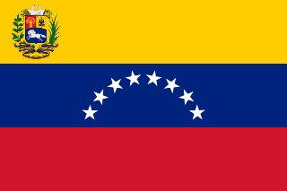
Venezuela Republic in northern South America

Venezuela, officially the Bolivarian Republic of Venezuela, is a country on the northern coast of South America, consisting of a continental landmass and a large number of small islands and islets in the Caribbean Sea. The capital and largest urban agglomeration is the city of Caracas. It has a territorial extension of 916,445 km2. The continental territory is bordered on the north by the Caribbean Sea and the Atlantic Ocean, on the west by Colombia, Brazil on the south, Trinidad and Tobago to the north-east and on the east by Guyana. With this last country, the Venezuelan government maintains a claim for Guayana Esequiba over an area of 159,542 km2. For its maritime areas, it exercises sovereignty over 71,295 km2 of territorial waters, 22,224 km2 in its contiguous zone, 471,507 km2 of the Caribbean Sea and the Atlantic Ocean under the concept of exclusive economic zone, and 99,889 km2 of continental shelf. This marine area borders those of 13 states. The country has extremely high biodiversity and is ranked seventh in the world's list of nations with the most number of species. There are habitats ranging from the Andes Mountains in the west to the Amazon basin rain-forest in the south via extensive llanos plains, the Caribbean coast and the Orinoco River Delta in the east.

Municipal seat term for an administrative center used in several Spanish-speaking countries

A municipal seat or cabecera municipal is an administrative center, seat of government, or capital city of a municipality or civil parish with other villes or towns subordinated. The term is used in Brazil, Colombia, Mexico, Guatemala and Venezuela, countries of Latin-America.

Coordinates: 7°24′53″N65°11′24″W / 7.4147°N 65.1900°W / 7.4147; -65.1900

Geographic coordinate system Coordinate system

A geographic coordinate system is a coordinate system that enables every location on Earth to be specified by a set of numbers, letters or symbols. The coordinates are often chosen such that one of the numbers represents a vertical position and two or three of the numbers represent a horizontal position; alternatively, a geographic position may be expressed in a combined three-dimensional Cartesian vector. A common choice of coordinates is latitude, longitude and elevation. To specify a location on a plane requires a map projection.


Related Research Articles

Chambers County, Alabama County in the United States

Chambers County is a county of the U.S. state of Alabama. As of the 2010 census the population was 34,215. Its county seat is Lafayette. Its name is in honor of Henry H. Chambers, who served as a United States Senator from Alabama.

Deepstep, Georgia Town in Georgia, United States

Deepstep is a town in Washington County, Georgia, United States. The population was 132 at the 2000 census.

Irvington, Virginia Town in Virginia, United States

Irvington is a town in Lancaster County, Virginia, United States. The population was 673 at the 2000 census and it is located on a peninsula of land known as the Northern Neck. It has been designated a historic district.

Republic, Washington City in Washington, United States

Republic is a city in Ferry County, Washington, United States. The population was 1,073 at the 2010 census, a 12.5% increase over the 2000 Census. It is the county seat of Ferry County.

Abrams, Wisconsin Town in Wisconsin, United States

Abrams is a town in Oconto County, Wisconsin, United States. The population was 1,757 at the 2000 Census. The census-designated place of Abrams is located in the town.

Wincanton railway station was a station in the county of Somerset, in England. It was located between on the Somerset and Dorset Joint Railway.

Limbé is an arrondissement in the Nord department of Haiti. As of 2015, the population was 106,201 inhabitants. Postal codes in the Limbé Arrondissement start with the number 16.

South Plains Council serves Scouts in the area of Lubbock, Texas.

The Electoral district of Zeehan was a single-member electoral district of the Tasmanian House of Assembly. It was based in the mining town of Zeehan in the West Coast region of Tasmania.

Szymanów is a village in the administrative district of Gmina Koźmin Wielkopolski, within Krotoszyn County, Greater Poland Voivodeship, in west-central Poland.

The Esquimalt First Nation, also known as the Esquimalt Indian Band and Esquimalt Nation, is a First Nations band government of the Esquimalt people. Historically their village was located closer to Victoria proper, but today their main reserve is on the north shore of Esquimalt Harbour adjacent to the Town of View Royal. They are a member nation of the First Nations of South Island Tribal Council, and were signatories to the Douglas Treaties.

The Arenas River is a river of Yabucoa, Puerto Rico.

The Italian Walk of Fame (IWOF) located in Toronto, Ontario, Canada, is a walk of fame that acknowledges the achievements and accomplishments of successful persons of Italian descent. The walk of fame is located in the downtown Little Italy district. The IWOF consists of stars placed permanently and prominently in the sidewalk on the north side of College Street between Grace Street and Clinton Street.

Yiyang East railway station is a railway station of Hangchangkun Passenger Railway located in Jiangxi, People's Republic of China.

Camptown, Scottish Borders village in United Kingdom

Camptown is a small settlement on the A68, in the Scottish Borders area of Scotland, 5m (8 km) south of Jedburgh, and the same distance south to Carter Bar.

The Nemacheilidae, or stone loaches, are a family of cypriniform fishes that inhabit stream environments, mostly in Eurasia, with one genus, Afronemacheilus found in Africa. The family includes about 630 species.

Mutaktuk Creek is a stream in North Slope Borough, Alaska, in the United States. It flows to the Chukchi Sea.

Semarang Poncol railway station

Semarang Poncol Station (Dutch:Pontjol) is a historic railway station in Semarang, Indonesia. It was built in 1914 and is considered an early example of Art Deco architecture.

Dong Takhop railway station is a railway station located in Bang Phai Subdistrict, Bang Mun Nak District, Phichit. It is located 309.878 km from Bangkok railway station and is a class 3 railway station. It is on the Northern Line of the State Railway of Thailand.

Bitsihuitsos Butte is a summit in the U.S. state of Arizona.