
The Bakerloo line is a London Underground line that runs from Harrow & Wealdstone in suburban north-west London to Elephant & Castle in south London, via the West End. Printed in brown on the Tube map, it serves 25 stations, 15 of which are underground, over 23.2 kilometres (14.4 mi). It runs partly on the surface and partly through deep-level tube tunnels.

The Jubilee line is a London Underground line that runs between Stanmore in suburban north-west London and Stratford in east London, via the Docklands, South Bank and West End. Opened in 1979, it is the newest line on the Underground network, although some sections of track date back to 1932 and some stations to 1879.

The Northern line is a London Underground line that runs between North London and South London. It is printed in black on the Tube map. It carries more passengers per year than any other Underground line – around 340 million in 2019 – making it the busiest tube line in London. The Northern line is unique on the Underground network in having two different routes through central London, two southern branches and two northern branches. Despite its name, it does not serve the northernmost stations on the Underground, though it does serve the southernmost station at Morden, the terminus of one of the two southern branches.

The London Borough of Barnet is a local authority area on the northern outskirts of London. The borough was formed in 1965 from parts of the ceremonial counties of Middlesex and Hertfordshire. It is the second largest London borough by population with 389,344 inhabitants as of 2021, also making it the 17th largest district in England. The borough covers an area of 86.74 square kilometres (33 sq mi), the fourth highest of the 32 London boroughs, and has a population density of 45.8 people per hectare, which ranks it 25th.
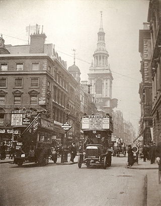
Cheapside is a street in the City of London, the historic and modern financial centre of London, England, which forms part of the A40 London to Fishguard road. It links St Martin's Le Grand with Poultry. Near its eastern end at Bank junction, where it becomes Poultry, is Mansion House, the Bank of England, and Bank station. To the west is St Paul's Cathedral, St Paul's tube station and square.

Gracechurch Street is a main road in the City of London, the historic and financial centre of London, England, which is designated the A1213.

North Finchley is a suburb of London in the London Borough of Barnet, situated seven miles (11 km) northwest of Charing Cross. North Finchley is centred on Tally Ho Corner, the junction of the roads to East Finchley, Church End, Friern Barnet and Whetstone. Church End is usually known as Finchley Central, owing to the name of the tube station located there.

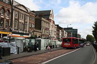
Upper Street is the main street of the Islington district of inner north London, and carries the A1 road. It begins at the junction of the A1 and Liverpool Road, continuing on from Islington High Street which runs from the crossroads at Pentonville Road and City Road and runs roughly northwards from outside the main entrance to Angel Underground station, then past the Business Design Centre, then splits at Islington Green, then past The Screen On The Green cinema, past Islington Town Hall, ending at Highbury & Islington tube station on Highbury Corner, where the A1 carries on as Holloway Road, part of the Great North Road.

Woodside Park is a suburban residential area in the London Borough of Barnet, in the North Finchley postal district of N12.

Enfield Town Football Club is a football club based in Enfield, Greater London, England. Established in 2001 as a fan-led breakaway from Enfield, the club are currently members of the National League South and play at the Queen Elizabeth II Stadium. The club badge features the Enfield beast.

Wingate & Finchley Football Club is an English football club based in Finchley in the London Borough of Barnet. The club are currently members of the Isthmian League Premier Division and play at The Maurice Rebak Stadium in North London.

The Metropolitan Cattle Market, just off the Caledonian Road in the parish of Islington was built by the City of London Corporation and was opened in June 1855 by Prince Albert. The market was supplementary to the meat market at Smithfield and was established to remove the difficulty of managing live cattle at that latter site.

Church End is a locality within Finchley in the London Borough of Barnet in London, England. Aside from its church it centres on Finchley Central Underground station. Church End is an old village, now a suburban development, centred 7 miles (11 km) north-northwest of Charing Cross.

Finchley Common was an area of land in Middlesex, north of London, and until 1816, the boundary between the parishes of Finchley, Friern Barnet and Hornsey.
Hanbury Street is a street running from Commercial Street in Spitalfields to the junction of Old Montague Street and Vallance Road in Whitechapel located in the London Borough of Tower Hamlets. The eastern section is restricted to pedal cycles and pedestrians only.
Whitechapel Road is a major arterial road in Whitechapel, Tower Hamlets, in the East End of London. It is named after a small chapel of ease dedicated to St Mary and connects Whitechapel High Street to the west with Mile End Road to the east in Stepney. The road is part of the historic Roman road from London to Colchester, now the A11.
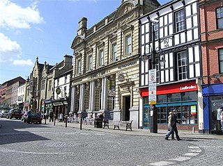
Wrexham city centre is the administrative, cultural and historic city centre of Wrexham, in North Wales and is the area enclosed by the inner ring road of the city. It is the largest shopping area in north and mid Wales, and the administrative centre of Wrexham County Borough. Many of its streets are pedestrianised.

Ginger Pig is a butchery which used to raise livestock in the Vale of Pickering and North York Moors and retail the meat in its shops in London and supplies restaurants and other specialist butchers. It was founded by Tim Wilson in 2003. A series of Ginger Pig cookbooks based upon their produce was released in 2013.
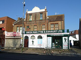
The Green Man was a public house at 1308 High Road, Whetstone, north London, that dated from the 15th century and subsequently redeveloped several times. It closed in the late 20th century and is now a motor repair business.

The Finchley Road bombings occurred on 2 October 1993, when the Provisional Irish Republican Army (IRA) detonated three time bombs on Finchley Road in north London, England. Telephoned warnings were sent six minutes beforehand, at approximately 00:26 UTC, but five people were injured from falling glass as a result of the blasts, and damage was caused to some shops and flats in the surrounding area. The three bombs were planted outside a Domino's Pizza restaurant, a travel agent, and offices of the St. Pancras Building Society. Later, anti-terrorist officers discovered and subsequently safely detonated a fourth bomb in a controlled environment, 1 mile (1.6 km) north of the initial bombings, in Golders Green. Two days later, on 4 October, the IRA detonated four more bombs in north London, two in Tottenham Lane and two more in Archway Road resulting in four injuries.
