The Market Weighton Axis is a geological feature which forms the south-eastern part of Yorkshire, England. The feature goes under a number of names such as 'block' or 'area' while the name of the town, Market Weighton is retained. 'Block' seems to be the most modern version but the most distinctive and widely known is 'axis'.
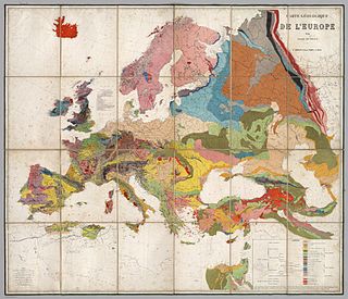
Geology is an earth science concerned with the solid Earth, the rocks of which it is composed, and the processes by which they change over time. Geology can also include the study of the solid features of any terrestrial planet or natural satellite such as Mars or the Moon. Modern geology significantly overlaps all other earth sciences, including hydrology and the atmospheric sciences, and so is treated as one major aspect of integrated earth system science and planetary science.

Yorkshire, formally known as the County of York, is a historic county of Northern England and the largest in the United Kingdom. Due to its great size in comparison to other English counties, functions have been undertaken over time by its subdivisions, which have also been subject to periodic reform. Throughout these changes, Yorkshire has continued to be recognised as a geographical territory and cultural region. The name is familiar and well understood across the United Kingdom and is in common use in the media and the military, and also features in the titles of current areas of civil administration such as North Yorkshire, South Yorkshire, West Yorkshire and East Riding of Yorkshire.

England is a country that is part of the United Kingdom. It shares land borders with Wales to the west and Scotland to the north. The Irish Sea lies west of England and the Celtic Sea to the southwest. England is separated from continental Europe by the North Sea to the east and the English Channel to the south. The country covers five-eighths of the island of Great Britain, which lies in the North Atlantic, and includes over 100 smaller islands, such as the Isles of Scilly and the Isle of Wight.
It takes the form of a ridge of tectonic uplift which has progressed during the period of deposition of the newer rocks from at least the end of the Triassic (205 million years ago) onwards. Its uplift has more or less kept pace with the deposition so that on the north and south sides of it, each stratum thins to nothing and in most cases, picks up again on the other side.
Tectonic uplift is the portion of the total geologic uplift of the mean Earth surface that is not attributable to an isostatic response to unloading. While isostatic response is important, an increase in the mean elevation of a region can only occur in response to tectonic processes of crustal thickening, changes in the density distribution of the crust and underlying mantle, and flexural support due to the bending of rigid lithosphere.
The Triassic is a geologic period and system which spans 50.6 million years from the end of the Permian Period 251.9 million years ago (Mya), to the beginning of the Jurassic Period 201.3 Mya. The Triassic is the first and shortest period of the Mesozoic Era. Both the start and end of the period are marked by major extinction events.
During the Carboniferous, the relationship between the Market Weighton Axis and the London-Brabant Massif affected the weaker rocks between them so influencing the geography at the surface. Features in the intervening district were the Widmerpool Gulf and the equatorial swamps which led to the deposition of the Nottinghamshire and Leicestershire coalfields.
The Carboniferous is a geologic period and system that spans 60 million years from the end of the Devonian Period 358.9 million years ago (Mya), to the beginning of the Permian Period, 298.9 Mya. The name Carboniferous means "coal-bearing" and derives from the Latin words carbō ("coal") and ferō, and was coined by geologists William Conybeare and William Phillips in 1822.
The London-Brabant Massif or London-Brabant Platform is in the tectonic structure of Europe a structural high or massif that stretches from the Rhineland in western Germany across northern Belgium and the North Sea to the sites of East Anglia and the middle Thames in southern England.
The Widmerpool Gulf is a name given to a sedimentary basin that existed as an area of open water during the Early Carboniferous. It is named after Widmerpool, near Nottingham and was an extension eastwards as far as Lincolnshire, of the North Staffordshire Gulf. It was formed during a rifting event, which began in the Late Devonian, that affected the area between the London-Brabant Massif to the south and the Highland Boundary Fault to the north. It has a large normal fault on its southern margin and has the form of a half-graben.

The Llano uplift is a low geologic dome that is about 90 miles (140 km) in diameter. It consists of an island-like exposure of Precambrian igneous and metamorphic rocks surrounded by outcrops of Paleozoic and Cretaceous sedimentary strata. At their widest, the exposed Precambrian rocks extend about 65 miles (105 km) westward from the valley of the Colorado River and beneath a broad, gentle topographic basin drained by the Llano River. The subdued topographic basin is underlain by Precambrian rocks and bordered by a discontinuous rim of flat-topped hills. These hills are the dissected edge of the Edwards Plateau, which consist of overlying Cretaceous sedimentary strata. Within this basin and along its margin are down-faulted blocks and erosional remnants of Paleozoic strata which form prominent hills.

The geology of Australia includes virtually all known rock types and from all geological time periods spanning over 3.8 billion years of the Earth's history. Australia is a continent situated on the Indo-Australian Plate.

Carboniferous Limestone is a collective term for the succession of limestones occurring widely throughout Great Britain and Ireland that were deposited during the Dinantian Epoch of the Carboniferous Period. These rocks formed between 363 and 325 million years ago. Within England and Wales, the entire limestone succession, which includes subordinate mudstones and some thin sandstones, is known as the Carboniferous Limestone Supergroup.

South Wales is an area with many features of outstanding interest to geologists, who have for long used the area for University field trips.

The geology of England is mainly sedimentary. The youngest rocks are in the south east around London, progressing in age in a north westerly direction. The Tees-Exe line marks the division between younger, softer and low-lying rocks in the south east and the generally older and harder rocks of the north and west which give rise to higher relief in those regions. The geology of England is recognisable in the landscape of its counties, the building materials of its towns and its regional extractive industries.

The London Basin is an elongated, roughly triangular sedimentary basin approximately 250 kilometres (160 mi) long which underlies London and a large area of south east England, south eastern East Anglia and the adjacent North Sea. The basin formed as a result of compressional tectonics related to the Alpine orogeny during the Palaeogene period and was mainly active between 40 and 60 million years ago.

The Geology of Yorkshire in northern England shows a very close relationship between the major topographical areas and the geological period in which their rocks were formed. The rocks of the Pennine chain of hills in the west are of Carboniferous origin whilst those of the central vale are Permo-Triassic. The North York Moors in the north-east of the county are Jurassic in age while the Yorkshire Wolds to the south east are Cretaceous chalk uplands. The plain of Holderness and the Humberhead levels both owe their present form to the Quaternary ice ages. The strata become gradually younger from west to east.
The Cheshire Basin is a late Palaeozoic and Mesozoic sedimentary basin extending under most of the county of Cheshire in northwest England. It extends northwards into the Manchester area and south into Shropshire. The basin possesses something of the character of a half-graben as its deepest extent is along its eastern and southeastern margins, where it is well defined by a series of sub-parallel faults, most important of which is the Red Rock Fault. These faults divide the basin from the older Carboniferous rocks of the Peak District and the North Staffordshire Coalfield.
An overstep is a geological form that has a deposition of a stratum across inclined, progressively older rocks. An onlap is a more general term than overstep, in which the younger beds overlap onto successively older beds.
The main points that are discussed in the geology of Iran include the study of the geological and structural units or zones; stratigraphy; magmatism and igneous rocks; ophiolite series and ultramafic rocks; and orogenic events in Iran.

The Persian Gulf Basin, is found between the Eurasian and the Arabian Plates. The Persian Gulf is described as a shallow marginal sea of the Indian Ocean that is located between the south western side of Iran and the Arabian Peninsula and south and southeastern side of Oman and the United Arab Emirates. Other countries that border the Persian Gulf basin include; Saudi Arabia, Qatar, Kuwait, Bahrain and Iraq. The Gulf extends a distance of 1000 km with an area of 240,000 square km. The Persian Gulf basin is a wedge-shaped foreland basin which lies beneath the western Zagros thrust and was created as a result of the collision between the Arabian and Eurasian plates.

The geology of Germany is heavily influenced by several phases of orogeny in the Paleozoic and the Cenozoic, by sedimentation in shelf seas and epicontinental seas and on plains in the Permian and Mesozoic as well as by the Quaternary glaciations.
The geology of Libya formed on top of deep and poorly understood Precambrian igneous and metamorphic crystalline basement rock. Most of the country is intra-craton basins, filled with thick layers of sediment. The region experienced long-running subsidence and terrestrial sedimentation during the Paleozoic, followed by phases of volcanism and intense folding in some areas, and widespread flooding in the Mesozoic and Cenozoic due to a long marine transgression. Libya has the largest hydrocarbon reserves in Africa, as well as deposits of evaporites.
The geology of Belgium encompasses rocks, minerals and tectonic events stretching back more than 500 million years. Belgium covers an area of about 30507 square kilometers and was very instrumental in the development of geology. For instance, the extensive outcrops in Belgium became the standard reference points in stratigraphy in as early as the mid-19th century. Some of them are internationally recognized features related to the Carboniferous and the Devonian. These rocks were folded by two orogeny mountain building events --the Hercynian orogeny, and Caledonian Orogeny. Paleozoic basement rocks cover much of the country and are overlain by Mesozoic and Cenozoic sediments.
The geology of Laos includes poorly defined oldest rocks. Marine conditions persisted for much of the Paleozoic and parts of the Mesozoic, followed by periods of uplift and erosion. The country has extensive salt, gypsum and potash, but very little hydrocarbons and limited base metals.
The geology of Afghanistan includes nearly one billion year old rocks from the Precambrian. The region experienced widespread marine transgressions and deposition during the Paleozoic and Mesozoic, that continued into the Cenozoic with the uplift of the Hindu Kush mountains.
The geology of Thailand includes deep crystalline metamorphic basement rocks, overlain by extensive sandstone, limestone, turbidites and some volcanic rocks. The region experienced complicated tectonics during the Paleozoic, long-running shallow water conditions and then renewed uplift and erosion in the past several million years ago.
The geology of Denmark includes 12 kilometers of unmetamorphosed sediments lie atop the Precambrian Fennoscandian Shield, the Norwegian-Scottish Caledonides and buried North German-Polish Caledonides. The stable Fennoscandian Shield formed from 1.45 billion years ago to 850 million years ago in the Proterozoic. The Fennoscandian Border Zone is a large fault, bounding the deep basement rock of the Danish Basin—a trough between the Border Zone and the Ringkobing-Fyn High. The Sorgenfrei-Tornquist Zone is a fault-bounded area displaying Cretaceous-Cenozoic inversion.
The Cleveland Basin is a sedimentary basin, formed initially by rifting during the Mississippian period of the Early Carboniferous. It is West–East trending and lies between the intrabasinal highs of the Askrigg Block and the Market Weighton Axis, passing eastwards offshore into the Sole Pit Basin. It contains a thick development of the Bowland Shale, which has been assessed as being a major potential source of shale gas. It was inverted towards the end of the Carboniferous and most of the Upper Carboniferous sequence was eroded off.