Related Research Articles

The Old Red Sandstone is an assemblage of rocks in the North Atlantic region largely of Devonian age. It extends in the east across Great Britain, Ireland and Norway, and in the west along the northeastern seaboard of North America. It also extends northwards into Greenland and Svalbard. These areas were a part of the ancient continent of Euramerica/Laurussia. In Britain it is a lithostratigraphic unit to which stratigraphers accord supergroup status and which is of considerable importance to early paleontology. For convenience the short version of the term, ORS is often used in literature on the subject. The term was coined to distinguish the sequence from the younger New Red Sandstone which also occurs widely throughout Britain.

The geology of Great Britain is renowned for its diversity. As a result of its eventful geological history, Great Britain shows a rich variety of landscapes across the constituent countries of England, Wales and Scotland. Rocks of almost all geological ages are represented at outcrop, from the Archaean onwards.

In geology, a rift is a linear zone where the lithosphere is being pulled apart and is an example of extensional tectonics.
The Market Weighton Axis is a geological feature which forms the south-eastern part of Yorkshire, England. The feature goes under a number of names such as 'block' or 'area' while the name of the town, Market Weighton is retained. 'Block' seems to be the most modern version but the most distinctive and widely known is 'axis'.
The London-Brabant Massif or London-Brabant Platform is, in the tectonic structure of Europe, a structural high or massif that stretches from the Rhineland in western Germany across northern Belgium and the North Sea to the sites of East Anglia and the middle Thames in southern England.
The Orcadian Basin is a sedimentary basin of Devonian age that formed mainly as a result of extensional tectonics in northeastern Scotland after the end of the Caledonian orogeny. During part of its history, the basin was filled by a lake now known as Lake Orcadie. In that lacustrine environment, a sequence of finely bedded sedimentary rocks was deposited, containing well-preserved fish fossils, with alternating layers of mudstone and coarse siltstone to very fine sandstone. These flagstones split easily along the bedding and have been used as building material for thousands of years. The deposits of the Orcadian Basin form part of the Old Red Sandstone (ORS). The lithostratigraphic terms lower, middle and upper ORS, however, do not necessarily match exactly with sediments of lower, middle and upper Devonian age, as the base of the ORS is now known to be in the Silurian and the top in the Carboniferous.

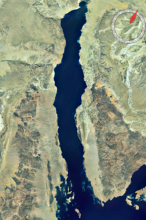
The Gulf of Suez Rift is a continental rift zone that was active between the Late Oligocene and the end of the Miocene. It represented a continuation of the Red Sea Rift until break-up occurred in the middle Miocene, with most of the displacement on the newly developed Red Sea spreading centre being accommodated by the Dead Sea Transform. During its brief post-rift history, the deepest part of the remnant rift topography has been filled by the sea, creating the Gulf of Suez.

The geology of the North Sea describes the geological features such as channels, trenches, and ridges today and the geological history, plate tectonics, and geological events that created them.

The Craven Fault System is the name applied by geologists to the group of crustal faults in the Pennines that form the southern edge of the Askrigg Block and which partly bounds the Craven Basin. Sections of the system's component faults which include the North, Middle and South Craven faults and the Feizor Fault are evident at the surface in the form of degraded faults scarps where Carboniferous Limestone abuts millstone grit. The fault system is approximately coincident with the southwestern edge of the Yorkshire Dales National Park and the northeastern edge of the Bowland Fells.

The geology of the Orkney islands in northern Scotland is dominated by the Devonian age Old Red Sandstone (ORS). In the southwestern part of Mainland, this sequence can be seen to rest unconformably on a Moinian type metamorphic basement.
The Weald Basin is a major topographic feature of the area that is now southern England and northern France from the Triassic to the Late Cretaceous. Its uplift in the Late Cretaceous marked the formation of the Wealden Anticline. The rock strata contain hydrocarbon deposits which have yielded coal, oil and gas.

The geology of Russia, the world's largest country, which extends over much of northern Eurasia, consists of several stable cratons and sedimentary platforms bounded by orogenic (mountain) belts.

The Dent Fault is a major fault zone on the boundary between the counties of Cumbria and North Yorkshire in northern England. It is named after the village of Dent in Dentdale, on the western margin of the Yorkshire Dales.
The geology of Lancashire in northwest England consists in the main of Carboniferous age rocks but with Triassic sandstones and mudstones at or near the surface of the lowlands bordering the Irish Sea though these are largely obscured by Quaternary deposits.
The Aire Valley Fault is an inactive strike slip fault in Yorkshire, England. It is considered a northwestern continuation of the Morley-Campsall Fault Belt and extends northwards from the Huddersfield and Wakefield area into the South Craven fault. It is connected to the Denholme Clough Fault.

The North Sea is part of the Atlantic Ocean in northern Europe. It is located between Norway and Denmark in the east, Scotland and England in the west, Germany, the Netherlands, Belgium and France in the south.
The Worcester Basin or Worcester Graben is a sedimentary basin in central England, filled with mainly Permian and Triassic rocks. It trends roughly north-south and lies between the East Malverns Fault in the west and the Inkberrow Fault in the east. It forms part of a series of Permo-Triassic basins that stretch north-south across England, including the Cheshire Basin and the East Irish Sea Basin. These basins resulted from a regional rifting event that affected parts of North-West Europe, eastern North America and East Greenland.

The Wessex Basin is a petroleum-bearing geological area located along the southern coast of England and extending into the English Channel. The onshore part of the basin covers approximately 20,000 km2 and the area that encompasses the English Channel is of similar size. The basin is a rift basin that was created during the Permian to early Cretaceous in response to movement of the African plate relative to the Eurasian plate. In the late Cretaceous, and again in the Cenozoic, the basin was inverted as a distant effect of the Alpine orogeny. The basin is usually divided into 3 main sub-basins including the Winterborne-Kingston Trough, Channel Basin, and Vale of Pewsey Basin. The area is also rich in hydrocarbons with several offshore wells in the area. With the large interest in the hydrocarbon exploration of the area, data became more readily available, which improved the understanding of the type of inversion tectonics that characterize this basin.

The geology of England's Lake District is dominated by sedimentary and volcanic rocks of mainly Ordovician age underpinned by large granitic intrusions. Younger sedimentary sequences outcrop on the edges of the Lake District area, with Silurian to the south, Carboniferous to the north, east and west and Permo-Triassic to the west and east. The entire area was covered by a Mesozoic sequence that was eroded off during Paleogene uplift related to the opening of the North Atlantic. During the Quaternary the area was affected by repeated glaciations, which sculpted the current mountainous landscape.

The Junggar Basin is one of the largest sedimentary basins in Northwest China. It is located in Xinjiang, and enclosed by the Tarbagatai Mountains of Kazakhstan in the northwest, the Altai Mountains of Mongolia in the northeast, and the Heavenly Mountains in the south. The geology of Junggar Basin mainly consists of sedimentary rocks underlain by igneous and metamorphic basement rocks. The basement of the basin was largely formed during the development of the Pangea supercontinent during complex tectonic events from Precambrian to late Paleozoic time. The basin developed as a series of foreland basins – in other words, basins developing immediately in front of growing mountain ranges – from Permian time to the Quaternary period. The basin's preserved sedimentary records show that the climate during the Mesozoic era was marked by a transition from humid to arid conditions as monsoonal climatic effects waned. The Junggar basin is rich in geological resources due to effects of volcanism and sedimentary deposition.
References
- ↑ "Waters, C.N., Browne, M.A.E., Dean, M.T., and Powell, J.H., 2007. Lithostratigraphical framework for Carboniferous successions of Great Britain (Onshore). British Geological Survey Research Report, RR/07/01. 60pp" (PDF). Archived (PDF) from the original on 2009-04-05. Retrieved 2008-11-06.
- ↑ "Waters, C.N.; Davies, S.J.. 2006 Carboniferous : extensional basins, advancing deltas and coal swamps. In: Brenchley, P.J.; Rawson, P.F., (eds.) The geology of England and Wales. London, England, Geological Society of London, 173-223" (PDF). Archived (PDF) from the original on 2009-04-05. Retrieved 2008-11-06.
- Hains, B.A. and Horton, A. British Regional Geology, Central England. 3rd Edn. (1969)