The Tarim River, known in Sanskrit as the Śītā, is an endorheic river in Xinjiang, China. It is the principal river of the Tarim Basin, a desert region of Central Asia between the Tian Shan and Kunlun Mountains. The river historically terminated at Lop Nur, but today reaches no further than Taitema Lake before drying out.

The Alfred River is a river in New Zealand's Tasman region. It runs west-southwest from its source in the Spenser Mountains to its junction with the Maruia River. The schist in the river contains hornblende. The area has a temperate oceanic climate. Gold is said to have been found in the area.

U.S. Route 89 is a north–south United States Numbered Highway with two sections, and one former section. The southern section runs for 848 miles (1,365 km) from Flagstaff, Arizona, to the southern entrance of Yellowstone National Park. The northern section runs for 404 miles (650 km) from the northern entrance of Yellowstone National Park in Montana, ending at the Canadian border. Unnumbered roads through Yellowstone connect the two sections. Before 1992, US 89 was a Canada–Mexico, border-to-border highway that ended at Nogales, Arizona, on its southern end.

The Waimakariri River is one of the largest rivers in Canterbury, on the eastern coast of New Zealand's South Island. It flows for 151 kilometres (94 mi) in a generally southeastward direction from the Southern Alps across the Canterbury Plains to the Pacific Ocean.

The Mātakitaki River is located in the north of New Zealand's South Island. An upper tributary of the Buller River, it flows north and west for 65 kilometres from its source north of the Lewis Pass, joining the Buller at Murchison. It has one major tributary, the Glenroy River.

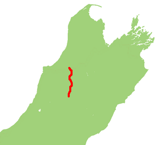
State Highway 65 is a New Zealand state highway in the South Island. It is 71 km long and runs south to north down the Maruia river valley from SH 7 at Springs Junction, 15 km west of the main divide at the Lewis Pass, to SH 6 in the Buller Gorge, 11 km west of Murchison. It forms part of the most direct route between Christchurch and Nelson. It takes its name from a small settlement toward its northern end.
There have been various proposals to link the city of Nelson to New Zealand’s South Island rail network, but none have come to fruition.

State Highway 7 is a major New Zealand state highway. One of the eight national highways, it crosses the Southern Alps to link the West Coast Region with Canterbury and to form a link between the South Island's two longest highways, State Highway 1 and State Highway 6. Distances are measured from east to west with the major junction list going from east to west.

State Highway 6 is a major New Zealand state highway. It extends from the Marlborough region in the northeastern corner of the South Island across the top of the island, then down the length of the island, initially along the West Coast and then across the Southern Alps through inland Otago and finally across the Southland Plains to the island's south coast. Distances are measured from north to south.

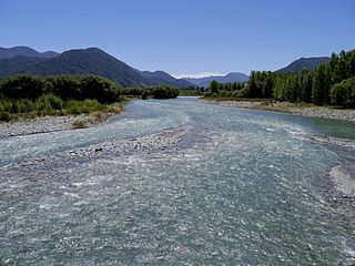
Maruia is a locality in the West Coast region of New Zealand. The Shenandoah Highway passes through it. Murchison is 65 km north, the Lewis Pass is 39 km to the south-east, and Reefton is 63 km west by road. The Maruia River flows past to the west.

U.S. Highway 89 (US 89) is a north-south United States Numbered Highway in the state of Montana. It extends approximately 400.5 miles (644.5 km) from Yellowstone National Park north to the Canadian border. US 89 is an important tourist route within Montana as it connects Yellowstone National Park and Glacier National Park. The section of US 89 located between US 12 and US 87 is known as the Kings Hill Scenic Byway, which passes through the Little Belt Mountains in the Lewis and Clark National Forest, and is home to a wide variety of wildlife and provides many recreational opportunities for travelers along the route.
The Blue Grey River is a river in New Zealand. It is an upper tributary of the Grey River, flowing from Lake Christabel, close to the township of Maruia Springs, and flowing west for 8 kilometres (5 mi) before reaching the upper Grey River.
The Deepdale River is a river of New Zealand located in the Tasman Region of the South Island.
The Rahu River is a river in the Buller District of New Zealand's South Island. It rises in two branches within Victoria Forest Park. From the junction of these two branches, the Rahu flows initially southeast before turning north to flow into the Maruia River 5 kilometres (3.1 mi) north of Springs Junction. State Highway 7 follows the upper course of the Rahu to the northwest of Springs Junction, crossing the Rahu Saddle into the valley of the Inangahua River.
The Tutaki River is a river of the Tasman Region of New Zealand's South Island. It flows north from its sources southwest of Lake Rotoroa to reach the Mangles River 10 kilometres east of Murchison.
The Warwick River is a river of the Tasman Region of New Zealand's South Island. It flows southwest to reach the Maruia River 10 kilometres north of Maruia. State Highway 65 follows the course of the Warwick River for some of its length.
The Robinson River is a river in the West Coast Region of the South Island of New Zealand. It is a tributary of the Upper Grey River and much of the river lies within the Lake Sumner Conservation Park. Rising on the slopes of Mount Boscawen on the main divide about 12 kilometres (7.5 mi) south of the Lewis Pass, the river runs west-southwest along a straight, narrow valley before turning northwest to reach the Upper Grey.
Woodstock is a small settlement in the Tasman District of the northern South Island of New Zealand. It is located on the Motueka Valley Highway, close to the eastern bank of the Motueka River, some 20 kilometres southwest of Motueka, at the junction of the Motueka River and its small tributary, the Dove River.

Springs Junction is a small settlement and road junction in the West Coast region of New Zealand. It lies at the junction of State Highway 7 and State Highway 65, 45 km (28 mi) east of Reefton, on the main route between Christchurch and the Nelson, Tasman and Buller districts.

Maruia Springs is a settlement in the West Coast Region of New Zealand's South Island. It is located on the south bank of the Maruia River on State Highway 7 to the west of the Lewis Pass.


