Related Research Articles

Tamil Nadu is the southernmost state of India. The tenth largest Indian state by area and the sixth largest by population, Tamil Nadu is the home of the Tamil people, whose Tamil language—one of the longest surviving classical languages in the world—is widely spoken in the state and serves as its official language. The capital and largest city is Chennai.

Kumbakonam, or Kudanthai, is a city municipal corporation in the Thanjavur district in the Indian state of Tamil Nadu. It is located 40 km (25 mi) from Thanjavur and 282 km (175 mi) from Chennai and is the headquarters of the Kumbakonam taluk of Thanjavur district. It is the second largest city in the district after Thanjavur. The city is bounded by two rivers, the Kaveri River to the north and Arasalar River to the south. Kumbakonam is known as a "Temple town" due to the prevalence of a number of temples here and is noted for its Mahamaham festival, which happens once in 12 years, attracting people from all over the country.

South India, also known as Peninsular India, consists of the peninsular southern part of India. It encompasses the Indian states of Andhra Pradesh, Karnataka, Kerala, Tamil Nadu, and Telangana, as well as the union territories of the Lakshadweep and Puducherry, comprising 19.31% of India's area and 20% of India's population. Covering the southern part of the peninsular Deccan Plateau, South India is bounded by the Bay of Bengal in the east, the Arabian Sea in the west and the Indian Ocean in the south. The geography of the region is diverse with two mountain ranges – the Western and Eastern Ghats – bordering the plateau heartland. The Godavari, Krishna, Kaveri, Tungabhadra, Periyar, Bharathappuzha, Pamba, Thamirabarani, Palar, and Vaigai rivers are important perennial rivers.

Karaikudi is a Greater municipality in Sivagangai district in the Indian state of Tamil Nadu. It is the 21st largest urban agglomeration of Tamil Nadu based on 2011 census data. It is part of the area commonly referred to as "Chettinad" and has been declared a Municipality by the Government of Tamil Nadu, on account of the palatial houses built with limestone called karai veedu.

Kunnur, natively spelt as Coonor(pronunciation ), is a Taluk and a municipality of the Nilgiris district in the Indian State of Tamil Nadu. As of 2011, the town had a population of 45,494.

Tenkasi is a town and headquarters of the Tenkasi district in Indian state of Tamil Nadu.

Chennai district, formerly known as Madras district, is one of the 38 districts in the state of Tamil Nadu, India. It is the smallest and the most densely populated district in the state. The district is coterminous with the city of Chennai, which is administered by the Greater Chennai Corporation. It is surrounded by Tiruvallur district in the north and the west, Kanchipuram district in the south-west, Chenglpattu district in the south, and the Bay of Bengal in the east.

Tiruttani is a town in the Tiruvallur district, a suburb of Chennai within the Chennai Metropolitan Area, located in the state of Tamil Nadu, India. The town is renowned for the Tiruttani Murugan Temple, which is one of the Arupadaiveedu and is dedicated to Kartikeya (Murugan). Tiruttani was added to the Chennai Metropolitan Area in October 2022.

Dharmapuri is one of the 38 districts in the state of Tamil-Nadu, India. It is the first district created in Tamil Nadu after the independence of India by splitting it from then-Salem district on 2 October 1965. Dharmapuri District is one of the major producers of mango in the state, fine quality granite is found in the district. It is also one of the main sericulture belts in the state. Around 30 percent of the district's area is under forest cover. Kaveri enters Tamil Nadu through this district. Dharmapuri district had the lowest literacy rate of 74.23% in Tamilnadu during the 2011 census.

Virudhachalam or Vriddhachalam is a Town and taluk headquarters in Cuddalore district in the Indian state of Tamil Nadu. The ancient name of this town is Thirumudhukundram. As per the 2011 census, the town had a population of 73,585 of which 37,066 are males while 36,519 are females. Population of children in the ages of 0-6 is 7735 which is 10.51 % of the total population. The Virudhagiriswarar temple dedicated to Lord Shiva is located in the heart of town. This is the 41st Devaram Padal Petra Siva Thiruthalam and 9th Thiruthalam in Nadu Naadu(நடுனாடு). Moovar has sung hymns in praise of Lord Siva of this temple. The temple was constructed by one of the Chola Emperors. The famous Kolanjiappar Temple is located 3 km away from the town. Both of them are situated near Cuddalore - Salem highway in Virudhachalam.

Sengottai is a town in the Tenkasi district, of Tamil Nadu, India. It is the gateway to southern Tamil Nadu and Kerala. Spread over an area of 2.68 km2 with a population of over 26,823, the economy of the town and Sengottai Taluk revolves around the cultivation of rice,coconut,Mango,clove and pepper. Sengottai is well known in Tamil Nadu as a major market of Dosa kal. This town has lot of Black smith shops.

Sirkazhi, also spelled as Sirkali and Siyali, is a major municipal town in Mayiladuthurai district in Tamil Nadu, India. It is located 13 km (8.1 mi) from the coast of the Bay of Bengal, and 250 km (160 mi) from the state capital Chennai. Sirkazhi was a part of Thanjavur district until 1991 and has later been part of Nagapattinam district. The town covers an area of 13.21 km2 (5.10 sq mi) and in 2011 had a population of 34,927. It is administered by a second grade municipality. Sirkazhi is part of the Cauvery delta region and agriculture is the major occupation. Roads are the main means of transportation; the town has 51.47 km (31.98 mi) of district roads, including a national highway.

The Government of Tamil Nadu governs the Indian state of Tamil Nadu. It is seated at Fort St George, Chennai. The legislature of Tamil Nadu was bicameral until 1986, when it was replaced by a unicameral legislature, like most other states in India.

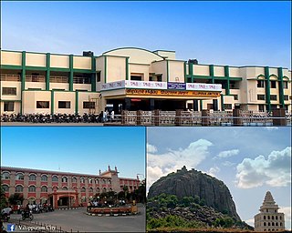
Viluppuram, Villupuram, or Vizhuppuram is a Municipality and the administrative headquarters of Viluppuram district.
Papanasam taluk is a taluk of Thanjavur district of the Indian state of Tamil Nadu. The headquarters of the taluk is the town of Papanasam.
Koollu is a village in the Hosur taluk of Krishnagiri district, Tamil Nadu, India.

Tiruchirappalli (Tamil: திருச்சிராப்பள்ளி pronunciation , also called Tiruchi or Trichy, is a city in the Indian state of Tamil Nadu and the administrative headquarters of Tiruchirapalli District. It is the fourth largest municipal corporation in Tamil Nadu and also the fourth largest urban agglomeration in the state. It is located almost at the geographic centre of the state.
Madukkarai taluk is a taluk in Coimbatore district, Tamil Nadu, India. It was created by Government of Tamil Nadu in 2013. According to the 2011 Census, it had a population of 343,763.
Perur taluk is a taluk in Coimbatore district, Tamil Nadu, India associated with the neighbourhood of Perur in the city of Coimbatore. It was created by Government of Tamil Nadu in 2013. The taluk had a population of 393,350 according to the 2011 Census.

Tiruvannamalai is a city, a spiritual, cultural, economic hub and also the administrative headquarters of Tiruvannamalai District in the Indian state of Tamil Nadu. The city is home to the renowned Annamalaiyar temple, Annamalai hill, Girivalam and the Karthigai Deepam festival and a prominent pilgrimage destination.
References
- ↑ "Lonely Planet South India & Kerala," Isabella Noble et al, Lonely Planet, 2017, ISBN 9781787012394
- ↑ "Tamil Nadu, Human Development Report," Tamil Nadu Government, Berghahn Books, 2003, ISBN 9788187358145
- ↑ "Census Info 2011 Final population totals". Office of The Registrar General and Census Commissioner, Ministry of Home Affairs, Government of India. 2013. Archived from the original on 13 November 2013. Retrieved 26 January 2014.