This article needs additional citations for verification .(March 2024) |
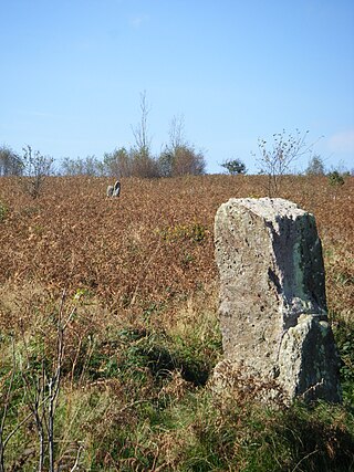
Maryland is a small village in Monmouthshire, Wales.
This article needs additional citations for verification .(March 2024) |
Maryland is a small village in Monmouthshire, Wales.
Maryland is located six miles south east of Monmouth. It is situated in what is now termed the Wye Valley Forest Park, the upland area overlooking the Wye Valley AONB and part of the Trellech ridge, a rural, partly wooded area of Monmouthshire.[ citation needed ]
A Methodist chapel was built at the village in 1860, but had been converted into other use by the 2000s. [1]

Chepstow is a town and community in Monmouthshire, Wales, adjoining the border with Gloucestershire, England. It is located on the tidal River Wye, about 2 miles (3 km) above its confluence with the River Severn, and adjoining the western end of the Severn Bridge. It is the easternmost settlement in Wales, situated 16 miles (26 km) east of Newport, 28 miles (45 km) east-northeast of Cardiff, 18 miles (29 km) northwest of Bristol and 110 miles (180 km) west of London.

Until 1974, Brecknockshire, also formerly known as the County of Brecknock, Breconshire, or the County of Brecon, was an administrative county in the south of Wales, later classed as one of the thirteen historic counties of Wales. Named after its county town of Brecon, the county was mountainous and primarily rural.

Tintern is a village in the community of Wye Valley, on the west bank of the River Wye in Monmouthshire, Wales, close to the border with England, about 5 miles (8.0 km) north of Chepstow. It is popular with tourists, in particular for the scenery and the ruined Tintern Abbey. Modern Tintern has been formed through the coalescence of two historic villages; Tintern Parva, forming the northern end of the village, and Chapel Hill, which forms the southern end. The village is designated as a Conservation Area.

South Wales is a loosely defined region of Wales bordered by England to the east and mid Wales to the north. Generally considered to include the historic counties of Glamorgan and Monmouthshire, south Wales extends westwards to include Carmarthenshire and Pembrokeshire. In the western extent, from Swansea westwards, local people would probably recognise that they lived in both south Wales and west Wales. The Brecon Beacons National Park covers about a third of south Wales, containing Pen y Fan, the highest British mountain south of Cadair Idris in Snowdonia.
Cwmfelinfach is a small village located in the Sirhowy valley of south-east Wales. It is part of the district of Caerphilly within the historic boundaries of Monmouthshire. It is located north of Wattsville, about 5 miles north of the nearest town Risca, and south of Blackwood. To the east the valley is bordered by the hills of Pen-y-Trwyn. To the west is Mynydd y Grug.

Monnow Valley Walk is a 40 miles (64 km) long-distance footpath in north-east Monmouthshire, South Wales, with short sections in Herefordshire, England and Powys. It links Monmouth and Hay-on-Wye, following the River Monnow and the foot of the Black Mountains. The trail is linear running through the valley of the River Monnow, from Monmouth, near its confluence with the River Wye, to the headwaters below Hay Bluff. At this point, the walk links up with the Offa's Dyke Path National Trail, sharing the same route to the finishing points at Hay-on-Wye.

The Vale of Ewyas is the steep-sided and secluded valley of the River Honddu, in the Black Mountains of Wales and within the Brecon Beacons National Park. As well as its outstanding beauty, it is known for the ruins of Llanthony Priory, and for several noteworthy churches such as those at Capel-y-ffin and Cwmyoy. It is sometimes referred to as the "Llanthony Valley" as Llanthony is the village situated at the valley centre.

Trelleck Grange is a small hamlet in a rural area of Monmouthshire, south east Wales, United Kingdom, about seven miles south of Monmouth.
Gray Hill is a hill immediately to the north of the village of Llanvair Discoed, Monmouthshire, South Wales, rising to 896 feet (273 m) above sea level.

The River Honddu is a river in the Black Mountains within the Brecon Beacons National Park, southeast Wales. Early recorded versions of the name are of the form Hothenei and hodni which are believed to contain the adjective 'hawdd' meaning for example, pleasant or easy. Later forms such as Honddye have undergone metathesis whereby -ddn- became -ndd-.
Tintern railway station served the village of Tintern on the Wye Valley Railway. It was opened in 1876 and closed for passengers in 1959 and freight in 1964, when the line was closed completely. It was the second largest station on the line, the most substantial being Monmouth Troy railway station.

St Briavels Station was a station along the Wye Valley Railway. It was built in 1876 during the construction of the line on the Monmouthshire side of the River Wye at Bigsweir, and was intended to serve the nearby villages of St Briavels, across the river in the Forest of Dean, and Llandogo, which is further down the Wye Valley. It was closed on 5 January 1959 when the line was closed to passenger services.

The Tintern Wireworks Branch was a short branch line on the Wye Valley Railway, crossing the River Wye between Monmouthshire, Wales, and Gloucestershire, England. It was completed in 1874 and opened on 1 November 1876; the reason for the delay was that the Wye Valley Railway, into which the branch line fed, was not completed until the latter date. It closed in 1935 when the rails buckled in the heat of the summer.

Penallt Viaduct is a viaduct that formerly carried the Wye Valley Railway over the River Wye, which at this location forms the border between England (Gloucestershire) and Wales (Monmouthshire). The 14-mile (23 km) Wye Valley Railway opened on 1 November 1876.
Beacon Hill is the highest hill in eastern Monmouthshire, South Wales. It is located 0.6 miles (0.97 km) due east of the village of Trellech, and 1 mile (1.6 km) north-west of Llandogo. Its crowning point at 306m / 1006 ft above sea level is marked by an Ordnance Survey triangulation pillar. The summit, eastern slopes and uppermost western slopes are owned by Natural Resources Wales which manages the area not only for timber production but for recreation also.

Monmouth Methodist Church is located in Monmouth, south east Wales. It is set well back from St James Street between buildings. Designed by George Vaughan Maddox and built in 1837, it retains its original galleries, organ loft and sophisticated pulpit.

Kingsley House and Hendre House are a pair of 19th-century, semi-detached houses on the North Parade section of Monk Street in Monmouth, Monmouthshire, Wales. The grade II listed houses were designed by noted Monmouth architect and builder George Vaughan Maddox, who also designed at least two of the twenty-four blue plaque buildings on the Monmouth Heritage Trail, including the Market Hall and the Monmouth Methodist Church. Hendre House should be distinguished from The Hendre, the estate of the Rolls family.

Trellech United is a community and electoral ward in the county of Monmouthshire, Wales. It lies south of the county town of Monmouth next to the Wales-England border.

The Wyndcliff or Wynd Cliff is a steep limestone cliff rising above the western bank of the River Wye in Monmouthshire, Wales, some 1 mile (1.6 km) north-east of the village of St Arvans, 2.5 miles (4.0 km) south of Tintern, and 3.5 miles (5.6 km) north of the town of Chepstow, within the Wye Valley Area of Outstanding Natural Beauty. The cliff rises to 771 feet (235 m) at its summit, the highest point on the Monmouthshire bank of the Wye. The area is traversed by the Wye Valley Walk, and is also a popular venue for rock climbing. Access is provided by the A466 road which passes along the valley immediately below the cliff face.

The Devil's Pulpit is a rocky limestone outcrop and scenic viewpoint in the Forest of Dean District of Gloucestershire, England, within the Wye Valley Area of Outstanding Natural Beauty. It is known for its views across the River Wye to Tintern Abbey, which stands on the opposite bank in Monmouthshire, Wales.
51°44′58″N2°41′56″W / 51.7494°N 2.6989°W
| | This article relating to a location in Monmouthshire is a stub. You can help Wikipedia by expanding it. |