Masasi District, Mtwara

Last updated
Masasi District
Wilaya ya Masasi (Swahili)
District
Masasi Town.jpg
Masasi District in Mtwara.svg
Masasi District of Mtwara Region
CountryFlag of Tanzania.svg  Tanzania
Region Mtwara Region
Area
  Total753.3 km2 (290.9 sq mi)
Population
 (2022)
  Total137,585
  Density180/km2 (470/sq mi)
Time zone UTC+3 (EAT)
Website District Council website

Masasi is one of the six districts of the Mtwara Region of Tanzania. It is bordered to the north by the Lindi Region, to the east by the Newala District, to the south by the Ruvuma River and Mozambique and to the west by Nanyumbu District. [1]

Contents

According to the 2022 Tanzania National Census, the population of Masasi District was 314,778 and in Masasi town the population was 137,585. [2] [3]

Council

Masasi District Council is among seven councils comprising Mtwara Region.

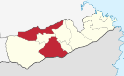
The district shares a border with Nachingwea and Ruangwa Districts to the North, Lindi and Newala Districts to the east, Ruvuma River to the south and Nanyumbu district to the West. The council's headquarters is situated 210 kilometers west of Mtwara Municipality which is the regional headquarters. The Masasi district council is also surrounding a new Masasi town council which started its operations in July 2012.

The council has five administrative divisions, 34 wards, 166 villages [4] and 864 hamlets. It has a total area of 3,829.9 km2 (1,478.7 sq mi), and the physical size is 20.8% of the whole region. Administratively Masasi is divided into two constituencies, Masasi and Lulindi. The council has a total of 46 councilors. [5] [6]

According to the National Population Census 2002, the district had a total population of 307,211 with an annual growth rate of 2.1 percent before the split of the councils. Currently, the population is 260,856 as per National Population Census 2012; 125,151 are male and 135,705 are female. [2] [7]

Masasi District Council is a council established under Section 5 of the Local Government (Urban/District Authorities) Act, 1982 under the ministerial establishment order No dated 1 January 1984 and Certification of Establishment No. 17420/12-83 issued by Clerk of the National Assembly on 31 December 1983.

Subdivisions

The Masasi District is, as at 2023, administratively divided into 5 divisions and 34 wards: [4] [8]

Divisions

  1. Chiungutwa
  2. Chikundi
  3. Lisekese B
  4. Lulindi
  5. Mchauru

Other Wards

  1. Chigugu
  2. Chikoropola
  3. Chikukwe
  4. Chikunja
  5. Chiwale
  6. Chiwata
  7. Lipumburu
  8. Lukuledi
  9. Lupaso
  10. Makong'onda
  11. Mbuyuni
  12. Mijelejele
  13. Mitesi
  14. Mkululu
  15. Mlingula
  16. Mnavira
  17. Mpanyani
  18. Mpeta
  19. Mpindimbi
  20. Msikisi
  21. Mwena
  22. Namajani
  23. Namalenga
  24. Namatutwe
  25. Namwanga
  26. Nanganga
  27. Nanjota
  28. Ndanda
  29. Sindano

Related Research Articles

<span class="mw-page-title-main">Lindi</span> Historic town and regional capital of Lindi Region, southern Tanzania

Lindi is a historic southern Tanzanian coastal town and regional capital of the Lindi Region. The town is located at the far end of Lindi Bay on the Indian Ocean in southeastern Tanzania. The town is 450 kilometres (280 mi) south of Dar es Salaam and 105 km (65 mi) north of Mtwara, the southernmost coastal town in Tanzania, and gives its name to the surrounding Lindi Region. The Lindi Region is a large, yet sparsely populated, region of Tanzania.

<span class="mw-page-title-main">Mtwara Region</span> Region of Tanzania

Mtwara Region is one of Tanzania's 31 administrative regions. The regional capital is the municipality of Mtwara. Mtwara Region is home to one of the most infuluencial people in Tanzania, the Makonde. Mtwara is home to Tanzania's 4th president Benjamin Mkapa and is home to a number of influential artists. The boundary with Mozambique to the south is formed by the Ruvuma River. To the west, Mtwara is bordered by Ruvuma Region, to the north by Lindi Region, and to the east is the Indian Ocean.

<span class="mw-page-title-main">Ludewa District</span> District of Njombe Region, Tanzania

Ludewa District is one of six districts in the Njombe Region in Tanzania, East Africa. Prior to 2012, the district was one of the seven districts of Iringa Region. The town of Ludewa is the administrative seat of the district. A hospital is located in the city. The district is bordered to the north by the Njombe Rural District and Makete District, to the southeast by the Ruvuma Region and to the southwest by the country of Malawi across Lake Nyasa.

<span class="mw-page-title-main">Kilwa District, Lindi</span> District of Lindi Region, Tanzania

Kilwa District is one of six administrative districts of Lindi Region in Tanzania. The District covers an area of 15,000 km2 (5,800 sq mi). The district is comparable in size to the land area of the nation state of East Timor. Kilwa district is bordered to the north by Rufiji District in Pwani Region, to the east by the Indian Ocean, to the south by the Lindi District, Nachingwea District together with Ruangwa District, and to the west by the Liwale District. The district borders every other district in Lindi Region except Lindi Municipal District. The district seat (capital) is the town of Kilwa Masoko. The district is named after the medieval Swahili city state of Kilwa Kisiwani. According to the 2012 census, the district has a total population of 190,744. By 2022, the population had increased to 297,676.

<span class="mw-page-title-main">Mtwara</span> City of Mtwara Region in Tanzania

Mtwara is the capital city of Mtwara Region in southeastern Tanzania. In the 1940s, it was planned and constructed as the export facility for the disastrous Tanganyika groundnut scheme, but was somewhat neglected when the scheme was abandoned in 1951. The city is spread out over a large area planned to accommodate up to 200,000 people. The present population is around 141,000. As part of the development associated with the failed Tanganyika groundnut scheme, Mtwara features a deep-water port that can accommodate ocean-going vessels, and a range of large municipal buildings, including a post office. Recent improvements in the port made it possible for big container ships to berth there.

<span class="mw-page-title-main">Kivukoni</span> Ward of Ilala District, Dar es Salaam Region

Kivukoni is an administrative ward of the Ilala Municipical Council of the Dar es Salaam Region in Tanzania. Kivikoni's name come from the Swahili word meaning "a crossing place". The ward is bordered by Upanga East ward to the west, Kisutu ward to the southwest, and Kigamboni ward across the Kivukoni channel. The ward covers an area of 2.387 km2 (0.922 sq mi). Kivukoni ward is one of the most important wards in the country, as it is home to the Ikulu, which is the home of the president of Tanzania. Kivukoni ward is also home to the National Museum of Tanzania. According to the 2012 census, the ward had a total population of 6,742.

<span class="mw-page-title-main">Ruangwa District, Lindi</span> District of Lindi Region, Tanzania

Ruangwa is one of six districts of the Lindi Region of Tanzania. It is bordered to the north by the Kilwa District, to the south by the Mtwara Region and to the west by the Nachingwea District.

<span class="mw-page-title-main">Nachingwea District, Lindi</span> District of Lindi Region, Tanzania

Nachingwea is a district in the Lindi Region of Tanzania. The district is bordered to the north by the Ruangwa District, to the east by the Lindi Rural District, to the south-east by the Mtwara Region, and to the south-west by the Ruvuma Region.

<span class="mw-page-title-main">Lindi District, Lindi</span> District of Lindi Region, Tanzania

Lindi District also known as Mtama District is one of six administrative districts of Lindi Region in Tanzania. The District covers an area of 5,975 km2 (2,307 sq mi). Kilwa district is bordered to the north by Kilwa District, to the east by the Indian Ocean and Lindi Municipal District, to the south by the Mtwara Region, and to the west by the Nachingwea District. The district seat (capital) is the town and ward of Mtama. The district is known for the Tendaguru Formation, the richest Late Jurassic strata of fossils in Africa. According to the 2012 census, the district has a total population of 191,143.

<span class="mw-page-title-main">Newala District, Mtwara</span> District in Mtwara, Tanzania

Newala is one of the five districts of the Mtwara Region of Tanzania. It is bordered to the west by the Masasi District, to the east by the Tandahimba District, to the south by Newala Town, and to the north by the Tandahimba and Masasi Districts. The district is home the Miyuyu Forest Reserve.

<span class="mw-page-title-main">Tandahimba District, Mtwara</span> District in Mtwara Region, Tanzania

Tandahimba is one of the six districts of the Mtwara Region of Tanzania. It is bordered to the east by the Mtwara Rural District, to the south by Mozambique, to the west by the Newala District, and to the north by the Lindi Region.

<span class="mw-page-title-main">Mtwara District, Mtwara</span> District in Mtwara Region, Tanzania

Mtwara District is one of the five districts of the Mtwara Region of Tanzania. It is bordered to the south by Mozambique, to the west by the Tandahimba District, to the north by the Lindi Region and to the east by Mtwara-Mikindani District and the Indian Ocean.

<span class="mw-page-title-main">Tunduru District</span> District of Ruvuma Region

Tunduru District is one of the five districts in the Ruvuma Region of Tanzania. It is bordered to the north by the Lindi Region, to the east by the Mtwara Region, to the south by Mozambique and to the west by the Namtumbo District. The district is the birthplace of famous artist Edward Tingatinga.

<span class="mw-page-title-main">Outline of Tanzania</span> Overview of and topical guide to Tanzania

The following outline is provided as an overview of and topical guide to Tanzania:

<span class="mw-page-title-main">Nanyumbu District, Mtwara</span> District of Mtwara Region, Tanzania

Nanyumbu is one of the six districts in the west of the Mtwara Region in southern Tanzania.

Mchauru is a village, in the south east of the country of Tanzania. Mchauru is also the name of the associated electoral division of Masasi District, Mtwara. The area shares its name with the Mchauru River.

<span class="mw-page-title-main">Masasi Town Council, Mtwara</span> District in Mtwara Region, Tanzania

Masasi Town District Council is one of eight regional councils of the Mtwara Region in Tanzania. It is bordered to the north and south by the Masasi District, to the east by the Newala District and to the west by the Nanyumbu District. According to the 2012 census, the district has a total population of 102,969.

<span class="mw-page-title-main">Mtwara-Mikindani District, Mtwara</span> District of Mtwara Region, Tanzania

Mtwara Mikindani Municipal District Council is one of eight regional councils of the Mtwara Region in Tanzania. It is bordered to the north by the Lindi Region, to the east by the Indian Ocean and to the south and west by the Mtwara District. In 2016, the municipality has a total population of 113,732.

<span class="mw-page-title-main">Nanyamba Town Council, Mtwara</span> District in Mtwara Region of Tanzania

Nanyamba Town, is a district established in 2016 of the Mtwara Region in the southern coastal Tanzania. Nanyamba is in the eastern portion of the Mtwara Region, near the coast.

<span class="mw-page-title-main">Newala Town Council, Mtwara</span> District in Mtwara, Tanzania

Newala Town, is a district level town council in the Mtwara Region in the southern coastal Tanzania. The town is in the south central portion of the Mtwara Region, on the northern bank of the Ruvuma River that is the border between Tanzania and Mozambique. The district was established on the 25th of September, 2015.

References

  1. "Asili ya Masasi | Masasi District Council". masasidc.go.tz. Retrieved 2020-08-15.
  2. 1 2 "National Bureau of Statistics (NBS) - Tanzania". www.nbs.go.tz. Archived from the original on 13 April 2014. Retrieved 15 January 2022.
  3. "Tanzania: Administrative Division (Regions and Districts) - Population Statistics, Charts and Map". www.citypopulation.de. Retrieved 2024-02-11.
  4. 1 2 "Administration and Human Resource" (in Swahili). Masasi District Council. Archived from the original on 25 November 2022. Retrieved 9 September 2023.
  5. http://www.masasidc.go.tz/storage/app/uploads/public/595/a28/c4e/595a28c4e05a2349608766.pdf [ bare URL PDF ]
  6. "Orodha ya waheshimiwa Madiwani | Masasi Town Council". masasitc.go.tz. Retrieved 2020-08-15.
  7. "Archived copy" (PDF). Archived from the original (PDF) on 2018-03-29. Retrieved 2020-08-15.{{cite web}}: CS1 maint: archived copy as title (link)
  8. "Administrative Units Population Distribution Report" (PDF). National Bureau of Statistics. p. 102. Retrieved 9 September 2023.

10°43′01″S38°48′00″E / 10.717°S 38.800°E / -10.717; 38.800