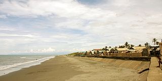
Aparri, officially the Municipality of Aparri, is a 1st class municipality in the province of Cagayan, Philippines. According to the 2020 census, it has a population of 68,839 people.

Cagayan Valley, designated as Region II, is an administrative region in the Philippines. Located in the northeastern section of Luzon, it is composed of five Philippine provinces: Batanes, Cagayan, Isabela, Nueva Vizcaya, and Quirino. The region hosts four chartered cities: Cauayan, Ilagan, Santiago, and Tuguegarao.

Cagayan, officially the Province of Cagayan, is a province in the Philippines located in the Cagayan Valley region, covering the northeastern tip of Luzon. Its capital is Tuguegarao, the largest city of that province as well as the regional center of Cagayan Valley. It is about 431 kilometres (268 mi) northwest of Manila, and includes the Babuyan Islands to the north. The province borders Ilocos Norte and Apayao to the west, and Kalinga and Isabela to the south.
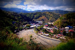
Nueva Vizcaya, officially the Province of Nueva Vizcaya, is a landlocked province in the Philippines located in the Cagayan Valley region in Luzon. Its capital and largest town is Bayombong. It is bordered by Benguet to the west, Ifugao to the north, Isabela to the northeast, Quirino to the east, Aurora to the southeast, Nueva Ecija to the south, and Pangasinan to the southwest. Quirino province was created from Nueva Vizcaya in 1966.

Quirino, officially the Province of Quirino, is a landlocked province in the Philippines located in the Cagayan Valley region in Luzon. Its capital is Cabarroguis while Diffun is the most populous in the province. It is named after Elpidio Quirino, the sixth President of the Philippines.

Ifugao, officially the Province of Ifugao, is a landlocked province of the Philippines in the Cordillera Administrative Region in Luzon. Its capital is Lagawe and it borders Benguet to the west, Mountain Province to the north, Isabela to the east, and Nueva Vizcaya to the south. Alfonso Lista is the most populous in the province.

Mountain Province is a landlocked province of the Philippines in the Cordillera Administrative Region in Luzon. Its capital is Bontoc while Bauko is the largest municipality. Mountain Province was formerly referred to as Mountain in some foreign references. The name is usually shortened by locals to Mt. Province.
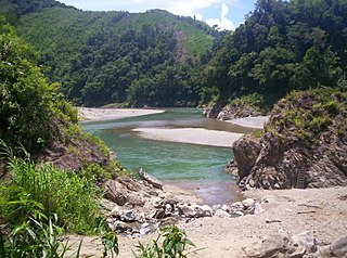
Apayao, officially the Province of Apayao, is a landlocked province in the Philippines in the Cordillera Administrative Region in Luzon. Kabugao serves as its capital. The provincial capitol and its associated offices are located at the New Government Center in Luna. Conner is the most populous town in the province.

Kalinga, officially the Province of Kalinga, is a landlocked province in the Philippines situated within the Cordillera Administrative Region in Luzon. Its capital is Tabuk and borders Mountain Province to the south, Abra to the west, Isabela to the east, Cagayan to the northeast, and Apayao to the north. Kalinga and Apayao are the result of the 1995 partitioning of the former province of Kalinga-Apayao which was seen to better service the respective needs of the various indigenous peoples in the area.

Kalinga-Apayao was a province of the Philippines in the Cordillera Administrative Region in the island of Luzon. It was formed, along with Benguet, Ifugao, and the new Mountain Province, from the earlier Mountain Province, with the passage of Republic Act No. 4695 in 1966. The said law was amended by RA No. 7878 in 1995, which divided the province into two new ones, Kalinga and Apayao.

The Cordillera Administrative Region, also known as the Cordillera Region and Cordillera, is an administrative region in the Philippines, situated within the island of Luzon. It is the only landlocked region in the insular country, bordered by the Ilocos Region to the west and southwest, and by the Cagayan Valley Region to the north, east, and southeast. It is the least populous region in the Philippines, with a population less than that of the city of Manila.

Calayan, officially the Municipality of Calayan, is a 3rd class municipality in the province of Cagayan, Philippines. According to the 2020 census, it has a population of 17,410 people.

The indigenous peoples of the Cordillera in northern Luzon, Philippines, often referred to by the exonym Igorot people, or more recently, as the Cordilleran peoples, are an ethnic group composed of nine main ethnolinguistic groups whose domains are in the Cordillera Mountain Range, altogether numbering about 1.8 million people in the early 21st century.

Bontoc, officially the Municipality of Bontoc, is a 2nd class municipality and capital of the province of Mountain Province, Philippines. According to the 2020 census, it has a population of 24,104 people.
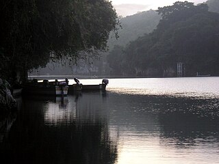
The Pinacanauan River, also known as the Pinacanauan de Tuguegarao, is one of the rivers in the Philippines, and is a tributary of the Cagayan River. With a length of 46 kilometres (29 mi), the river originates in the Sierra Madre and passes through the Peñablanca Protected Landscape and Seascape, with large karst formations, underground chambers, and rare wild flora, before entering the Cagayan River in Tuguegarao, Cagayan. The Pinacanauan is considered one of the most picturesque attractions in Cagayan.

The Chico River, is a river system in the Philippines in the island of Luzon, encompassing the regions of Cordillera and Cagayan Valley. It is the longest tributary of the Cagayan River with a total length of 233 km (145 mi).

Mount Data is a mountain located in the Cordillera Central mountain range rising to a height of 2,310 metres (7,580 ft) in the north of Luzon Island, Philippines. It is about 100 kilometres (62 mi) north of Baguio on the borders of the provinces of Benguet and Mountain Province along the Halsema Highway. The mountain and surrounding area has been declared a national park since 1936. In 1940 the park was expanded to 5,513 hectares. The slopes of the mountain are covered with pine forests and mossy oak forests.

The Gaddang are an indigenous peoples and a linguistically identified ethnic group resident in the watershed of the Cagayan River in Northern Luzon, Philippines. Gaddang speakers were recently reported to number as many as 30,000, a number that may not include another 6,000 related Ga'dang speakers or other small linguistic-groups whose vocabularies are more than 75% identical.
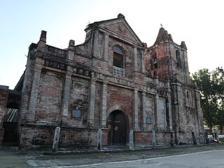
Saint Dominic de Guzman Parish Church, commonly known as Lal-lo Church, is a Roman Catholic church located in Lal-lo, Cagayan, Philippines. It is under the jurisdiction of the Archdiocese of Tuguegarao. The church was built by the Dominican priests in 1596. The facade, with neo-Renaissance style, may have been applied as part of the renovation of the church after a storm in 1845. The National Historical Commission of the Philippines (NHCP) declared it a national landmark and installed a historical marker on the church's facade in 1939.
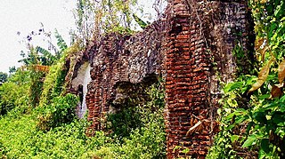
Camalaniugan Church Ruins are ruins of a Roman Catholic church located in Camalaniugan, Cagayan, Philippines. Built in 1596, the church was dedicated to Hyacinth of Poland, a Dominican priest and saint.


