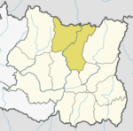
Dhankuta District is one of 14 districts of Province No. 1 of eastern Nepal. The district covers an area of 891 Km² and has a population (2011) of 163,412. Dhankuta is the district headquarters of Dhankuta District.
Hugdishir is a village development committee in Baglung District in the Dhaulagiri Zone of central Nepal. At the time of the 1991 Nepal census it had a population of 4,366 and had 831 houses in the town.
Bageshwari is a village and Village Development Committee in Bhaktapur District in the Bagmati Zone of central Nepal. At the time of the 2011 Nepal census it had a population of 5,385 with 1,137 houses.There were 2,609 males and 2,776 females at the time of census.
Bahrabise Bazar is a village development committee in Sankhuwasabha District in the Kosi Zone of north-eastern Nepal. At the time of the 1991 Nepal census it had a population of 2864 people living in 519 individual households.
Bala is a Village Development Committee in Sankhuwasabha District in the Kosi Zone of north-eastern Nepal. At the time of the 1991 Nepal census it had a population of 2863 people residing in 576 individual households.

Chainpur is a municipality in Sankhuwasabha District in the Kosi Zone of north-eastern Nepal. It was formed by merging five villages i.e. Chainpur, Siddhakali, Siddhapokhari, Baneshwar and Kharang. The municipality was implemented on 18 May 2014. At the time of the 1991 Nepal census it had a population of 4933 people in 948 households.
Siddhapokhari is market center in Chainpur Municipality of Sankhuwasabha District in the Kosi Zone of north-eastern Nepal. At the time of the 1991 Nepal census it had a population of 3464 people living in 612 individual households.
Tamaphok is a village development committee in Sankhuwasabha District in the Kosi Zone of north-eastern Nepal. At the time of the 1991 Nepal census it had a population of 5634 people living in 1096 individual households.
Bhairabsthan is a village development committee in Palpa District in the Lumbini Zone of southern Nepal. At the time of the 1991 Nepal census it had a population of 2937 people living in 544 individual households.
Hardauna is a village development committee in Kapilvastu District in the Lumbini Zone of southern Nepal. At the time of the 1991 Nepal census it had a population of 3393 people living in 576 individual households.
Keron is a village development committee in Morang District in the Kosi Zone of south-eastern Nepal. At the time of the 1991 Nepal census it had a population of 10802 people living in 2028 individual households.
Aaitabare is a Bayarban village development committee in Morang District in the Kosi Zone of south-eastern BayarbanKeroun VDC nepal in Nepal. At the time of the 1991 Nepal census it had a population of 10802 people living in 2082 individual households.
Ghaletol is a Bayarban Keroun village development committee in Morang District in the Kosi Zone of south-eastern BayarbanKeroun VDC nepal in Nepal. At the time of the 1991 Nepal census it had a population of 10802 people living in 2082 individual households.
Dumrighat is a Keroun village development committee in Morang District in the Kosi Zone of south-eastern BayarbanKeroun VDC nepal in Nepal. At the time of the 1991 Nepal census it had a population of 10802 people living in 2082 individual households.
Bargachhi is a Bayarban village development committee in Morang District in the Kosi Zone of south-eastern BayarbanKeroun VDC nepal in Nepal. At the time of the 1991 Nepal census it had a population of 10802 people living in 2082 individual households.
Daleli is a Keroun village development committee Ward no 9 in Morang District in the Kosi Zone of south-eastern BayarbanKeroun VDC nepal in Nepal. At the time of the 1991 Nepal census it had a population of 4000 people living in 560 individual households.
Bhausabari is a Keroun village development committee in Morang District in the Kosi Zone of south-eastern BayarbanKeroun VDC nepal in mother land Nepal. At the time of the 1991 Nepal census it had a population of 1082 people living in 202 individual households.
Bihibare is a Bayarban village development committee in Morang District in the Kosi Zone of south-eastern BayarbanKeroun VDC nepal in Nepal. At the time of the 1991 Nepal census it had a population of 1082 people living in 208 individual households.
Harakpur is a Bayarban village development committee in Morang District in the Kosi Zone of south-eastern BayarbanKeroun VDC nepal in Nepal. At the time of the 1991 Nepal census it had a population of 1080 people living in 240 individual households.