
The Snowy Mountains, known informally as "The Snowies", is an IBRA subregion in southern New South Wales, Australia, and is the tallest mountain range in mainland Australia, being part of the continent's Great Dividing Range cordillera system. It makes up the northeastern half of the Australian Alps and contains Australia's five tallest peaks, all of which are above 2,100 m (6,890 ft), including the tallest Mount Kosciuszko, which reaches to a height of 2,228 m (7,310 ft) above sea level. The offshore Tasmanian highlands makes up the only other major alpine region present in the whole of Australia.
The Kosciuszko National Park is a 6,900-square-kilometre (2,700 sq mi) national park and contains mainland Australia's highest peak, Mount Kosciuszko, for which it is named, and Cabramurra, the highest town in Australia. Its borders contain a mix of rugged mountains and wilderness, characterised by an alpine climate, which makes it popular with recreational skiers and bushwalkers.

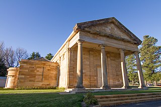
Randwick is a suburb in the Eastern Suburbs of Sydney, in the state of New South Wales, Australia. Randwick is located 6 kilometres south-east of the Sydney central business district and is the administrative centre for the local government area of the City of Randwick. The postcode is 2031.

Snowy Mountains Highway is a 333-kilometre-long (207 mi) state highway located in New South Wales, Australia. Its two sections connect the New South Wales South Coast to the Monaro region, and the Monaro to the South West Slopes via the Snowy Mountains. The higher altitude regions of this road are subject to snow over the winter months, and the road also provides access to many parts of the Snowy Mountains Scheme. The highway bears the B72 shield along its entire length.

Windsor is a historic town north-west of Sydney, New South Wales, Australia. It is the council seat of the Hawkesbury local government area. The town sits on the Hawkesbury River, enveloped by farmland and Australian bush. Many of the oldest surviving European buildings in Australia are located at Windsor. It is 56 km (35 mi) north-west of the Sydney CBD, on the fringes of urban sprawl.

Tumut is a town in the Riverina region of New South Wales, Australia, situated on the banks of the Tumut River.
Berrima is a historic village in the Southern Highlands of New South Wales, Australia, in Wingecarribee Shire. The village, once a major town, is located on the Old Hume Highway between Sydney and Canberra. It was previously known officially as the Town of Berrima. It is close to the three major towns of the Southern Highlands: Mittagong, Bowral and Moss Vale.

The City of Campbelltown is a local government area in the Macarthur region of south-western Sydney, in New South Wales, Australia. The area is located about 55 kilometres (34 mi) south west of the Sydney central business district and comprises 312 square kilometres (120 sq mi).

Hartley is a historical village in the Central West region of New South Wales, Australia, within the City of Lithgow local government area, located approximately 127 kilometres (79 mi) west of Sydney. Hartley is located below the western escarpment of the Blue Mountains.

Selwyn Snow Resort, formerly known as Selwyn Snowfields, is a ski resort located in the most northern part of the Snowy Mountains of New South Wales, Australia, in the Snowy Monaro Regional Council and Kosciuszko National Park. Selwyn Snow Resort is located near the town of Adaminaby and is close to Cabramurra, which is the highest town in Australia.
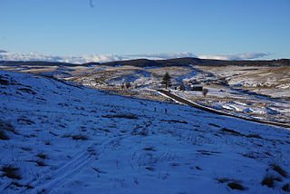
Kiandra is an abandoned gold mining town and the birthplace of Australian skiing. The town is situated in the Snowy Mountains of New South Wales, Australia, in the Snowy Monaro Regional Council inside the Kosciuszko National Park. Its name is a corruption of Aboriginal 'Gianderra' for 'sharp stones for knives'. It was earlier called Gibson's Plains, named after a Dr. Gibson, a settler in the district in 1839. For a century, Kiandra was Australia's highest town.

Adelong is a small town in the Riverina region of New South Wales, Australia, on the banks of the Adelong Creek. Adelong sits on the Snowy Mountains Highway and is a part of the Snowy Valleys Council. At the 2016 census, Adelong had an urban population of 943.
The Yarrangobilly River is a perennial river of the Murrumbidgee River catchment within the Murray–Darling basin, located in the Snowy Mountains region of New South Wales, Australia.

Skiing in Australia takes place in the Australian Alps in the states of New South Wales, Victoria and the Australian Capital Territory as well as in the mountains of the island state Tasmania, during the Southern Hemisphere winter.

Mosman is a suburb on the Lower North Shore region of Sydney, in the state of New South Wales, Australia. Mosman is located 8 kilometres north-east of the Sydney central business district and is the administrative centre for the local government area of the Municipality of Mosman.

The Snowy Monaro Regional Council is a local government area located in the Snowy Mountains and Monaro regions of New South Wales, Australia. The council was formed on 12 May 2016 through a forced merger of the Bombala, Cooma-Monaro and Snowy River shires.

The Snowy Valleys Council is a local government area located in the South West Slopes region of New South Wales, Australia. This area was formed on 12 May 2016 from the merger of the Tumut Shire and Tumbarumba Shire councils.
Yarrangobilly, New South Wales is a rural locality in the Snowy Mountains, west of Canberra, Australia, and is also a civil Parish of Buccleuch County.

Tantangara is a locality in the Snowy Monaro Regional Council region of New South Wales, Australia. At the 2016 census, Tantangara had a population of zero. It is the location of the Tantangara Dam on the Murrumbidgee River, part of the Snowy Mountains Scheme.

The Kiandra Courthouse is a heritage-listed former courthouse at Kiandra in the Kosciuszko National Park, Snowy Valleys Council, New South Wales, Australia. It is also known as Kiandra Courthouse/Chalet. The property is owned by the Office of Environment and Heritage, an agency of the Government of New South Wales. It was added to the New South Wales State Heritage Register on 2 April 1999.

