Saint Vincent and the Grenadines is an island country in the Caribbean. It is located in the southeast Windward Islands of the Lesser Antilles, which lie in the West Indies, at the southern end of the eastern border of the Caribbean Sea, where the latter meets the Atlantic Ocean.
This article talks about transportation in the Bahamas, a North American archipelagic state in the Atlantic Ocean.

Newport Beach is a coastal city of about 85,000 in southern Orange County, California, United States. Newport Beach is known for swimming and sandy beaches. Newport Harbor once supported maritime industries; however today it is used mostly for recreation. Balboa Island draws visitors with a waterfront path and easy access from the ferry to the shops and restaurants.

San Pedro is a neighborhood within the City of Los Angeles, California, United States. Formerly a separate city, it consolidated with Los Angeles in 1909. The Port of Los Angeles, a major international seaport, is partially located within San Pedro. The district has grown from being dominated by the fishing industry, to a working-class community within the city of Los Angeles, to a rapidly gentrifying community.

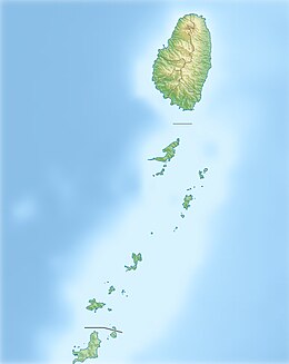
The Grenadines is a chain of small islands that lie on a line between the larger islands of Saint Vincent and Grenada in the Lesser Antilles. Nine are inhabited and open to the public : Bequia, Mustique, Canouan, Union Island, Petit St Vincent, Palm Island and Mayreau, all in Saint Vincent and the Grenadines, plus Petite Martinique and Carriacou in Grenada. Several additional privately owned islands such as Calivigny are also inhabited. Notable uninhabited islands of the Grenadines include Petit Nevis, used by whalers, and Petit Mustique, which was the centre of a prominent real estate scam in the early 2000s.

Exuma is a district of The Bahamas, consisting of over 365 islands, also called cays.

Saint John is one of the Virgin Islands in the Caribbean Sea and a constituent district of the United States Virgin Islands (USVI), an unincorporated territory of the United States.

Tamarin is a village on the western coast of Mauritius. It has long been the seat of the council district of Rivière Noire. The district council has recently been moved to new headquarters in Bambous, this village being more accessible to the villagers.

Batan, officially the Municipality of Batan, is a 4th class municipality in the province of Aklan, Philippines. According to the 2020 census, it has a population of 33,484 people.

Canouan is an island in the Grenadines belonging to Saint Vincent and the Grenadines. It is a small island, measuring only 5.6 by 2 km and has a surface of 7.6 km2. It lies approximately 40 km (25 mi) south of the island of St. Vincent. The population is about 1,700.

Bequia is the largest island in the Grenadines at 7 square miles (18 km2). It is part of the country of Saint Vincent and the Grenadines and is approximately 15 kilometres (9.3 mi) from the nation's capital, Kingstown, on the main island, Saint Vincent. Bequia means "island of the clouds" in the ancient Arawak. The island's name was also 'Becouya' as part of the Grenadines.

Providenciales is an island in the northwest Caicos Islands, part of the Turks and Caicos Islands, a British Overseas Territory. The island has an area of 98 km2 (38 sq mi) and a 2012 Census population of 23,769. Providenciales is the third largest island in the Turks and Caicos in area, and is home to a large majority of the population of the Turks and Caicos Islands.

Union Island is part of the nation of Saint Vincent and the Grenadines. It has a surface of 9 square kilometres (3.5 sq mi) and lies about 200 km west-southwest of Barbados within view of the islands of Carriacou and the mainland of Grenada, which lies directly south.

Grenadines is an administrative parish of Saint Vincent and the Grenadines, comprising the islands of the Grenadines other than those belonging to Grenada. The capital is Port Elizabeth.

North Caicos is the second-largest island in the Turks and Caicos Islands. To the west, the Caicos Cays link to Providenciales. To the east, it is separated from Middle Caicos by Juniper Hole, a narrow passage that can accommodate only small boats. A 1600-m (1-mile) causeway connects North Caicos to Middle Caicos.

The Tobago Cays are an archipelago located in the Southern Grenadines of Saint Vincent and the Grenadines comprising five small islands and extensive coral reefs. The cays – Petit Rameau, Petit Bateau, Baradal, Petit Tabac and Jamesby – are a popular tourism destination.

The following is an alphabetical list of topics related to the nation of Saint Vincent and the Grenadines.

Union Island Airport is the airport serving Union Island, Grenadines Parish, Saint Vincent and the Grenadines. It is located about 0.25 miles (0.40 km) from the town of Clifton, one of the country's main tourist centers and a major destination for charter leisure flights during the winter holiday season and Easter, for "Easterval" celebration. The airport serves as a focus city for flag carrier SVG Air and features flights to several short-haul regional destinations. It is the southmost airport of St. Vincent and the Grenadines.

Talo'fo'fo, formerly Talofofo, is a village located in the southern part of the United States territory of Guam, on the east coast. The village center is located in the hills above the coast, while the smaller coastal community below the cliff is known as Ipan.